Headwaters Of South And Roaring Forks And Mainstem To Confluence With South Fork River Run
Community Reviews
Been here? Share the conditions.
Reviews, ratings & photos are added in the free Snoflo iOS app — rate a spot, tag the conditions, and your visit is verified by location. Add or manage your reviews from the app.
Headwaters Of South And Roaring Forks And Mainstem To Confluence With South Fork
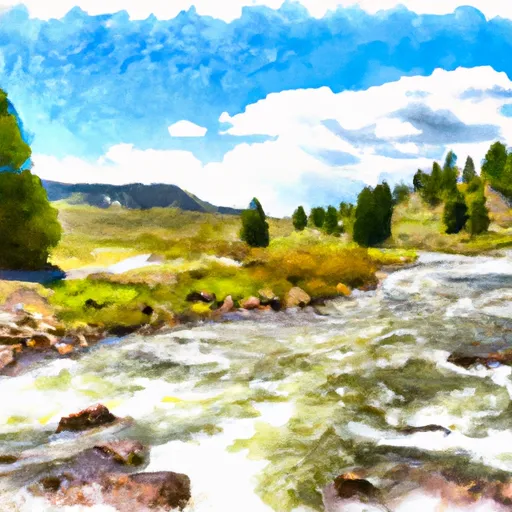
The river rapids and obstacles vary based on the segment. The Headwaters of South and Roaring Forks have rapids such as Oak Creek Falls, which is a Class III rapid with a steep drop over rocks. The Mainstem to Confluence with South Fork has rapids such as Cauldron, which is a Class IV rapid with a steep drop and narrow chute. Obstacles such as rocks and boulders add to the challenge of the river run.
Specific regulations to the area include obtaining a permit to float the river and following specific guidelines for camping and fires. The river is managed by the Bridger-Teton National Forest, which has specific rules and regulations for recreational activities in the area.
Overall, the Whitewater River Run offers a thrilling whitewater experience for those seeking an adrenaline rush. With varying levels of difficulty and obstacles, the river provides a challenge for both experienced and novice paddlers. It is important to follow regulations and guidelines to ensure the safety of all participants and protect the natural environment.
Plan your run down to the hour
Same weather feed Snoflo's iOS app uses -- updated continuously from NOAA / yr.no. Watch the precipitation column on the meteogram; rain ahead of a run typically lifts flows 12-48 hours later depending on the basin.
Next 5 days, hour by hour
Temperature line with weather symbols on top, snow + rain accumulation as columns, humidity as a dotted line.
5-day forecast table
Every 3 hours, broken out across temperature, snow, rain, humidity, and wind. Each cell is colour-coded relative to the column min/max.
| Time | Condition | Temp (°F) | Snow (in) | Rain (in) | Humidity (%) | Wind (mps) | Wind dir |
|---|---|---|---|---|---|---|---|
| Loading detailed forecast… | |||||||
15-day temperature & precipitation
Daily temperatures, snow, and rain projected over the next two weeks -- the upstream story that drives next week's flows.
Regional streamflow levels
USGS streamgauges around Headwaters Of South And Roaring Forks And Mainstem To Confluence With South Fork -- useful for spotting upstream pulses and gauging which tributary is contributing what.
| Streamgauge | Discharge | View |
|---|---|---|
| Snake River At Moose | 6,550 cfs | → |
| Granite C Ab Granite C Supplemental | 62 cfs | → |
| Snake River Nr Moran Wy | 4,970 cfs | → |
| Gros Ventre River At Zenith Wy | 229 cfs | → |
| Gros Ventre River At Kelly Wy | 620 cfs | → |
| Teton River Ab South Leigh Creek Nr Driggs Id | 349 cfs | → |
Plan a longer trip
The closest boat launches, other paddle runs, and campgrounds so a day on the water can grow into a full weekend.
Boat launches
Other river runs
- Badger Creek
- Headwaters Of North And South Forks And Mainstem To Boundary Of Jedediah Smith Wilderness
- Headwaters Of North And South Fork And Mainstem To Targhee Nf Boundary
- Bitch Creek
- Teton River
Campgrounds
Fishing spots
Whitewater safety
- Check the flow before you run
- Use the linked-gauge card and Regional Flow panel above. Class ratings change with flow -- a Class III at low water can become Class IV+ at high water.
- Know your skill ceiling
- Pick runs comfortably below your ceiling. Cold-water and big-water runs raise the consequences of any mistake.
- Wear the right gear
- Helmet, PFD, drysuit / wetsuit when water is below 60°F. Throw bag, knife, and whistle on your person, not in the boat.
- Scout, set safety, and run with a team
- Scout new rapids on foot, set safety with throw bags above the consequence pool, and run with at least one other competent paddler.
- Respect the river
- Strainers, undercuts, low-head dams, and wood can kill at any class rating. When in doubt, portage.
Set push alerts in the Snoflo app
Save Headwaters Of South And Roaring Forks And Mainstem To Confluence With South Fork as a favorite, set a discharge threshold (e.g. "alert me when flow hits 600 cfs"), and the iOS app pushes the moment the linked gauge crosses.
About Headwaters Of South And Roaring Forks And Mainstem To Confluence With South Fork
What's the optimal flow for Headwaters Of South And Roaring Forks And Mainstem To Confluence With South Fork?
The optimal flow depends on the section and the craft. Check the Run Details panel for the linked gauge and current status.
How fresh is the cfs reading on this page?
The linked USGS streamgauge reports continuously (every 15 minutes); Snoflo refreshes throughout the day. Hover the streamflow sparkline to read individual datapoints.
What's the whitewater class?
See the Run Details panel for the class rating Snoflo tracks for this run. Class ratings change with flow -- a Class III at low water can become Class IV in high water.
Where do I put in / take out?
Tap Directions in the hero above to open driving directions to the put-in. For shuttle planning, check the Nearby Boat Launches panel and the river run operator's site.
Can I get alerts when flows hit the optimal range?
Yes -- alerts are managed in the Snoflo iOS app. Favorite this run, set a discharge threshold, and you'll get a push the moment the gauge crosses.
Other runs near here
Snoflo-tracked paddle runs within driving distance of Headwaters Of South And Roaring Forks And Mainstem To Confluence With South Fork.