Scab Creek River Run
Community Reviews
Been here? Share the conditions.
Reviews, ratings & photos are added in the free Snoflo iOS app — rate a spot, tag the conditions, and your visit is verified by location. Add or manage your reviews from the app.
Scab Creek
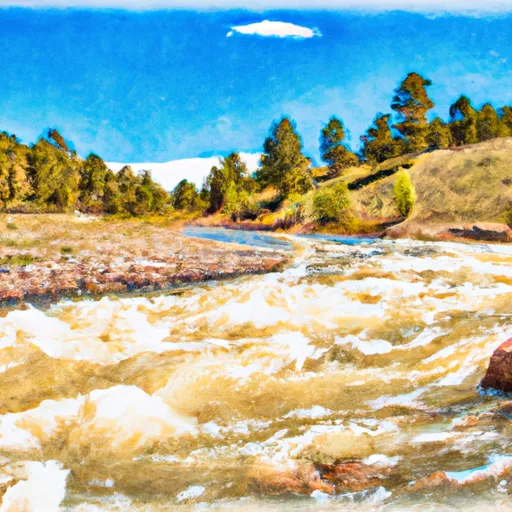
The Scab Creek section of the Whitewater River in Wyoming is a popular destination for intermediate and advanced kayakers. The ideal streamflow range for this section is between 200 and 500 cfs, which typically occurs during the spring and early summer months. The class rating for this section ranges between III and IV, with challenging rapids and obstacles such as the Meatgrinder, Picket Fence, and Devil's Slide.
The segment mileage for Scab Creek is approximately 6 miles, with stunning scenery and rugged terrain. This section is known for its steep gradient and technical rapids, making it a thrilling run for experienced kayakers. However, due to the difficulty of the rapids and the remote location of the river, it is recommended that paddlers have advanced skills and knowledge of the area before attempting this run.
Specific regulations for the Scab Creek section of the Whitewater River include obtaining a permit from the Bridger-Teton National Forest office, as well as adhering to Leave No Trace principles. Additionally, motorized vehicles are not allowed in the wilderness area, and camping is limited to designated areas. Paddlers should also be aware of the potential for high water levels, as well as the presence of wildlife such as bears and mountain lions in the area.
Plan your run down to the hour
Same weather feed Snoflo's iOS app uses -- updated continuously from NOAA / yr.no. Watch the precipitation column on the meteogram; rain ahead of a run typically lifts flows 12-48 hours later depending on the basin.
Next 5 days, hour by hour
Temperature line with weather symbols on top, snow + rain accumulation as columns, humidity as a dotted line.
5-day forecast table
Every 3 hours, broken out across temperature, snow, rain, humidity, and wind. Each cell is colour-coded relative to the column min/max.
| Time | Condition | Temp (°F) | Snow (in) | Rain (in) | Humidity (%) | Wind (mps) | Wind dir |
|---|---|---|---|---|---|---|---|
| Loading detailed forecast… | |||||||
15-day temperature & precipitation
Daily temperatures, snow, and rain projected over the next two weeks -- the upstream story that drives next week's flows.
Regional streamflow levels
USGS streamgauges around Scab Creek -- useful for spotting upstream pulses and gauging which tributary is contributing what.
| Streamgauge | Discharge | View |
|---|---|---|
| Pine Creek Above Fremont Lake | 322 cfs | → |
| Sf L Wind Riv Ab Washakie Res | 160 cfs | → |
| New Fork River Near Big Piney | 718 cfs | → |
| Bull Lake Creek Above Bull Lake | 773 cfs | → |
| Green River At Warren Bridge | 954 cfs | → |
| Big Sandy River Near Farson | 103 cfs | → |
Plan a longer trip
The closest boat launches, other paddle runs, and campgrounds so a day on the water can grow into a full weekend.
Boat launches
Campgrounds
- Scab Creek
- Scab Creek Small Vehicle Campground
- Scab Creek Small Vehicle Campsite 15
- Scab Creek Small Vehicle Campsite 1
- Scab Creek Small Vehicle Campsite 14
- Scab Creek Small Vehicle Campsite 2
Points of interest
Whitewater safety
- Check the flow before you run
- Use the linked-gauge card and Regional Flow panel above. Class ratings change with flow -- a Class III at low water can become Class IV+ at high water.
- Know your skill ceiling
- Pick runs comfortably below your ceiling. Cold-water and big-water runs raise the consequences of any mistake.
- Wear the right gear
- Helmet, PFD, drysuit / wetsuit when water is below 60°F. Throw bag, knife, and whistle on your person, not in the boat.
- Scout, set safety, and run with a team
- Scout new rapids on foot, set safety with throw bags above the consequence pool, and run with at least one other competent paddler.
- Respect the river
- Strainers, undercuts, low-head dams, and wood can kill at any class rating. When in doubt, portage.
Set push alerts in the Snoflo app
Save Scab Creek as a favorite, set a discharge threshold (e.g. "alert me when flow hits 600 cfs"), and the iOS app pushes the moment the linked gauge crosses.
About Scab Creek
What's the optimal flow for Scab Creek?
The optimal flow depends on the section and the craft. Check the Run Details panel for the linked gauge and current status.
How fresh is the cfs reading on this page?
The linked USGS streamgauge reports continuously (every 15 minutes); Snoflo refreshes throughout the day. Hover the streamflow sparkline to read individual datapoints.
What's the whitewater class?
See the Run Details panel for the class rating Snoflo tracks for this run. Class ratings change with flow -- a Class III at low water can become Class IV in high water.
Where do I put in / take out?
Tap Directions in the hero above to open driving directions to the put-in. For shuttle planning, check the Nearby Boat Launches panel and the river run operator's site.
Can I get alerts when flows hit the optimal range?
Yes -- alerts are managed in the Snoflo iOS app. Favorite this run, set a discharge threshold, and you'll get a push the moment the gauge crosses.
Other runs near here
Snoflo-tracked paddle runs within driving distance of Scab Creek.