Wilderness Raggeds
Community Reviews
Been here? Share the conditions.
Reviews, ratings & photos are added in the free Snoflo iOS app — rate a spot, tag the conditions, and your visit is verified by location. Add or manage your reviews from the app.

Wilderness Raggeds
Reasons to Visit:
1. Breathtaking Scenery: Wilderness Raggeds boasts stunning landscapes featuring towering mountains, pristine alpine lakes, and lush forests, providing a picturesque retreat for nature enthusiasts.
2. Outdoor Recreation: The area offers ample opportunities for outdoor activities such as hiking, camping, backpacking, fishing, wildlife spotting, and photography.
3. Solitude and Serenity: Being a lesser-known destination compared to some other Colorado wilderness areas, Wilderness Raggeds provides a quieter experience, allowing visitors to escape the crowds and immerse themselves in the tranquility of nature.
4. Rich Biodiversity: The region is known for its diverse ecosystems, providing habitats for various wildlife species, including elk, deer, mountain lions, black bears, and numerous bird species.
Points of Interest:
1. Maroon Bells-Snowmass Wilderness: Adjacent to Wilderness Raggeds, this area is renowned for its iconic Maroon Bells, two of the most photographed peaks in North America. The wilderness offers incredible hiking trails and scenic vistas.
2. Raggeds Wilderness: The namesake wilderness area presents visitors with opportunities for exploring a rugged landscape with deep canyons, wildflower-filled meadows, and impressive geological formations.
3. Oh-Be-Joyful Recreation Area: Situated near Wilderness Raggeds, this area is known for its cascading waterfalls, crystal-clear streams, and excellent fishing spots. It is a haven for kayakers and rafters as well.
Interesting Facts:
1. Wilderness Raggeds encompasses about 65,393 acres of protected land.
2. Various endangered and threatened species inhabit the area, such as the Canada lynx and the boreal toad, making it an important conservation site.
3. The region offers exceptional fall foliage, with vibrant colors adorning the landscape during September and October.
Best Time to Visit:
The ideal time to visit Wilderness Raggeds largely depends on the activities one wishes to engage in. Generally, the summer months (June to August) provide the most favorable weather for hiking, camping, and fishing. However, the fall season (September to October) is particularly stunning due to the vibrant foliage. Spring (April to June) offers opportunities for wildflower viewing, while winter (December to February) provides a chance for snowshoeing and cross-country skiing.
It is crucial to consult reliable sources such as the United States Forest Service, Colorado Parks and Wildlife, and official tourist websites for up-to-date information and to ensure accuracy and complete verification.
Trails in Wilderness Raggeds
Named trails whose route falls inside the park.
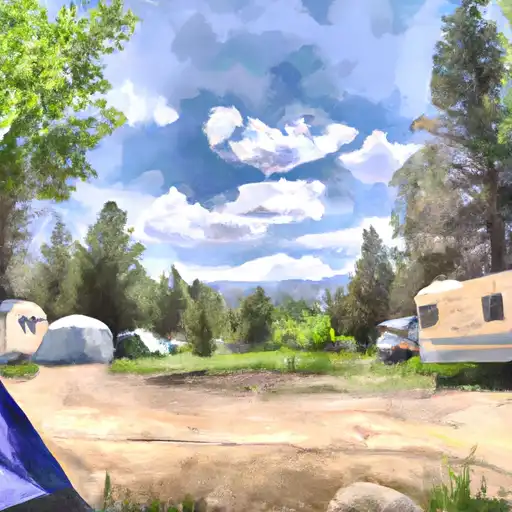
Camping in Wilderness Raggeds
Campgrounds inside the park, with today's conditions score.
Plan your visit down to the hour
Same weather feed Snoflo's iOS app uses -- updated continuously from NOAA / yr.no.
Next 5 days, hour by hour
Temperature line with weather symbols on top, snow + rain accumulation as columns, humidity as a dotted line.
5-day forecast table
Every 3 hours, broken out across temperature, snow, rain, humidity, and wind.
| Time | Condition | Temp (°F) | Snow (in) | Rain (in) | Humidity (%) | Wind (mps) | Wind dir |
|---|---|---|---|---|---|---|---|
| Loading detailed forecast… | |||||||
15-day temperature & precipitation
Daily temperatures, snow, and rain projected over the next two weeks.
Responsible recreation & Leave No Trace
- Know before you go
- Check the operator's site for hours, permit requirements, seasonal closures, and fire restrictions before heading out.
- Stay on trail
- Stick to marked paths to protect vegetation, prevent erosion, and avoid disturbing wildlife habitat.
- Respect wildlife
- Observe from a distance, never feed wildlife, and store food securely if camping is permitted on-site.
- Pack it in, pack it out
- Carry out all trash, food scraps, and gear. Many parks have limited or no trash service.
- Leave what you find
- Don't take rocks, plants, or artifacts. They make the park what it is for the next visitor.
Set push alerts in the Snoflo app
Save Wilderness Raggeds as a favorite, set a custom threshold (precipitation, freezing temperatures, fire-restriction days), and the iOS app will push the moment conditions cross.
About Wilderness Raggeds
What can I do at Wilderness Raggeds?
Most Snoflo-tracked parks support hiking, picnicking, and wildlife viewing. Check the operator's site for activity-specific rules (camping, fishing, paddling, hunting).
How fresh is the weather data?
The hourly forecast updates throughout the day from NOAA / yr.no. Streamflow comes live from USGS streamgauges.
When is the best time to visit?
Use the 15-day temperature & precipitation outlook on this page to plan -- pick a window with comfortable temperatures and low precipitation.
How do I get to Wilderness Raggeds?
Tap Directions in the hero above to open driving directions in Google Maps, or Open in map to center the Snoflo interactive map on the park.
Can I get alerts when conditions change?
Yes -- alerts are managed in the Snoflo iOS app. Favorite this park, set a threshold (temperature, precipitation), and you'll get a push the moment it crosses.
Park & land designation reference
A quick legend for the federal and state land categories Snoflo tracks. Each designation comes with different rules around access, recreation, and resource extraction.
- National Park
- Large protected natural areas managed by the federal government to preserve significant landscapes, ecosystems, and cultural resources; recreation is allowed but conservation is the priority.
- State Park
- Public natural or recreational areas managed by a state government, typically smaller than national parks and focused on regional natural features, recreation, and education.
- Local Park
- Community-level parks managed by cities or counties, emphasizing recreation, playgrounds, sports, and green space close to populated areas.
- Wilderness Area
- The highest level of land protection in the U.S.; designated areas where nature is left essentially untouched, with no roads, structures, or motorized motorized access permitted.
- National Recreation Area
- Areas set aside primarily for outdoor recreation (boating, hiking, fishing, often around reservoirs, rivers, or scenic landscapes); may allow more development.
- National Conservation Area (BLM)
- BLM-managed areas with special ecological, cultural, or scientific value; more protection than typical BLM land but less strict than Wilderness Areas.
- State Forest
- State-managed forests focused on habitat, watershed, recreation, and sustainable timber harvest.
- Bureau of Land Management (BLM) Land
- Vast federal lands managed for mixed use -- recreation, grazing, mining, conservation -- with fewer restrictions than national parks or forests.