Halfmoon West Campground
Community Reviews
Been here? Share the conditions.
Reviews, ratings & photos are added in the free Snoflo iOS app — rate a spot, tag the conditions, and your visit is verified by location. Add or manage your reviews from the app.
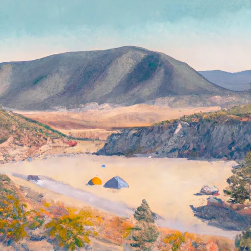
Halfmoon West
Reservations are not accepted for camping at Halfmoon West, and it operates on a first-come, first-served basis. Therefore, it is recommended to arrive early to secure a spot, especially during peak season. Speaking of which, the best time to visit this camping area is during the summer months when the weather is pleasant and ideal for outdoor activities like hiking and fishing.
While enjoying the natural beauty of Halfmoon West, campers should be cautious of the wildlife in the area, particularly bears. It is crucial to store food properly and follow bear safety guidelines to prevent any encounters. Additionally, it is advised to bring insect repellent as mosquitoes can be troublesome during certain times of the year. Overall, Halfmoon West camping area promises a peaceful getaway for nature lovers seeking an authentic camping experience in the beautiful state of Colorado.
What's on-site at Halfmoon West
Key facilities Snoflo tracks for this campground. Confirm with the operator before booking -- amenities can change seasonally.
Plan your trip down to the hour
Same weather feed Snoflo's iOS app uses -- updated continuously from NOAA / yr.no.
Next 5 days, hour by hour
Temperature line with weather symbols on top, snow + rain accumulation as columns, humidity as a dotted line.
5-day forecast table
Every 3 hours, broken out across temperature, snow, rain, humidity, and wind. Each cell is colour-coded relative to the column min/max so trends jump out at a glance.
| Time | Condition | Temp (°F) | Snow (in) | Rain (in) | Humidity (%) | Wind (mps) | Wind dir |
|---|---|---|---|---|---|---|---|
| Loading detailed forecast… | |||||||
15-day temperature & precipitation
Daily temperatures, snow, and rain projected over the next two weeks. Hover any point for the full breakdown.
Other campgrounds in the area
Snoflo-tracked campsites within driving distance of Halfmoon West, with reservations status.
| Campground | Reservations | Toilets | View |
|---|---|---|---|
| Halfmoon East Campground | ✓ | ✗ | → |
| Halfmoon West Campground | ✓ | ✗ | → |
| Halfmoon East | ✗ | ✗ | → |
| Elbert Creek Campground | ✓ | ✗ | → |
| Elbert Creek | ✗ | ✓ | → |
Nearby streamflow
USGS streamgauges within reach of Halfmoon West -- pulled live from the National Water Information System.
| Streamgauge | Discharge | View |
|---|---|---|
| Halfmoon Creek Near Malta | 7 cfs | → |
| Arkansas River Below Empire Gulch Near Malta | 43 cfs | → |
| Lake Creek Above Twin Lakes Reservoir | 27 cfs | → |
| Lake Fork Below Sugar Loaf Reservoir | 4 cfs | → |
| Arkansas River Near Leadville | 10 cfs | → |
| Ef Arkansas R At Us Hiway 24 | 9 cfs | → |
Nearby snow depths
NRCS SNOTEL stations within reach of Halfmoon West -- relevant when planning a shoulder-season or alpine trip.
| SNOTEL station | Snowpack | 24h Snowfall | View |
|---|---|---|---|
| Brumley | 1.0 in | 0.0 in | → |
| Brumley | 0.0 in | 0.0 in | → |
| Independence Pass | 0.0 in | 0.0 in | → |
| Nohrsc Ivanhoe | 0.0 in | 0.0 in | → |
| Ivanhoe | 1.0 in | 0.0 in | → |
| Independence Pass | 0.0 in | 0.0 in | → |
Plan a longer trip
The closest parks, lakes, boat launches, and paddle runs so a camping night can grow into a full weekend.
Parks
- Wilderness Leadville
- Wilderness Mount Massive
- Wilderness Hunter-Fryingpan
- Wilderness Holy Cross
- Mollie Gibson Park
- Snyder Park
Boat launches
- Red Rooster Boating Site
- Dexter Point Boating Site
- Matchless Boating Site
- Turquoise Lake Trail Lake County
- Cr 390 Chaffee County
Fishing spots
- Hayden Meadows Reservoir
- Crystal Lake Fishing Site
- Crystal Lakes
- Mount Elbert Forebay
- Deception Point Fishing Site
- Moache Fishing Site
Camping essentials & Leave No Trace
- Pack it in, pack it out
- Take all trash, food scraps, and gear back with you to keep campsites clean and protect wildlife.
- Respect wildlife
- Observe animals from a distance, store food securely, and never feed wildlife to maintain natural behavior and safety.
- Know before you go
- Check weather, fire restrictions, trail conditions, and permit requirements to ensure a safe and well-planned trip.
- Minimize campfire impact
- Use established fire rings, keep fires small, fully extinguish them, or opt for a camp stove when fires are restricted.
- Leave what you find
- Preserve natural and cultural features by avoiding removal of plants, rocks, artifacts, or other elements of the environment.
Set push alerts in the Snoflo app
Save Halfmoon West as a favorite, set a custom threshold (precipitation, snowpack, freezing temperatures), and the iOS app will push the moment conditions cross.
About Halfmoon West
Can I make reservations at Halfmoon West?
This campground does not appear to accept reservations -- it's typically first-come, first-served. Arrive early on summer weekends.
How fresh is the weather data on this page?
The hourly forecast updates throughout the day from the NOAA / yr.no public feeds. Streamflow data is pulled live from USGS streamgauges and snowpack from the NRCS SNOTEL network.
What's the best time of year to visit?
Use the 15-day temperature & precipitation outlook on this page to plan -- pick a window with comfortable temperatures and low precipitation. For longer trips, the 5-day hourly meteogram shows snow + rain accumulation hour-by-hour.
How do I get to Halfmoon West?
Tap Directions in the hero above to open driving directions in Google Maps, or Open in map to center the Snoflo interactive map on the campground.
Can I get alerts when conditions change?
Yes -- alerts are managed through the Snoflo iOS app. Favorite this campground, set a threshold (temperature, snowpack, precipitation), and you'll get a push the moment it crosses.
Other campgrounds near here
Snoflo-tracked campgrounds within driving distance of Halfmoon West.