Theodore Roosevelt National Park South Unit
Community Reviews
Been here? Share the conditions.
Reviews, ratings & photos are added in the free Snoflo iOS app — rate a spot, tag the conditions, and your visit is verified by location. Add or manage your reviews from the app.
Theodore Roosevelt National Park South Unit
Reasons to Visit:
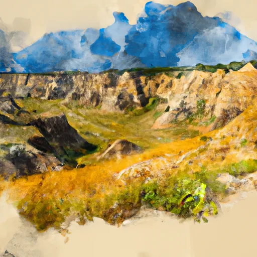
1. Stunning Scenery: The South Unit of Theodore Roosevelt National Park showcases breathtaking scenery with colorful badlands, rugged canyons, and vast open prairies. The landscape offers a stark contrast to the surrounding flat plains of North Dakota.
2. Wildlife Viewing: The park is home to a diverse array of wildlife, including bison, elk, deer, prairie dogs, coyotes, and over 186 species of birds. This makes it an excellent destination for wildlife enthusiasts and bird watchers.
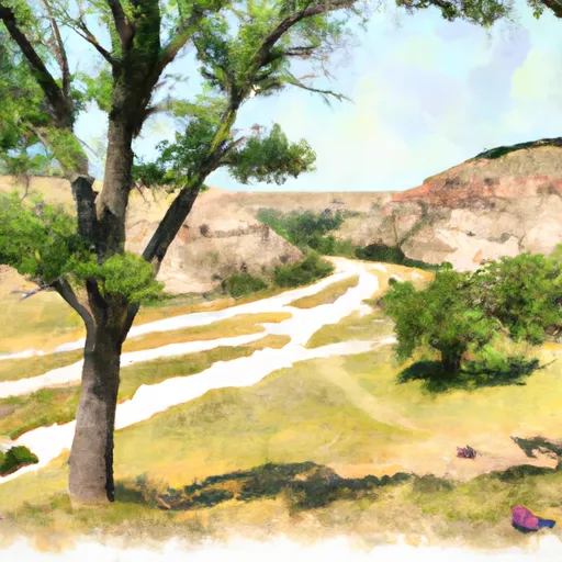
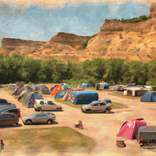
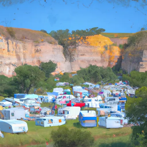
3. Outdoor Recreational Activities: Visitors can partake in a range of activities such as hiking, horseback riding, camping, fishing, and scenic drives. The park provides numerous trails of varying difficulties, allowing exploration for all skill levels.
Points of Interest:
1. Painted Canyon: Located near the visitor center, the Painted Canyon offers a panoramic view of the badlands. Visitors can enjoy the vista from the overlook or hike the 1.1-mile trail that descends into the canyon for a closer experience.
2. Wind Canyon: This area provides stunning views of the Little Missouri River winding through the badlands. It offers a short, accessible trail where visitors can witness the dramatic cliffs and unique rock formations.
3. Petrified Forest Loop: The scenic drive along this loop takes you through a petrified forest. Fossilized remains of ancient trees dating back over 65 million years can be seen along the 10-mile drive.
Interesting Facts:
1. Theodore Roosevelt National Park was established in 1947 to honor President Theodore Roosevelt, who was instrumental in preserving natural areas throughout the US.
2. The park covers approximately 70,446 acres, divided into North and South Units.
3. The South Unit is the more developed and easily accessible of the two units, with a visitor center, campgrounds, and a variety of amenities.
Best Time to Visit:
The best time to visit the South Unit of Theodore Roosevelt National Park is during the late spring (May and June) and early fall (September and October). During these times, the weather is generally mild, and the park is less crowded. Spring brings blooming wildflowers, while fall showcases beautiful autumn colors. Summers can be hot, with temperatures often exceeding 90°F, and winters are cold, with temperatures frequently below freezing.
Please note that it is always recommended to check with the official Theodore Roosevelt National Park website or contact the park directly for the most up-to-date information on park hours, accessibility, and road conditions before planning your visit.
Streamflow in Theodore Roosevelt National Park South Unit
Live USGS discharge at streamgauges inside the park boundary.
Trails in Theodore Roosevelt National Park South Unit
Named trails whose route falls inside the park.
Camping in Theodore Roosevelt National Park South Unit
Campgrounds inside the park, with today's conditions score.
Points of interest in Theodore Roosevelt National Park South Unit
Landmarks and points of interest inside the park boundary.


Plan your visit down to the hour
Same weather feed Snoflo's iOS app uses -- updated continuously from NOAA / yr.no.
Next 5 days, hour by hour
Temperature line with weather symbols on top, snow + rain accumulation as columns, humidity as a dotted line.
5-day forecast table
Every 3 hours, broken out across temperature, snow, rain, humidity, and wind.
| Time | Condition | Temp (°F) | Snow (in) | Rain (in) | Humidity (%) | Wind (mps) | Wind dir |
|---|---|---|---|---|---|---|---|
| Loading detailed forecast… | |||||||
15-day temperature & precipitation
Daily temperatures, snow, and rain projected over the next two weeks.
Responsible recreation & Leave No Trace
- Know before you go
- Check the operator's site for hours, permit requirements, seasonal closures, and fire restrictions before heading out.
- Stay on trail
- Stick to marked paths to protect vegetation, prevent erosion, and avoid disturbing wildlife habitat.
- Respect wildlife
- Observe from a distance, never feed wildlife, and store food securely if camping is permitted on-site.
- Pack it in, pack it out
- Carry out all trash, food scraps, and gear. Many parks have limited or no trash service.
- Leave what you find
- Don't take rocks, plants, or artifacts. They make the park what it is for the next visitor.
Set push alerts in the Snoflo app
Save Theodore Roosevelt National Park South Unit as a favorite, set a custom threshold (precipitation, freezing temperatures, fire-restriction days), and the iOS app will push the moment conditions cross.
About Theodore Roosevelt National Park South Unit
What can I do at Theodore Roosevelt National Park South Unit?
Most Snoflo-tracked parks support hiking, picnicking, and wildlife viewing. Check the operator's site for activity-specific rules (camping, fishing, paddling, hunting).
How fresh is the weather data?
The hourly forecast updates throughout the day from NOAA / yr.no. Streamflow comes live from USGS streamgauges.
When is the best time to visit?
Use the 15-day temperature & precipitation outlook on this page to plan -- pick a window with comfortable temperatures and low precipitation.
How do I get to Theodore Roosevelt National Park South Unit?
Tap Directions in the hero above to open driving directions in Google Maps, or Open in map to center the Snoflo interactive map on the park.
Can I get alerts when conditions change?
Yes -- alerts are managed in the Snoflo iOS app. Favorite this park, set a threshold (temperature, precipitation), and you'll get a push the moment it crosses.
Park & land designation reference
A quick legend for the federal and state land categories Snoflo tracks. Each designation comes with different rules around access, recreation, and resource extraction.
- National Park
- Large protected natural areas managed by the federal government to preserve significant landscapes, ecosystems, and cultural resources; recreation is allowed but conservation is the priority.
- State Park
- Public natural or recreational areas managed by a state government, typically smaller than national parks and focused on regional natural features, recreation, and education.
- Local Park
- Community-level parks managed by cities or counties, emphasizing recreation, playgrounds, sports, and green space close to populated areas.
- Wilderness Area
- The highest level of land protection in the U.S.; designated areas where nature is left essentially untouched, with no roads, structures, or motorized motorized access permitted.
- National Recreation Area
- Areas set aside primarily for outdoor recreation (boating, hiking, fishing, often around reservoirs, rivers, or scenic landscapes); may allow more development.
- National Conservation Area (BLM)
- BLM-managed areas with special ecological, cultural, or scientific value; more protection than typical BLM land but less strict than Wilderness Areas.
- State Forest
- State-managed forests focused on habitat, watershed, recreation, and sustainable timber harvest.
- Bureau of Land Management (BLM) Land
- Vast federal lands managed for mixed use -- recreation, grazing, mining, conservation -- with fewer restrictions than national parks or forests.