Cave Loop \ Slot Canyon Trail Fork overview
Community Reviews
Been here? Share the conditions.
Reviews, ratings & photos are added in the free Snoflo iOS app — rate a spot, tag the conditions, and your visit is verified by location. Add or manage your reviews from the app.
Cave Loop \ Slot Canyon Trail Fork
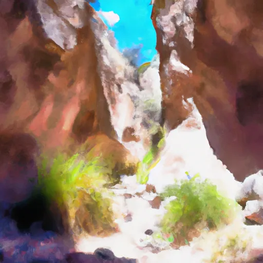
There are several good reasons to visit the Cave Loop Slot Canyon Trail Fork. The trail offers a unique opportunity to explore narrow slot canyons and see beautiful rock formations. The area is also home to a variety of wildlife, including desert bighorn sheep, mountain lions, and gray foxes. Hikers can enjoy stunning views of the surrounding cliffs and valleys, and the trail is a great place to take photos or simply enjoy the peace and quiet of nature. Overall, the Cave Loop Slot Canyon Trail Fork is a must-visit destination for anyone who loves hiking and exploring the great outdoors.
Plan your visit down to the hour
Same weather feed Snoflo's iOS app uses -- updated continuously from NOAA / yr.no.
Next 5 days, hour by hour
Temperature line with weather symbols on top, snow + rain accumulation as columns, humidity as a dotted line.
5-day forecast table
Every 3 hours, broken out across temperature, snow, rain, humidity, and wind.
| Time | Condition | Temp (°F) | Snow (in) | Rain (in) | Humidity (%) | Wind (mps) | Wind dir |
|---|---|---|---|---|---|---|---|
| Loading detailed forecast… | |||||||
15-day temperature & precipitation
Daily temperatures, snow, and rain projected over the next two weeks.
Plan a longer trip
The closest parks, campgrounds, fishing spots, and other landmarks so a quick visit can grow into a full day.
Parks
- Kasha-Katuwe Tent Rocks National Monument
- Wilderness Dome
- Bandelier National Monument
- Wilderness Bandelier
- Valles Caldera National Preserve
- Rover Park
Campgrounds
- Lookout Park
- Cochiti - Cochiti Lake
- Tetilla Peak - Cochiti Lake
- Juniper - Bandelier National Monument
- Ponderosa Reservation Group Campground
- Paliza Family Campground
Responsible visitation & Leave No Trace
- Know before you go
- Check the operator's site (BLM, NPS, state agency, or private owner) for access rules, permits, and seasonal closures before driving out.
- Stay on trail
- Many points of interest sit in fragile ecosystems. Stick to marked paths to protect vegetation and prevent erosion.
- Respect wildlife
- Observe from a distance, never feed wildlife, and give nesting birds and denning mammals plenty of space.
- Pack it in, pack it out
- Take all trash, food scraps, and gear back with you. Remote sites often have no trash service.
- Leave what you find
- Don't take rocks, plants, fossils, or artifacts. Federal law protects cultural and natural resources on public land.
Set push alerts in the Snoflo app
Save Cave Loop \ Slot Canyon Trail Fork as a favorite, set a weather threshold (precipitation, freezing temperatures), and the iOS app will push the moment conditions cross.
About Cave Loop \ Slot Canyon Trail Fork
What is Cave Loop \ Slot Canyon Trail Fork?
A point of interest in New-Mexico tracked by Snoflo -- typically a scenic landmark, named summit, monument, or viewpoint.
How fresh is the weather data?
The hourly forecast updates throughout the day from NOAA / yr.no public feeds.
When is the best time to visit?
Use the 15-day temperature & precipitation outlook on this page to pick a window with comfortable temperatures and low precipitation.
How do I get there?
Tap Directions in the hero above for Google Maps driving directions, or Open in map to center the Snoflo interactive map on the spot.
Can I get alerts when conditions change?
Yes -- alerts are managed in the Snoflo iOS app. Favorite this POI, set a threshold (temperature, precipitation), and you'll get a push the moment it crosses.
Other points of interest near here
Snoflo-tracked landmarks within driving distance of Cave Loop \ Slot Canyon Trail Fork.