Miramar dam

Miramar
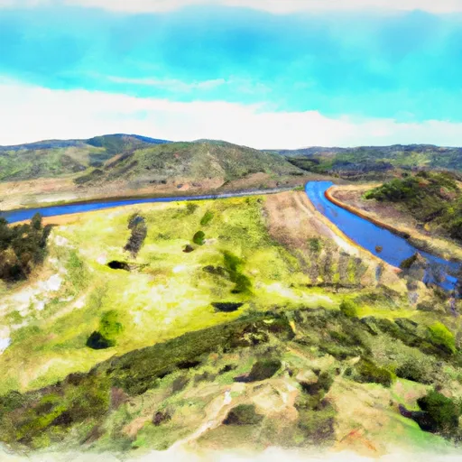
Miramar is a significant Earth dam located in the city of Miramar, California, completed in 1960 with a height of 165 feet and a hydraulic height of 159 feet. It serves as a crucial water supply structure on Big Surr Creek, providing a storage capacity of 7250 acre-feet and covering a surface area of 162 acres. The dam is under state jurisdiction and regulation, with the Department of Water Resources and Safety of Dams overseeing its permitting, inspection, and enforcement processes.
With a high hazard potential but a satisfactory condition assessment as of 2017, Miramar Dam is a vital infrastructure for the region's water resource management. The dam is owned and operated by the local government, with a primary purpose of water supply. It is situated in San Diego County and falls under the jurisdiction of the Los Angeles District of the US Army Corps of Engineers. Despite its age, the dam has been regularly inspected, with the last assessment conducted in December 2020, ensuring its safety and reliability in the face of potential risks and emergencies.
As an essential component of the water supply system in Miramar, this dam plays a crucial role in storing and regulating water flow from Big Surr Creek. With its strategic location and significant storage capacity, Miramar Dam contributes to the overall water security and resilience of the region, especially in times of drought or increasing water demand due to climate change. Water resource and climate enthusiasts can appreciate the engineering and regulatory aspects of this infrastructure, which highlights the importance of sustainable water management practices in the face of evolving environmental challenges.
Plan around the weather
Same NOAA / yr.no feed Snoflo's iOS app uses. Watch the precipitation column on the meteogram -- rain on the basin upstream typically lifts inflow 24-72 hours later.
Next 5 days, hour by hour
Temperature line with weather symbols on top, snow + rain accumulation as columns, humidity as a dotted line.
5-day forecast table
Every 3 hours, broken out across temperature, snow, rain, humidity, and wind. Each cell is colour-coded relative to the column min/max.
| Time | Condition | Temp (°F) | Snow (in) | Rain (in) | Humidity (%) | Wind (mps) | Wind dir |
|---|---|---|---|---|---|---|---|
| Loading detailed forecast… | |||||||
15-day temperature & precipitation
Daily temperatures, snow, and rain projected over the next two weeks.
Nearby streamflow gauges
USGS streamgauges around Miramar -- inflows here typically show up in storage 24-72 hours later.
| Streamgauge | Discharge | View |
|---|---|---|
| Los Penasquitos C Nr Poway Ca | 0 cfs | → |
| San Diego R A Mast Rd Nr Santee Ca | 1 cfs | → |
| San Diego R A Fashion Valley At San Diego Ca | 2 cfs | → |
| Los Coches C Nr Lakeside Ca | 0 cfs | → |
| Santa Maria C Nr Ramona Ca | · | → |
| Guejito C Nr San Pasqual Ca | 0 cfs | → |
Make a day of it
Boat launches, lakeside camping, fishing access, and other reservoirs near Miramar.
Boat launches
See all →


Campgrounds
See all →


Fishing spots
See all →


River runs
See all →


About Miramar
Where does the data for Miramar come from?
Structural and regulatory data come from the U.S. Army Corps of Engineers' National Inventory of Dams (NID). Weather forecast comes from NOAA / yr.no -- the same feed Snoflo's iOS app uses.
How often is the report updated?
NID structural data refreshes annually as the Corps publishes updated assessments. The weather forecast refreshes throughout the day.
What does the High hazard rating mean?
The Corps of Engineers' hazard potential classification grades probable consequences if the dam fails: High = probable loss of human life; Significant = no probable loss of human life but possible economic loss / environmental damage; Low = no probable loss of human life, only minor economic / environmental losses. See the Dam Data Reference card below for the full definitions.
What's "% of normal"?
The current storage value compared to the historical average storage on this calendar day. 100% = right on average; values above 100% mean above-normal storage (wet year); values below mean below-normal (dry year or drought).
Can I get alerts when storage crosses a threshold?
Yes -- alerts are managed in the Snoflo iOS app. Favorite this dam, set a threshold, and you'll get a push the moment conditions cross.
Dam data reference
Condition Assessment
- Satisfactory
- No existing or potential dam safety deficiencies are recognized. Acceptable performance is expected under all loading conditions (static, hydrologic, seismic) in accordance with the minimum applicable state or federal regulatory criteria or tolerable risk guidelines.
- Fair
- No existing dam safety deficiencies are recognized for normal operating conditions. Rare or extreme hydrologic and/or seismic events may result in a dam safety deficiency. Risk may be in the range to take further action.
- Poor
- A dam safety deficiency is recognized for normal operating conditions which may realistically occur. Remedial action is necessary. POOR may also be used when uncertainties exist as to critical analysis parameters which identify a potential dam safety deficiency.
- Unsatisfactory
- A dam safety deficiency is recognized that requires immediate or emergency remedial action for problem resolution.
- Not Rated
- The dam has not been inspected, is not under state or federal jurisdiction, or has been inspected but, for whatever reason, has not been rated.
Hazard Potential Classification
- High
- Dams assigned the high hazard potential classification are those where failure or mis-operation will probably cause loss of human life.
- Significant
- Dams assigned the significant hazard potential classification are those dams where failure or mis-operation results in no probable loss of human life but can cause economic loss, environmental damage, disruption of lifeline facilities, or impact other concerns. Significant hazard potential classification dams are often located in predominantly rural or agricultural areas but could be in areas with population and significant infrastructure.
- Low
- Dams assigned the low hazard potential classification are those where failure or mis-operation results in no probable loss of human life and low economic and/or environmental losses. Losses are principally limited to the owner's property.
- Undetermined
- Dams for which a downstream hazard potential has not been designated or is not provided.