Franktown Parker Fpa-4 Reservoir Report
Last Updated: February 1, 2026
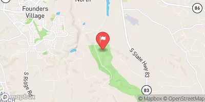
Franktown Parker Fpa-4 is a vital flood risk reduction infrastructure located in Franktown, Colorado, along the Antelope Creek.
°F
°F
mph
Wind
%
Humidity
15-Day Weather Outlook
Summary
Built in 1963 by the USDA NRCS, this earth dam stands at a height of 30 feet and spans 630 feet in length, providing a storage capacity of 192 acre-feet. Its primary purpose is flood risk reduction, serving as a critical safeguard against potential flooding events in the area. The dam has a low hazard potential and is deemed to be in satisfactory condition as of the last inspection in April 2019.
Managed by the local government, Franktown Parker Fpa-4 is regulated by the Colorado Department of Water Resources, ensuring that the dam meets state standards for safety and operation. Despite its age, the dam continues to play a crucial role in protecting the surrounding community from potential flood risks, with a maximum discharge capacity of 842 cubic feet per second. The risk assessment for the dam is categorized as high, indicating the importance of ongoing monitoring and maintenance to ensure its continued effectiveness in flood protection.
Located in Douglas County, Colorado, Franktown Parker Fpa-4 exemplifies the collaboration between federal and state agencies in managing water resources and mitigating climate-related risks. With its strategic design and satisfactory condition, the dam stands as a testament to effective flood risk reduction infrastructure in the region. As water resource and climate enthusiasts, understanding the key details and functions of dams like Franktown Parker Fpa-4 is essential in appreciating the efforts to safeguard communities and ecosystems from the impacts of extreme weather events.
Year Completed |
1963 |
Dam Length |
630 |
Dam Height |
30 |
River Or Stream |
ANTELOPE CREEK |
Primary Dam Type |
Earth |
Surface Area |
18 |
Hydraulic Height |
30 |
Drainage Area |
2 |
Nid Storage |
192 |
Structural Height |
30 |
Hazard Potential |
Low |
Nid Height |
30 |
Seasonal Comparison
Hourly Weather Forecast
Nearby Streamflow Levels
Dam Data Reference
Condition Assessment
SatisfactoryNo existing or potential dam safety deficiencies are recognized. Acceptable performance is expected under all loading conditions (static, hydrologic, seismic) in accordance with the minimum applicable state or federal regulatory criteria or tolerable risk guidelines.
Fair
No existing dam safety deficiencies are recognized for normal operating conditions. Rare or extreme hydrologic and/or seismic events may result in a dam safety deficiency. Risk may be in the range to take further action. Note: Rare or extreme event is defined by the regulatory agency based on their minimum
Poor A dam safety deficiency is recognized for normal operating conditions which may realistically occur. Remedial action is necessary. POOR may also be used when uncertainties exist as to critical analysis parameters which identify a potential dam safety deficiency. Investigations and studies are necessary.
Unsatisfactory
A dam safety deficiency is recognized that requires immediate or emergency remedial action for problem resolution.
Not Rated
The dam has not been inspected, is not under state or federal jurisdiction, or has been inspected but, for whatever reason, has not been rated.
Not Available
Dams for which the condition assessment is restricted to approved government users.
Hazard Potential Classification
HighDams assigned the high hazard potential classification are those where failure or mis-operation will probably cause loss of human life.
Significant
Dams assigned the significant hazard potential classification are those dams where failure or mis-operation results in no probable loss of human life but can cause economic loss, environment damage, disruption of lifeline facilities, or impact other concerns. Significant hazard potential classification dams are often located in predominantly rural or agricultural areas but could be in areas with population and significant infrastructure.
Low
Dams assigned the low hazard potential classification are those where failure or mis-operation results in no probable loss of human life and low economic and/or environmental losses. Losses are principally limited to the owner's property.
Undetermined
Dams for which a downstream hazard potential has not been designated or is not provided.
Not Available
Dams for which the downstream hazard potential is restricted to approved government users.


 Franktown Parker Fpa-4
 Palmer Lake
 Upper Reservoir - Palmer Lake
 Deadmans Creek