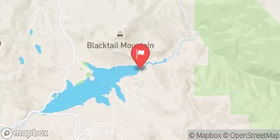
Fish Creek Reservoir Report
Nearby: Fish Creek Saddle Long Lake
Last Updated: February 21, 2026
Fish Creek, located in Routt County, Colorado, is a vital water resource managed by the local government of Steamboat Springs.
Summary
The dam, completed in 1954, serves the primary purpose of water supply, with a storage capacity of 5,359 acre-feet and a surface area of 136 acres. The Middle Fork Fish Creek, where the dam is situated, has a drainage area of 4 square miles and can discharge up to 6,589 cubic feet per second.
With a dam height of 78 feet and a spillway width of 80 feet, Fish Creek Dam poses a high hazard potential but is currently assessed as being in satisfactory condition. The structure has undergone several modifications over the years to ensure its structural integrity, with the most recent inspection conducted in July 2020. Despite its moderate risk rating, the dam's risk management measures and emergency action plan readiness are not explicitly mentioned in the available data, highlighting areas for potential improvement in ensuring the safety and resilience of this critical water infrastructure in the face of changing climate conditions.
°F
°F
mph
Wind
%
Humidity
15-Day Weather Outlook
Years Modified |
1959 - Structural, 1972 - Structural, 1996 - Structural |
Year Completed |
1954 |
Dam Length |
868 |
Dam Height |
78 |
River Or Stream |
MIDDLE FORK FISH CREEK |
Primary Dam Type |
Earth |
Surface Area |
136 |
Hydraulic Height |
78 |
Drainage Area |
4 |
Nid Storage |
5359 |
Structural Height |
88 |
Hazard Potential |
High |
Foundations |
Rock, Soil |
Nid Height |
88 |
Seasonal Comparison
5-Day Hourly Forecast Detail
Nearby Streamflow Levels
Dam Data Reference
Condition Assessment
SatisfactoryNo existing or potential dam safety deficiencies are recognized. Acceptable performance is expected under all loading conditions (static, hydrologic, seismic) in accordance with the minimum applicable state or federal regulatory criteria or tolerable risk guidelines.
Fair
No existing dam safety deficiencies are recognized for normal operating conditions. Rare or extreme hydrologic and/or seismic events may result in a dam safety deficiency. Risk may be in the range to take further action. Note: Rare or extreme event is defined by the regulatory agency based on their minimum
Poor A dam safety deficiency is recognized for normal operating conditions which may realistically occur. Remedial action is necessary. POOR may also be used when uncertainties exist as to critical analysis parameters which identify a potential dam safety deficiency. Investigations and studies are necessary.
Unsatisfactory
A dam safety deficiency is recognized that requires immediate or emergency remedial action for problem resolution.
Not Rated
The dam has not been inspected, is not under state or federal jurisdiction, or has been inspected but, for whatever reason, has not been rated.
Not Available
Dams for which the condition assessment is restricted to approved government users.
Hazard Potential Classification
HighDams assigned the high hazard potential classification are those where failure or mis-operation will probably cause loss of human life.
Significant
Dams assigned the significant hazard potential classification are those dams where failure or mis-operation results in no probable loss of human life but can cause economic loss, environment damage, disruption of lifeline facilities, or impact other concerns. Significant hazard potential classification dams are often located in predominantly rural or agricultural areas but could be in areas with population and significant infrastructure.
Low
Dams assigned the low hazard potential classification are those where failure or mis-operation results in no probable loss of human life and low economic and/or environmental losses. Losses are principally limited to the owner's property.
Undetermined
Dams for which a downstream hazard potential has not been designated or is not provided.
Not Available
Dams for which the downstream hazard potential is restricted to approved government users.
Area Campgrounds
| Location | Reservations | Toilets |
|---|---|---|
 Granite Campground
|
||
 Granite
|
||
 Summit Lake
|
||
 Dry Lake Campground
|
||
 Dry Lake
|
||
 Hidden Lakes Campground
|


 Fish Creek
 Lower Fish Creek
 Casey`s Pond
 Fetcher Park
 Tiago Lake
 Teal Lake