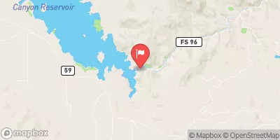
Mount Pisgah Reservoir Report
Nearby: Jordan #1 Magnuson #1
Last Updated: February 21, 2026
Mount Pisgah, also known as Wright's Reservoir, is a private earth dam located in Teller County, Colorado.
Summary
Completed in 1911, this dam serves primarily for irrigation purposes along Four Mile Creek. With a height of 69 feet and a hydraulic height of 80 feet, Mount Pisgah has a storage capacity of 3,540 acre-feet and covers a surface area of 124 acres.
Despite being privately owned, Mount Pisgah is regulated by the Colorado Department of Water Resources, with state jurisdiction, permitting, inspection, and enforcement in place. The dam has a spillway width of 60 feet and a maximum discharge capacity of 6,073 cubic feet per second. Its hazard potential is classified as high, with a fair condition assessment as of the last inspection in April 2020.
This historic structure not only provides crucial irrigation water but also supports recreational activities in the area. With its scenic location and important role in water resource management, Mount Pisgah stands as a testament to the intersection of human ingenuity and environmental stewardship in the face of changing climate conditions.
°F
°F
mph
Wind
%
Humidity
15-Day Weather Outlook
Year Completed |
1911 |
Dam Length |
610 |
Dam Height |
69 |
River Or Stream |
FOUR MILE CREEK |
Primary Dam Type |
Earth |
Surface Area |
124 |
Hydraulic Height |
80 |
Drainage Area |
72 |
Nid Storage |
3540 |
Structural Height |
80 |
Hazard Potential |
High |
Nid Height |
80 |
Seasonal Comparison
5-Day Hourly Forecast Detail
Nearby Streamflow Levels
Dam Data Reference
Condition Assessment
SatisfactoryNo existing or potential dam safety deficiencies are recognized. Acceptable performance is expected under all loading conditions (static, hydrologic, seismic) in accordance with the minimum applicable state or federal regulatory criteria or tolerable risk guidelines.
Fair
No existing dam safety deficiencies are recognized for normal operating conditions. Rare or extreme hydrologic and/or seismic events may result in a dam safety deficiency. Risk may be in the range to take further action. Note: Rare or extreme event is defined by the regulatory agency based on their minimum
Poor A dam safety deficiency is recognized for normal operating conditions which may realistically occur. Remedial action is necessary. POOR may also be used when uncertainties exist as to critical analysis parameters which identify a potential dam safety deficiency. Investigations and studies are necessary.
Unsatisfactory
A dam safety deficiency is recognized that requires immediate or emergency remedial action for problem resolution.
Not Rated
The dam has not been inspected, is not under state or federal jurisdiction, or has been inspected but, for whatever reason, has not been rated.
Not Available
Dams for which the condition assessment is restricted to approved government users.
Hazard Potential Classification
HighDams assigned the high hazard potential classification are those where failure or mis-operation will probably cause loss of human life.
Significant
Dams assigned the significant hazard potential classification are those dams where failure or mis-operation results in no probable loss of human life but can cause economic loss, environment damage, disruption of lifeline facilities, or impact other concerns. Significant hazard potential classification dams are often located in predominantly rural or agricultural areas but could be in areas with population and significant infrastructure.
Low
Dams assigned the low hazard potential classification are those where failure or mis-operation results in no probable loss of human life and low economic and/or environmental losses. Losses are principally limited to the owner's property.
Undetermined
Dams for which a downstream hazard potential has not been designated or is not provided.
Not Available
Dams for which the downstream hazard potential is restricted to approved government users.
Area Campgrounds
| Location | Reservations | Toilets |
|---|---|---|
 Mueller State Park
|
||
 Crags Campground
|
||
 The Crags
|
||
 Rocky Mountain Mennonite Camp
|
||
 The Bank Campground Campsite A-13
|
||
 The Bank Campground Campsite A-12
|


 Mount Pisgah
 Fourmile Creek
 Little High Creek