Way dam

Way
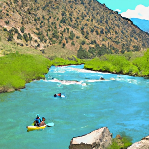
Way, also known as Coulter, is a privately owned irrigation dam located in Kremmling, Colorado. Built in 1941 by designer B.T. Chase, this Earth-type dam has a height of 20 feet and a length of 560 feet, with a storage capacity of 145 acre-feet. Its primary purpose is irrigation, serving the Beaver Creek-OS river/stream system in Grand County. The dam has a low hazard potential and is in fair condition, with the last inspection conducted in August 2017.
Despite its age, Way dam continues to play a vital role in water resource management in the region, providing water for irrigation, fire protection, livestock, and small fish pond purposes. With a maximum discharge capacity of 400 cubic feet per second, the dam is equipped with a slide gate outlet for water release. While the risk assessment indicates a moderate level of risk, the dam meets state regulatory requirements for inspection, enforcement, and permitting, ensuring its continued safe operation in the face of changing climate conditions.
As climate change impacts water resources, structures like Way dam become increasingly important in managing water supply and demand. With its strategic location and historical significance, Way dam stands as a testament to the resilience and adaptability of water infrastructure in the face of evolving environmental challenges. As water enthusiasts and climate advocates, understanding and supporting the stewardship of dams like Way is crucial for ensuring sustainable water management practices for future generations.
Plan around the weather
Same NOAA / yr.no feed Snoflo's iOS app uses. Watch the precipitation column on the meteogram -- rain on the basin upstream typically lifts inflow 24-72 hours later.
Next 5 days, hour by hour
Temperature line with weather symbols on top, snow + rain accumulation as columns, humidity as a dotted line.
5-day forecast table
Every 3 hours, broken out across temperature, snow, rain, humidity, and wind. Each cell is colour-coded relative to the column min/max.
| Time | Condition | Temp (°F) | Snow (in) | Rain (in) | Humidity (%) | Wind (mps) | Wind dir |
|---|---|---|---|---|---|---|---|
| Loading detailed forecast… | |||||||
15-day temperature & precipitation
Daily temperatures, snow, and rain projected over the next two weeks.
Nearby streamflow gauges
USGS streamgauges around Way -- inflows here typically show up in storage 24-72 hours later.
| Streamgauge | Discharge | View |
|---|---|---|
| Colorado River Near Kremmling | 1,160 cfs | → |
| Blue River Below Green Mountain Reservoir | 607 cfs | → |
| Muddy Crk Blw Wolford Mtn Reser. Nr Kremmling | 222 cfs | → |
| Williams Fork Below Williams Fork Reservoir | 394 cfs | → |
| Williams Fork Near Parshall | 11 cfs | → |
| Piney River Near State Bridge | 11 cfs | → |


About Way
Where does the data for Way come from?
Structural and regulatory data come from the U.S. Army Corps of Engineers' National Inventory of Dams (NID). Weather forecast comes from NOAA / yr.no -- the same feed Snoflo's iOS app uses.
How often is the report updated?
NID structural data refreshes annually as the Corps publishes updated assessments. The weather forecast refreshes throughout the day.
What does the Low hazard rating mean?
The Corps of Engineers' hazard potential classification grades probable consequences if the dam fails: High = probable loss of human life; Significant = no probable loss of human life but possible economic loss / environmental damage; Low = no probable loss of human life, only minor economic / environmental losses. See the Dam Data Reference card below for the full definitions.
What's "% of normal"?
The current storage value compared to the historical average storage on this calendar day. 100% = right on average; values above 100% mean above-normal storage (wet year); values below mean below-normal (dry year or drought).
Can I get alerts when storage crosses a threshold?
Yes -- alerts are managed in the Snoflo iOS app. Favorite this dam, set a threshold, and you'll get a push the moment conditions cross.
Dam data reference
Condition Assessment
- Satisfactory
- No existing or potential dam safety deficiencies are recognized. Acceptable performance is expected under all loading conditions (static, hydrologic, seismic) in accordance with the minimum applicable state or federal regulatory criteria or tolerable risk guidelines.
- Fair
- No existing dam safety deficiencies are recognized for normal operating conditions. Rare or extreme hydrologic and/or seismic events may result in a dam safety deficiency. Risk may be in the range to take further action.
- Poor
- A dam safety deficiency is recognized for normal operating conditions which may realistically occur. Remedial action is necessary. POOR may also be used when uncertainties exist as to critical analysis parameters which identify a potential dam safety deficiency.
- Unsatisfactory
- A dam safety deficiency is recognized that requires immediate or emergency remedial action for problem resolution.
- Not Rated
- The dam has not been inspected, is not under state or federal jurisdiction, or has been inspected but, for whatever reason, has not been rated.
Hazard Potential Classification
- High
- Dams assigned the high hazard potential classification are those where failure or mis-operation will probably cause loss of human life.
- Significant
- Dams assigned the significant hazard potential classification are those dams where failure or mis-operation results in no probable loss of human life but can cause economic loss, environmental damage, disruption of lifeline facilities, or impact other concerns. Significant hazard potential classification dams are often located in predominantly rural or agricultural areas but could be in areas with population and significant infrastructure.
- Low
- Dams assigned the low hazard potential classification are those where failure or mis-operation results in no probable loss of human life and low economic and/or environmental losses. Losses are principally limited to the owner's property.
- Undetermined
- Dams for which a downstream hazard potential has not been designated or is not provided.