Deep Creek West Dam

Deep Creek West
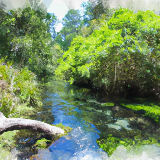
Deep Creek West, located in St. Johns, Florida, is a state-regulated dam with a primary purpose of flood risk reduction. This earth dam, with a height of 10 feet and a hydraulic height of 8 feet, was completed with a storage capacity of 152 acre-feet and a normal storage of 102 acre-feet. The dam spans a length of 5495 feet and sits on a drainage area of 0.02 square miles, serving as a critical infrastructure in managing water resources in the region.
Despite being classified as having a low hazard potential, Deep Creek West was assessed to be in fair condition as of May 2017. The dam is monitored and maintained by the St. Johns River Water Management District, with state jurisdiction and permitting in place. While primarily designed for flood risk reduction, the dam also supports recreation and water supply purposes in the area. Its location along the Deep Creek tributary and proximity to the city of Hastings highlight its importance in safeguarding against potential water-related hazards and ensuring the sustainable management of water resources.
With a risk assessment deemed moderate, efforts are in place to continually evaluate and manage any potential risks associated with Deep Creek West. Emergency action plans and risk management measures are integral components in ensuring the safety and functionality of the dam. As water resource and climate enthusiasts, staying informed about the condition and maintenance of critical infrastructure like Deep Creek West is vital in promoting resilience and sustainability in the face of changing environmental conditions.
Plan around the weather
Same NOAA / yr.no feed Snoflo's iOS app uses. Watch the precipitation column on the meteogram -- rain on the basin upstream typically lifts inflow 24-72 hours later.
Next 5 days, hour by hour
Temperature line with weather symbols on top, snow + rain accumulation as columns, humidity as a dotted line.
5-day forecast table
Every 3 hours, broken out across temperature, snow, rain, humidity, and wind. Each cell is colour-coded relative to the column min/max.
| Time | Condition | Temp (°F) | Snow (in) | Rain (in) | Humidity (%) | Wind (mps) | Wind dir |
|---|---|---|---|---|---|---|---|
| Loading detailed forecast… | |||||||
15-day temperature & precipitation
Daily temperatures, snow, and rain projected over the next two weeks.
Nearby streamflow gauges
USGS streamgauges around Deep Creek West -- inflows here typically show up in storage 24-72 hours later.
| Streamgauge | Discharge | View |
|---|---|---|
| Deep Creek At Spuds | 69 cfs | → |
| Dunns Creek Near Satsuma | 4,020 cfs | → |
| Pellicer Creek Near Espanola | 369 cfs | → |
| St. Johns R At Buffalo Bluff Nr Satsuma | 16,700 cfs | → |
| Haw Creek Ab Russells Landing Nr St Johns Park Fl | 113 cfs | → |
| Ocklawaha R At Rodman Dam Nr Orange Springs | 413 cfs | → |
Make a day of it
Boat launches, lakeside camping, fishing access, and other reservoirs near Deep Creek West.
Boat launches
See all →


Campgrounds
See all →


Fishing spots
See all →


River runs
See all →


About Deep Creek West
Where does the data for Deep Creek West come from?
Structural and regulatory data come from the U.S. Army Corps of Engineers' National Inventory of Dams (NID). Weather forecast comes from NOAA / yr.no -- the same feed Snoflo's iOS app uses.
How often is the report updated?
NID structural data refreshes annually as the Corps publishes updated assessments. The weather forecast refreshes throughout the day.
What does the Low hazard rating mean?
The Corps of Engineers' hazard potential classification grades probable consequences if the dam fails: High = probable loss of human life; Significant = no probable loss of human life but possible economic loss / environmental damage; Low = no probable loss of human life, only minor economic / environmental losses. See the Dam Data Reference card below for the full definitions.
What's "% of normal"?
The current storage value compared to the historical average storage on this calendar day. 100% = right on average; values above 100% mean above-normal storage (wet year); values below mean below-normal (dry year or drought).
Can I get alerts when storage crosses a threshold?
Yes -- alerts are managed in the Snoflo iOS app. Favorite this dam, set a threshold, and you'll get a push the moment conditions cross.
Dam data reference
Condition Assessment
- Satisfactory
- No existing or potential dam safety deficiencies are recognized. Acceptable performance is expected under all loading conditions (static, hydrologic, seismic) in accordance with the minimum applicable state or federal regulatory criteria or tolerable risk guidelines.
- Fair
- No existing dam safety deficiencies are recognized for normal operating conditions. Rare or extreme hydrologic and/or seismic events may result in a dam safety deficiency. Risk may be in the range to take further action.
- Poor
- A dam safety deficiency is recognized for normal operating conditions which may realistically occur. Remedial action is necessary. POOR may also be used when uncertainties exist as to critical analysis parameters which identify a potential dam safety deficiency.
- Unsatisfactory
- A dam safety deficiency is recognized that requires immediate or emergency remedial action for problem resolution.
- Not Rated
- The dam has not been inspected, is not under state or federal jurisdiction, or has been inspected but, for whatever reason, has not been rated.
Hazard Potential Classification
- High
- Dams assigned the high hazard potential classification are those where failure or mis-operation will probably cause loss of human life.
- Significant
- Dams assigned the significant hazard potential classification are those dams where failure or mis-operation results in no probable loss of human life but can cause economic loss, environmental damage, disruption of lifeline facilities, or impact other concerns. Significant hazard potential classification dams are often located in predominantly rural or agricultural areas but could be in areas with population and significant infrastructure.
- Low
- Dams assigned the low hazard potential classification are those where failure or mis-operation results in no probable loss of human life and low economic and/or environmental losses. Losses are principally limited to the owner's property.
- Undetermined
- Dams for which a downstream hazard potential has not been designated or is not provided.