Riner Pond Dam East Dam

Riner Pond Dam East
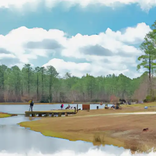
Riner Pond Dam East, located in Swainsboro, Georgia, stands as a testament to engineering excellence with its earth buttress design that was completed in 1960 by the designer Collins. The dam, situated on the Hammock Branch river, serves the primary purpose of recreation, offering a serene escape for water resource and climate enthusiasts to enjoy the tranquil surroundings. With a low hazard potential and a moderate risk assessment rating, the dam provides a safe and stable environment for visitors to appreciate the beauty of nature.
Standing at a height of 18.4 feet and a length of 495 feet, Riner Pond Dam East boasts a storage capacity of 85 acre-feet, with a normal storage level of 62 acre-feet. The dam's uncontrolled spillway and outlet gates add to its charm, while its condition assessment remains unrated. Despite lacking state regulation and inspection, the dam's structural integrity and low hazard potential ensure a safe and enjoyable recreational experience for all who visit. With its location in Emanuel County, Georgia, this hidden gem offers a unique opportunity for water resource enthusiasts to explore and appreciate nature's wonders.
For those seeking a peaceful retreat in the heart of Georgia, Riner Pond Dam East provides a picturesque setting for outdoor enthusiasts to immerse themselves in the beauty of the surrounding landscape. With its serene waters and recreational opportunities, this dam offers a one-of-a-kind experience for individuals interested in water resources and climate. From fishing to birdwatching, visitors can enjoy a variety of activities while basking in the tranquility of this hidden oasis. So pack your gear, grab your binoculars, and head on over to Riner Pond Dam East for an unforgettable adventure in nature's playground.
Plan around the weather
Same NOAA / yr.no feed Snoflo's iOS app uses. Watch the precipitation column on the meteogram -- rain on the basin upstream typically lifts inflow 24-72 hours later.
Next 5 days, hour by hour
Temperature line with weather symbols on top, snow + rain accumulation as columns, humidity as a dotted line.
5-day forecast table
Every 3 hours, broken out across temperature, snow, rain, humidity, and wind. Each cell is colour-coded relative to the column min/max.
| Time | Condition | Temp (°F) | Snow (in) | Rain (in) | Humidity (%) | Wind (mps) | Wind dir |
|---|---|---|---|---|---|---|---|
| Loading detailed forecast… | |||||||
15-day temperature & precipitation
Daily temperatures, snow, and rain projected over the next two weeks.
Nearby streamflow gauges
USGS streamgauges around Riner Pond Dam East -- inflows here typically show up in storage 24-72 hours later.
| Streamgauge | Discharge | View |
|---|---|---|
| Ogeechee River At Midville | 869 cfs | → |
| Ogeechee River At Rocky Ford Rd | 616 cfs | → |
| Oconee River Near Mount Vernon | 1,460 cfs | → |
| Oconee River At Dublin | 1,180 cfs | → |
| Ohoopee River Near Reidsville | 138 cfs | → |
| Williamson Swamp Creek At Davisboro | 41 cfs | → |


About Riner Pond Dam East
Where does the data for Riner Pond Dam East come from?
Structural and regulatory data come from the U.S. Army Corps of Engineers' National Inventory of Dams (NID). Weather forecast comes from NOAA / yr.no -- the same feed Snoflo's iOS app uses.
How often is the report updated?
NID structural data refreshes annually as the Corps publishes updated assessments. The weather forecast refreshes throughout the day.
What does the Low hazard rating mean?
The Corps of Engineers' hazard potential classification grades probable consequences if the dam fails: High = probable loss of human life; Significant = no probable loss of human life but possible economic loss / environmental damage; Low = no probable loss of human life, only minor economic / environmental losses. See the Dam Data Reference card below for the full definitions.
What's "% of normal"?
The current storage value compared to the historical average storage on this calendar day. 100% = right on average; values above 100% mean above-normal storage (wet year); values below mean below-normal (dry year or drought).
Can I get alerts when storage crosses a threshold?
Yes -- alerts are managed in the Snoflo iOS app. Favorite this dam, set a threshold, and you'll get a push the moment conditions cross.
Dam data reference
Condition Assessment
- Satisfactory
- No existing or potential dam safety deficiencies are recognized. Acceptable performance is expected under all loading conditions (static, hydrologic, seismic) in accordance with the minimum applicable state or federal regulatory criteria or tolerable risk guidelines.
- Fair
- No existing dam safety deficiencies are recognized for normal operating conditions. Rare or extreme hydrologic and/or seismic events may result in a dam safety deficiency. Risk may be in the range to take further action.
- Poor
- A dam safety deficiency is recognized for normal operating conditions which may realistically occur. Remedial action is necessary. POOR may also be used when uncertainties exist as to critical analysis parameters which identify a potential dam safety deficiency.
- Unsatisfactory
- A dam safety deficiency is recognized that requires immediate or emergency remedial action for problem resolution.
- Not Rated
- The dam has not been inspected, is not under state or federal jurisdiction, or has been inspected but, for whatever reason, has not been rated.
Hazard Potential Classification
- High
- Dams assigned the high hazard potential classification are those where failure or mis-operation will probably cause loss of human life.
- Significant
- Dams assigned the significant hazard potential classification are those dams where failure or mis-operation results in no probable loss of human life but can cause economic loss, environmental damage, disruption of lifeline facilities, or impact other concerns. Significant hazard potential classification dams are often located in predominantly rural or agricultural areas but could be in areas with population and significant infrastructure.
- Low
- Dams assigned the low hazard potential classification are those where failure or mis-operation results in no probable loss of human life and low economic and/or environmental losses. Losses are principally limited to the owner's property.
- Undetermined
- Dams for which a downstream hazard potential has not been designated or is not provided.