Sand Hill Lake Dam Dam

Sand Hill Lake Dam
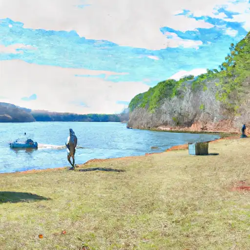
Sand Hill Lake Dam, located in Treutlen County, Georgia, was constructed in 1964 by designer Jim Gillis for recreational purposes. This private earth dam stands at a height of 14 feet and spans 975 feet in length. It impounds Pendleton Creek, creating a surface area of 180 acres and a maximum storage capacity of 1,649 acre-feet. Despite being uncontrolled, the dam has a low hazard potential and is classified as having a moderate risk level.
The dam, owned privately, is not regulated by the state but undergoes inspections every five years. Its primary purpose of recreation aligns with its surroundings at Shiloh Cemetery Environment, offering opportunities for leisure and enjoyment for locals and visitors alike. The dam's condition is currently not rated, and it carries out uncontrolled spillway operations with an outlet gate system in place. The risk assessment deems the dam to have a moderate risk level, highlighting the importance of ongoing monitoring and maintenance to ensure its structural integrity and safety for the surrounding community.
Sand Hill Lake Dam is an integral part of the local landscape, providing both recreational opportunities and a water resource for the area. With its historical significance dating back to the 1960s, the dam serves as a reminder of the importance of proper infrastructure management and risk assessment in the face of changing climate patterns. Enthusiasts of water resources and climate will find the details of this dam's design, construction, and current condition to be a fascinating case study in the intersection of human development and environmental stewardship.
Plan around the weather
Same NOAA / yr.no feed Snoflo's iOS app uses. Watch the precipitation column on the meteogram -- rain on the basin upstream typically lifts inflow 24-72 hours later.
Next 5 days, hour by hour
Temperature line with weather symbols on top, snow + rain accumulation as columns, humidity as a dotted line.
5-day forecast table
Every 3 hours, broken out across temperature, snow, rain, humidity, and wind. Each cell is colour-coded relative to the column min/max.
| Time | Condition | Temp (°F) | Snow (in) | Rain (in) | Humidity (%) | Wind (mps) | Wind dir |
|---|---|---|---|---|---|---|---|
| Loading detailed forecast… | |||||||
15-day temperature & precipitation
Daily temperatures, snow, and rain projected over the next two weeks.
Nearby streamflow gauges
USGS streamgauges around Sand Hill Lake Dam -- inflows here typically show up in storage 24-72 hours later.
| Streamgauge | Discharge | View |
|---|---|---|
| Oconee River Near Mount Vernon | 1,460 cfs | → |
| Oconee River At Dublin | 1,180 cfs | → |
| Ogeechee River At Midville | 869 cfs | → |
| Ohoopee River Near Reidsville | 138 cfs | → |
| Oconee River Near Oconee | 899 cfs | → |
| Altamaha River Near Baxley | 5,320 cfs | → |


About Sand Hill Lake Dam
Where does the data for Sand Hill Lake Dam come from?
Structural and regulatory data come from the U.S. Army Corps of Engineers' National Inventory of Dams (NID). Weather forecast comes from NOAA / yr.no -- the same feed Snoflo's iOS app uses.
How often is the report updated?
NID structural data refreshes annually as the Corps publishes updated assessments. The weather forecast refreshes throughout the day.
What does the Low hazard rating mean?
The Corps of Engineers' hazard potential classification grades probable consequences if the dam fails: High = probable loss of human life; Significant = no probable loss of human life but possible economic loss / environmental damage; Low = no probable loss of human life, only minor economic / environmental losses. See the Dam Data Reference card below for the full definitions.
What's "% of normal"?
The current storage value compared to the historical average storage on this calendar day. 100% = right on average; values above 100% mean above-normal storage (wet year); values below mean below-normal (dry year or drought).
Can I get alerts when storage crosses a threshold?
Yes -- alerts are managed in the Snoflo iOS app. Favorite this dam, set a threshold, and you'll get a push the moment conditions cross.
Dam data reference
Condition Assessment
- Satisfactory
- No existing or potential dam safety deficiencies are recognized. Acceptable performance is expected under all loading conditions (static, hydrologic, seismic) in accordance with the minimum applicable state or federal regulatory criteria or tolerable risk guidelines.
- Fair
- No existing dam safety deficiencies are recognized for normal operating conditions. Rare or extreme hydrologic and/or seismic events may result in a dam safety deficiency. Risk may be in the range to take further action.
- Poor
- A dam safety deficiency is recognized for normal operating conditions which may realistically occur. Remedial action is necessary. POOR may also be used when uncertainties exist as to critical analysis parameters which identify a potential dam safety deficiency.
- Unsatisfactory
- A dam safety deficiency is recognized that requires immediate or emergency remedial action for problem resolution.
- Not Rated
- The dam has not been inspected, is not under state or federal jurisdiction, or has been inspected but, for whatever reason, has not been rated.
Hazard Potential Classification
- High
- Dams assigned the high hazard potential classification are those where failure or mis-operation will probably cause loss of human life.
- Significant
- Dams assigned the significant hazard potential classification are those dams where failure or mis-operation results in no probable loss of human life but can cause economic loss, environmental damage, disruption of lifeline facilities, or impact other concerns. Significant hazard potential classification dams are often located in predominantly rural or agricultural areas but could be in areas with population and significant infrastructure.
- Low
- Dams assigned the low hazard potential classification are those where failure or mis-operation results in no probable loss of human life and low economic and/or environmental losses. Losses are principally limited to the owner's property.
- Undetermined
- Dams for which a downstream hazard potential has not been designated or is not provided.