


Widgeon Pond Dam Reservoir Report
Last Updated: April 26, 2026
Nearby: Macdonald Pond Dam Culver Springs Dam
°F
°F
mph
Wind
%
Humidity
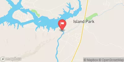
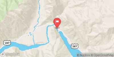
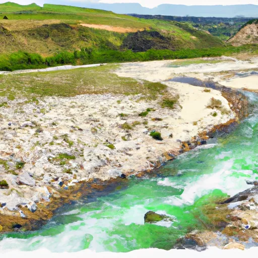
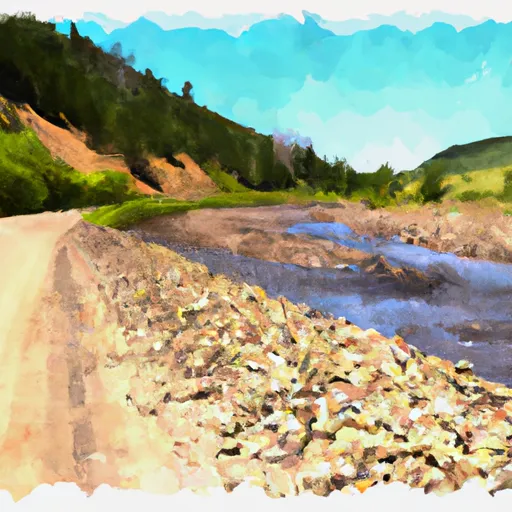
Widgeon Pond Dam, located in Beaverhead, Montana, is a vital structure managed by the U.S.
Summary
Fish and Wildlife Services. Built in 1964, this Earth type dam stands at a height of 12 feet and has a maximum storage capacity of 1476 acre-feet, primarily serving as a Fish and Wildlife Pond. The dam spans 1250 feet in length and regulates the flow of Hackett Creek, with a drainage area of 4.45 square miles.
Despite its low hazard potential, the dam's condition assessment in 2018 was deemed poor, highlighting the need for maintenance and potential upgrades. The last inspection date was in August 2018, with a scheduled frequency of every 5 years. The dam has an outlet with other controlled gates, and the spillway width is 823 feet. Although the risk assessment and emergency action plan status are unknown, the dam plays a crucial role in managing water resources in the region.
For water resource and climate enthusiasts, Widgeon Pond Dam serves as a noteworthy example of infrastructure managed by federal agencies to support wildlife conservation efforts. With its historical significance dating back to the 1960s, the dam presents an opportunity for further research and potential restoration projects to enhance its effectiveness in maintaining the ecological balance of the surrounding area. As climate change continues to impact water sources, ensuring the resilience and proper upkeep of structures like Widgeon Pond Dam will be crucial for sustainable water management practices in the future.
Regional Streamflow Levels
15-Day Long Term Forecast
Years Modified |
1967 - Other |
Year Completed |
1964 |
Dam Length |
1250 |
Dam Height |
12 |
River Or Stream |
HACKETT CREEK |
Primary Dam Type |
Earth |
Surface Area |
135 |
Hydraulic Height |
10 |
Drainage Area |
4.45 |
Nid Storage |
1476 |
Structural Height |
12 |
Outlet Gates |
Other Controlled |
Hazard Potential |
Low |
Foundations |
Soil |
Nid Height |
12 |
Seasonal Comparison
5-Day Hourly Forecast Detail
Dam Data Reference
Condition Assessment
SatisfactoryNo existing or potential dam safety deficiencies are recognized. Acceptable performance is expected under all loading conditions (static, hydrologic, seismic) in accordance with the minimum applicable state or federal regulatory criteria or tolerable risk guidelines.
Fair
No existing dam safety deficiencies are recognized for normal operating conditions. Rare or extreme hydrologic and/or seismic events may result in a dam safety deficiency. Risk may be in the range to take further action. Note: Rare or extreme event is defined by the regulatory agency based on their minimum
Poor A dam safety deficiency is recognized for normal operating conditions which may realistically occur. Remedial action is necessary. POOR may also be used when uncertainties exist as to critical analysis parameters which identify a potential dam safety deficiency. Investigations and studies are necessary.
Unsatisfactory
A dam safety deficiency is recognized that requires immediate or emergency remedial action for problem resolution.
Not Rated
The dam has not been inspected, is not under state or federal jurisdiction, or has been inspected but, for whatever reason, has not been rated.
Not Available
Dams for which the condition assessment is restricted to approved government users.
Hazard Potential Classification
HighDams assigned the high hazard potential classification are those where failure or mis-operation will probably cause loss of human life.
Significant
Dams assigned the significant hazard potential classification are those dams where failure or mis-operation results in no probable loss of human life but can cause economic loss, environment damage, disruption of lifeline facilities, or impact other concerns. Significant hazard potential classification dams are often located in predominantly rural or agricultural areas but could be in areas with population and significant infrastructure.
Low
Dams assigned the low hazard potential classification are those where failure or mis-operation results in no probable loss of human life and low economic and/or environmental losses. Losses are principally limited to the owner's property.
Undetermined
Dams for which a downstream hazard potential has not been designated or is not provided.
Not Available
Dams for which the downstream hazard potential is restricted to approved government users.
Area Campgrounds
| Location | Reservations | Toilets |
|---|---|---|
 Elk Lake Dispersed Camping and Picnic Area
|
||
 Upper Lake Campground
|
||
 Upper Lake
|
||
 Cliff Point Campground
|
||
 Cliff Point
|
||
 Hilltop
|
River Runs
-
 Shakelford Homestead, Sec. 26, T12S, R1W To 1/2 Mi Below Landon Camp, Sec. 32, T12S, R1W
-
 1/2 Below Landon Camp, Sec. 32, T12S, R1W To Up River 3/4 Mi, Sec. 31, T12S, R1W
-
 1/4 Mi West Landon Camp, Sec. 31, T12S, R1W To Fossil Creek, Sec. 27, T12S, R2W
-
 Elk Rv & Wf Madison Rv, Sec. 17, T12S, R1E To Dirty Creek, Sec. 11, T11S, R1W
-
 Jackpine Rd & Wf Madison Rd, Sec. 4, T12S, R1E To Shakelford Homestead, Sec. 25, T1S, R1W
-
 Dirty Ck To Elk River & Gravelly Range Road #290, Sec. 15 T11S R2W