Murguia Dam Reservoir Report
Nearby: Latty Dam Gerdner Dam
Last Updated: February 2, 2026
Murguia Dam, located in Des Moines, Iowa, along the Mississippi River, stands as a testament to engineering excellence with its primary purpose being recreation.
°F
°F
mph
Wind
%
Humidity
15-Day Weather Outlook
Summary
Constructed in 1978 by KAHN ENGINEERING CONSULT, this private-owned earth dam stands at a height of 43 feet and spans a length of 520 feet. The dam boasts a storage capacity of 675 acre-feet, with a normal storage of 397 acre-feet, covering a surface area of 30 acres. Despite its uncontrolled spillway type, the dam is deemed to have a significant hazard potential, although its condition assessment remains satisfactory as of the last inspection in July 2019.
With the Iowa Department of Natural Resources serving as the regulatory agency for Murguia Dam, the dam is subject to regular inspections and enforcement. Situated along the TR-YELLOW SPRING CREEK, the dam's drainage area covers 1.11 square miles, with a moderate risk classification. While the dam does not feature outlet gates or associated structures, its strategic location and design make it a vital component for recreational activities in the region. Furthermore, its satisfactory condition assessment and enforcement by the state regulatory agency ensure its continued safe operation for water resource and climate enthusiasts to enjoy.
Year Completed |
1978 |
Dam Length |
520 |
Dam Height |
43 |
River Or Stream |
TR-YELLOW SPRING CREEK |
Primary Dam Type |
Earth |
Surface Area |
30 |
Drainage Area |
1.11 |
Nid Storage |
675 |
Hazard Potential |
Significant |
Foundations |
Soil |
Nid Height |
43 |
Seasonal Comparison
Hourly Weather Forecast
Nearby Streamflow Levels
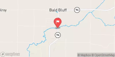 Henderson Creek Near Oquawka
|
75cfs |
 Iowa River At Wapello
|
7560cfs |
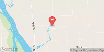 Pope Creek Near Keithsburg
|
56cfs |
 Skunk River At Augusta
|
1210cfs |
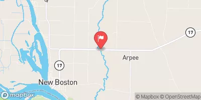 Edwards River Near New Boston
|
107cfs |
 Big Creek Near Mt. Pleasant
|
0cfs |
Dam Data Reference
Condition Assessment
SatisfactoryNo existing or potential dam safety deficiencies are recognized. Acceptable performance is expected under all loading conditions (static, hydrologic, seismic) in accordance with the minimum applicable state or federal regulatory criteria or tolerable risk guidelines.
Fair
No existing dam safety deficiencies are recognized for normal operating conditions. Rare or extreme hydrologic and/or seismic events may result in a dam safety deficiency. Risk may be in the range to take further action. Note: Rare or extreme event is defined by the regulatory agency based on their minimum
Poor A dam safety deficiency is recognized for normal operating conditions which may realistically occur. Remedial action is necessary. POOR may also be used when uncertainties exist as to critical analysis parameters which identify a potential dam safety deficiency. Investigations and studies are necessary.
Unsatisfactory
A dam safety deficiency is recognized that requires immediate or emergency remedial action for problem resolution.
Not Rated
The dam has not been inspected, is not under state or federal jurisdiction, or has been inspected but, for whatever reason, has not been rated.
Not Available
Dams for which the condition assessment is restricted to approved government users.
Hazard Potential Classification
HighDams assigned the high hazard potential classification are those where failure or mis-operation will probably cause loss of human life.
Significant
Dams assigned the significant hazard potential classification are those dams where failure or mis-operation results in no probable loss of human life but can cause economic loss, environment damage, disruption of lifeline facilities, or impact other concerns. Significant hazard potential classification dams are often located in predominantly rural or agricultural areas but could be in areas with population and significant infrastructure.
Low
Dams assigned the low hazard potential classification are those where failure or mis-operation results in no probable loss of human life and low economic and/or environmental losses. Losses are principally limited to the owner's property.
Undetermined
Dams for which a downstream hazard potential has not been designated or is not provided.
Not Available
Dams for which the downstream hazard potential is restricted to approved government users.
Area Campgrounds
| Location | Reservations | Toilets |
|---|---|---|
 Big Hollow Creek Park
|
||
 Delabar State Park
|
||
 Fourth Pumping Plant Rec Area
|
||
 Henderson County State Conservation
|
||
 Big River State Forest
|

 Murguia Dam
 Des Moines County