Iowa Noname91 Reservoir Report
Nearby: Big Hollow Dam Shaw Dam
Last Updated: February 2, 2026
Iowa Noname91 is a locally owned dam located in Des Moines County, Iowa, specifically in the city of Burlington.
°F
°F
mph
Wind
%
Humidity
15-Day Weather Outlook
Summary
Built in 1980 by the USDA SCS, this earth dam stands at a height of 29 feet and has a length of 340 feet. Its primary purposes include fire protection and serving as a stock or small fish pond, with a storage capacity of 37 acre-feet and a surface area of 2.2 acres.
Managed by the Iowa Department of Natural Resources, Iowa Noname91 is regulated, permitted, inspected, and enforced by the state. The dam is situated on TR-Big Hollow Creek and falls under the jurisdiction of the Rock Island District of the US Army Corps of Engineers. With a low hazard potential and a moderate risk assessment rating, the dam has not been rated for its condition but is considered to meet guidelines for emergency action plans.
Overall, Iowa Noname91 serves as an important structure for fire protection and water management in the area. Its location in a rural setting makes it an essential resource for the community, providing both recreational and practical benefits. With proper state oversight and management, this dam plays a crucial role in supporting the local ecosystem and water supply in Des Moines County.
Year Completed |
1980 |
Dam Length |
340 |
Dam Height |
29 |
River Or Stream |
TR-BIG HOLLOW CREEK |
Primary Dam Type |
Earth |
Surface Area |
2.2 |
Drainage Area |
0.12 |
Nid Storage |
37 |
Hazard Potential |
Low |
Foundations |
Soil |
Nid Height |
29 |
Seasonal Comparison
Hourly Weather Forecast
Nearby Streamflow Levels
 Skunk River At Augusta
|
1210cfs |
 Iowa River At Wapello
|
7560cfs |
 Big Creek Near Mt. Pleasant
|
0cfs |
 Henderson Creek Near Oquawka
|
75cfs |
 Pope Creek Near Keithsburg
|
56cfs |
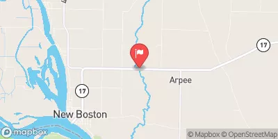 Edwards River Near New Boston
|
107cfs |
Dam Data Reference
Condition Assessment
SatisfactoryNo existing or potential dam safety deficiencies are recognized. Acceptable performance is expected under all loading conditions (static, hydrologic, seismic) in accordance with the minimum applicable state or federal regulatory criteria or tolerable risk guidelines.
Fair
No existing dam safety deficiencies are recognized for normal operating conditions. Rare or extreme hydrologic and/or seismic events may result in a dam safety deficiency. Risk may be in the range to take further action. Note: Rare or extreme event is defined by the regulatory agency based on their minimum
Poor A dam safety deficiency is recognized for normal operating conditions which may realistically occur. Remedial action is necessary. POOR may also be used when uncertainties exist as to critical analysis parameters which identify a potential dam safety deficiency. Investigations and studies are necessary.
Unsatisfactory
A dam safety deficiency is recognized that requires immediate or emergency remedial action for problem resolution.
Not Rated
The dam has not been inspected, is not under state or federal jurisdiction, or has been inspected but, for whatever reason, has not been rated.
Not Available
Dams for which the condition assessment is restricted to approved government users.
Hazard Potential Classification
HighDams assigned the high hazard potential classification are those where failure or mis-operation will probably cause loss of human life.
Significant
Dams assigned the significant hazard potential classification are those dams where failure or mis-operation results in no probable loss of human life but can cause economic loss, environment damage, disruption of lifeline facilities, or impact other concerns. Significant hazard potential classification dams are often located in predominantly rural or agricultural areas but could be in areas with population and significant infrastructure.
Low
Dams assigned the low hazard potential classification are those where failure or mis-operation results in no probable loss of human life and low economic and/or environmental losses. Losses are principally limited to the owner's property.
Undetermined
Dams for which a downstream hazard potential has not been designated or is not provided.
Not Available
Dams for which the downstream hazard potential is restricted to approved government users.

 Iowa Noname91