Conner Dam Reservoir Report
Nearby: Sieren Dam Lake Belva Deer Dam
Last Updated: February 2, 2026
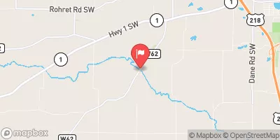
Conner Dam, located in Keokuk, Iowa, on the TR-GERMAN CREEK, was completed in 1979 with a primary purpose of providing fire protection, stock, or a small fish pond.
°F
°F
mph
Wind
%
Humidity
15-Day Weather Outlook
Summary
The earth dam stands at a height of 37 feet and stretches across 427 feet, creating a surface area of 3.9 acres and a storage capacity of 65 acre-feet. The dam is privately owned and regulated by the Iowa Department of Natural Resources, with inspections and enforcement measures in place to ensure its safety and compliance with state regulations.
Despite being classified as having a low hazard potential, Conner Dam is considered to have a moderate risk level. The dam does not have an Emergency Action Plan (EAP) in place, and its condition assessment is listed as "Not Rated." While it lacks certain risk management measures and updated emergency protocols, the dam continues to serve its intended purposes effectively. With a scenic location in Coppock, Iowa, and a history of providing valuable water resources for the community, Conner Dam remains an important feature for both water resource and climate enthusiasts to explore and appreciate in the region.
Year Completed |
1979 |
Dam Length |
427 |
Dam Height |
37 |
River Or Stream |
TR-GERMAN CREEK |
Primary Dam Type |
Earth |
Surface Area |
3.9 |
Drainage Area |
0.06 |
Nid Storage |
65 |
Hazard Potential |
Low |
Foundations |
Soil |
Nid Height |
37 |
Seasonal Comparison
Hourly Weather Forecast
Nearby Streamflow Levels
 North Skunk River Near Sigourney
|
97cfs |
 English River At Kalona
|
41cfs |
 Des Moines River At Ottumwa
|
1090cfs |
 South Skunk River Near Oskaloosa
|
485cfs |
 Big Bear Creek At Ladora
|
133cfs |
 Old Mans Creek Near Iowa City
|
24cfs |
Dam Data Reference
Condition Assessment
SatisfactoryNo existing or potential dam safety deficiencies are recognized. Acceptable performance is expected under all loading conditions (static, hydrologic, seismic) in accordance with the minimum applicable state or federal regulatory criteria or tolerable risk guidelines.
Fair
No existing dam safety deficiencies are recognized for normal operating conditions. Rare or extreme hydrologic and/or seismic events may result in a dam safety deficiency. Risk may be in the range to take further action. Note: Rare or extreme event is defined by the regulatory agency based on their minimum
Poor A dam safety deficiency is recognized for normal operating conditions which may realistically occur. Remedial action is necessary. POOR may also be used when uncertainties exist as to critical analysis parameters which identify a potential dam safety deficiency. Investigations and studies are necessary.
Unsatisfactory
A dam safety deficiency is recognized that requires immediate or emergency remedial action for problem resolution.
Not Rated
The dam has not been inspected, is not under state or federal jurisdiction, or has been inspected but, for whatever reason, has not been rated.
Not Available
Dams for which the condition assessment is restricted to approved government users.
Hazard Potential Classification
HighDams assigned the high hazard potential classification are those where failure or mis-operation will probably cause loss of human life.
Significant
Dams assigned the significant hazard potential classification are those dams where failure or mis-operation results in no probable loss of human life but can cause economic loss, environment damage, disruption of lifeline facilities, or impact other concerns. Significant hazard potential classification dams are often located in predominantly rural or agricultural areas but could be in areas with population and significant infrastructure.
Low
Dams assigned the low hazard potential classification are those where failure or mis-operation results in no probable loss of human life and low economic and/or environmental losses. Losses are principally limited to the owner's property.
Undetermined
Dams for which a downstream hazard potential has not been designated or is not provided.
Not Available
Dams for which the downstream hazard potential is restricted to approved government users.
Area Campgrounds
| Location | Reservations | Toilets |
|---|---|---|
 Chacauqua River Access
|
||
 Manhattan Bridge Access
|
||
 Belva - Deer Rec Area
|
||
 Yenruogis County Park
|
||
 Skunk River Access
|

 Conner Dam