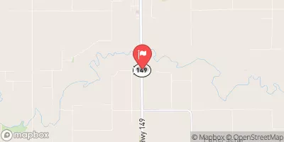
Jefferson County Roadgrade Dam 24-72-11 Reservoir Report
Nearby: Hickenbottom Dam Hammes Dam
Last Updated: February 2, 2026
Located in Jefferson County, Iowa, the Roadgrade Dam 24-72-11, also known as the Big Cedar Creek Dam, was completed in 1984 by the USDA NRCS.
°F
°F
mph
Wind
%
Humidity
15-Day Weather Outlook
Summary
This earth dam stands at a height of 25 feet and spans 800 feet in length, with a storage capacity of 64 acre-feet for flood control purposes. The dam is regulated by the Iowa Department of Natural Resources and is inspected regularly to ensure its structural integrity and safety.
Despite its low hazard potential, the Roadgrade Dam plays a crucial role in managing the flow of the TR- Big Cedar Creek, protecting the surrounding area from potential flooding. The dam has a moderate risk assessment rating, indicating that it is adequately maintained and managed to mitigate any potential risks. With a surface area of 3.3 acres and a drainage area of 0.21 square miles, the dam serves as a vital infrastructure for water resource management in the region.
Owned by the local government, the Roadgrade Dam 24-72-11 serves as a key component of the water management system in Jefferson County. With its uncontrolled spillway and soil foundation, the dam is designed to withstand various hydraulic pressures and provide essential flood protection for the community of Big Cedar Creek. Climate and water resource enthusiasts can appreciate the strategic design and maintenance efforts put into this critical infrastructure for ensuring the safety and well-being of the surrounding area.
Year Completed |
1984 |
Dam Length |
800 |
Dam Height |
25 |
River Or Stream |
TR- BIG CEDAR CR. |
Primary Dam Type |
Earth |
Surface Area |
3.3 |
Drainage Area |
0.21 |
Nid Storage |
64 |
Hazard Potential |
Low |
Foundations |
Soil |
Nid Height |
25 |
Seasonal Comparison
Hourly Weather Forecast
Nearby Streamflow Levels
 Des Moines River At Ottumwa
|
1090cfs |
 North Skunk River Near Sigourney
|
97cfs |
 Des Moines River At Keosauqua
|
1800cfs |
 Cedar Creek Near Oakland Mills
|
10cfs |
 Fox River At Bloomfield
|
7cfs |
 Big Creek Near Mt. Pleasant
|
0cfs |
Dam Data Reference
Condition Assessment
SatisfactoryNo existing or potential dam safety deficiencies are recognized. Acceptable performance is expected under all loading conditions (static, hydrologic, seismic) in accordance with the minimum applicable state or federal regulatory criteria or tolerable risk guidelines.
Fair
No existing dam safety deficiencies are recognized for normal operating conditions. Rare or extreme hydrologic and/or seismic events may result in a dam safety deficiency. Risk may be in the range to take further action. Note: Rare or extreme event is defined by the regulatory agency based on their minimum
Poor A dam safety deficiency is recognized for normal operating conditions which may realistically occur. Remedial action is necessary. POOR may also be used when uncertainties exist as to critical analysis parameters which identify a potential dam safety deficiency. Investigations and studies are necessary.
Unsatisfactory
A dam safety deficiency is recognized that requires immediate or emergency remedial action for problem resolution.
Not Rated
The dam has not been inspected, is not under state or federal jurisdiction, or has been inspected but, for whatever reason, has not been rated.
Not Available
Dams for which the condition assessment is restricted to approved government users.
Hazard Potential Classification
HighDams assigned the high hazard potential classification are those where failure or mis-operation will probably cause loss of human life.
Significant
Dams assigned the significant hazard potential classification are those dams where failure or mis-operation results in no probable loss of human life but can cause economic loss, environment damage, disruption of lifeline facilities, or impact other concerns. Significant hazard potential classification dams are often located in predominantly rural or agricultural areas but could be in areas with population and significant infrastructure.
Low
Dams assigned the low hazard potential classification are those where failure or mis-operation results in no probable loss of human life and low economic and/or environmental losses. Losses are principally limited to the owner's property.
Undetermined
Dams for which a downstream hazard potential has not been designated or is not provided.
Not Available
Dams for which the downstream hazard potential is restricted to approved government users.

 Jefferson County Roadgrade Dam 24-72-11