West Fork Big Creek Watershed Site S-16 Reservoir Report
Last Updated: February 5, 2026
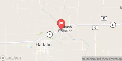
West Fork Big Creek Watershed Site S-16 is a critical water resource site located in Iowa, specifically in Decatur County.
°F
°F
mph
Wind
%
Humidity
15-Day Weather Outlook
Summary
Managed by the local government, this site is regulated by the Iowa Department of Natural Resources and undergoes regular inspections, permitting, and enforcement to ensure its integrity. The dam at this site, completed in 1996, serves multiple purposes including fire protection, stock maintenance, and flood risk reduction.
This Earth type dam stands at a height of 18 feet and has a storage capacity of 77 acre-feet, with a surface area of 4.7 acres and a drainage area of 0.23 square miles. Although the hazard potential is rated as low, the risk assessment indicates a moderate risk level. Despite not having a condition assessment rating, the site is actively managed and meets regulatory guidelines. West Fork Big Creek Watershed Site S-16 plays a crucial role in water resource management and climate resilience efforts in the region, highlighting the importance of sustainable infrastructure for protecting both communities and the environment.
Year Completed |
1996 |
Dam Length |
615 |
Dam Height |
18 |
River Or Stream |
TR- SHAIN CREEK |
Primary Dam Type |
Earth |
Surface Area |
4.7 |
Drainage Area |
0.23 |
Nid Storage |
77 |
Hazard Potential |
Low |
Foundations |
Soil |
Nid Height |
18 |
Seasonal Comparison
Hourly Weather Forecast
Nearby Streamflow Levels
Dam Data Reference
Condition Assessment
SatisfactoryNo existing or potential dam safety deficiencies are recognized. Acceptable performance is expected under all loading conditions (static, hydrologic, seismic) in accordance with the minimum applicable state or federal regulatory criteria or tolerable risk guidelines.
Fair
No existing dam safety deficiencies are recognized for normal operating conditions. Rare or extreme hydrologic and/or seismic events may result in a dam safety deficiency. Risk may be in the range to take further action. Note: Rare or extreme event is defined by the regulatory agency based on their minimum
Poor A dam safety deficiency is recognized for normal operating conditions which may realistically occur. Remedial action is necessary. POOR may also be used when uncertainties exist as to critical analysis parameters which identify a potential dam safety deficiency. Investigations and studies are necessary.
Unsatisfactory
A dam safety deficiency is recognized that requires immediate or emergency remedial action for problem resolution.
Not Rated
The dam has not been inspected, is not under state or federal jurisdiction, or has been inspected but, for whatever reason, has not been rated.
Not Available
Dams for which the condition assessment is restricted to approved government users.
Hazard Potential Classification
HighDams assigned the high hazard potential classification are those where failure or mis-operation will probably cause loss of human life.
Significant
Dams assigned the significant hazard potential classification are those dams where failure or mis-operation results in no probable loss of human life but can cause economic loss, environment damage, disruption of lifeline facilities, or impact other concerns. Significant hazard potential classification dams are often located in predominantly rural or agricultural areas but could be in areas with population and significant infrastructure.
Low
Dams assigned the low hazard potential classification are those where failure or mis-operation results in no probable loss of human life and low economic and/or environmental losses. Losses are principally limited to the owner's property.
Undetermined
Dams for which a downstream hazard potential has not been designated or is not provided.
Not Available
Dams for which the downstream hazard potential is restricted to approved government users.


 West Fork Big Creek Watershed Site S-16