Rotman Dam

Rotman Dam
Rotman Dam, also known as Rotman Lake Dam, is a privately owned structure located in Hamilton, Michigan, specifically in Allegan County. Completed in 2008, this earth-type dam stands at a height of 26 feet and has a hydraulic height of 25 feet, serving primarily for recreational purposes. With a storage capacity of 110 acre-feet, the dam sits on a tributary to the Little Rabbit River, covering a surface area of 11 acres and draining a small area of 0.06 square miles.
Despite its low hazard potential and satisfactory condition assessment, Rotman Dam is subject to regular state regulation, inspection, and enforcement by the Michigan Department of Environment, Great Lakes, and Energy (DEGLE). The dam lacks a spillway but has a spillway width of 50 feet. In the event of an emergency, the dam's risk assessment is considered high, with a DSAC assigned date yet to be determined. The structure has no association with the US Army Corps of Engineers and has not undergone any modifications since its completion.
Overall, Rotman Dam stands as a vital recreational asset in the area, providing a serene environment for outdoor activities and water-related leisure. Its construction and management adhere to state regulatory standards, ensuring the safety and enjoyment of visitors to Rotman Lake. As a key feature in the local landscape, the dam contributes to the conservation and utilization of water resources while offering a picturesque setting for climate enthusiasts to appreciate and explore.
Plan around the weather
Same NOAA / yr.no feed Snoflo's iOS app uses. Watch the precipitation column on the meteogram -- rain on the basin upstream typically lifts inflow 24-72 hours later.
Next 5 days, hour by hour
Temperature line with weather symbols on top, snow + rain accumulation as columns, humidity as a dotted line.
5-day forecast table
Every 3 hours, broken out across temperature, snow, rain, humidity, and wind. Each cell is colour-coded relative to the column min/max.
| Time | Condition | Temp (°F) | Snow (in) | Rain (in) | Humidity (%) | Wind (mps) | Wind dir |
|---|---|---|---|---|---|---|---|
| Loading detailed forecast… | |||||||
15-day temperature & precipitation
Daily temperatures, snow, and rain projected over the next two weeks.
Nearby streamflow gauges
USGS streamgauges around Rotman Dam -- inflows here typically show up in storage 24-72 hours later.
| Streamgauge | Discharge | View |
|---|---|---|
| Macatawa River At State Road Near Zeeland | 4 cfs | → |
| Rabbit River Near Hopkins | 15 cfs | → |
| Kalamazoo River At New Richmond | 1,190 cfs | → |
| Kalamazoo River Near New Richmond | 4,480 cfs | → |
| Grand River At Grand Rapids | 1,260 cfs | → |
| Rogue River Near Rockford | 91 cfs | → |
Make a day of it
Boat launches, lakeside camping, fishing access, and other reservoirs near Rotman Dam.
Boat launches
See all →


Campgrounds
See all →


Fishing spots
See all →


River runs
See all →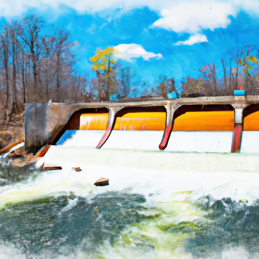


More reservoirs
See all →
About Rotman Dam
Where does the data for Rotman Dam come from?
Structural and regulatory data come from the U.S. Army Corps of Engineers' National Inventory of Dams (NID). Weather forecast comes from NOAA / yr.no -- the same feed Snoflo's iOS app uses.
How often is the report updated?
NID structural data refreshes annually as the Corps publishes updated assessments. The weather forecast refreshes throughout the day.
What does the Low hazard rating mean?
The Corps of Engineers' hazard potential classification grades probable consequences if the dam fails: High = probable loss of human life; Significant = no probable loss of human life but possible economic loss / environmental damage; Low = no probable loss of human life, only minor economic / environmental losses. See the Dam Data Reference card below for the full definitions.
What's "% of normal"?
The current storage value compared to the historical average storage on this calendar day. 100% = right on average; values above 100% mean above-normal storage (wet year); values below mean below-normal (dry year or drought).
Can I get alerts when storage crosses a threshold?
Yes -- alerts are managed in the Snoflo iOS app. Favorite this dam, set a threshold, and you'll get a push the moment conditions cross.
Dam data reference
Condition Assessment
- Satisfactory
- No existing or potential dam safety deficiencies are recognized. Acceptable performance is expected under all loading conditions (static, hydrologic, seismic) in accordance with the minimum applicable state or federal regulatory criteria or tolerable risk guidelines.
- Fair
- No existing dam safety deficiencies are recognized for normal operating conditions. Rare or extreme hydrologic and/or seismic events may result in a dam safety deficiency. Risk may be in the range to take further action.
- Poor
- A dam safety deficiency is recognized for normal operating conditions which may realistically occur. Remedial action is necessary. POOR may also be used when uncertainties exist as to critical analysis parameters which identify a potential dam safety deficiency.
- Unsatisfactory
- A dam safety deficiency is recognized that requires immediate or emergency remedial action for problem resolution.
- Not Rated
- The dam has not been inspected, is not under state or federal jurisdiction, or has been inspected but, for whatever reason, has not been rated.
Hazard Potential Classification
- High
- Dams assigned the high hazard potential classification are those where failure or mis-operation will probably cause loss of human life.
- Significant
- Dams assigned the significant hazard potential classification are those dams where failure or mis-operation results in no probable loss of human life but can cause economic loss, environmental damage, disruption of lifeline facilities, or impact other concerns. Significant hazard potential classification dams are often located in predominantly rural or agricultural areas but could be in areas with population and significant infrastructure.
- Low
- Dams assigned the low hazard potential classification are those where failure or mis-operation results in no probable loss of human life and low economic and/or environmental losses. Losses are principally limited to the owner's property.
- Undetermined
- Dams for which a downstream hazard potential has not been designated or is not provided.