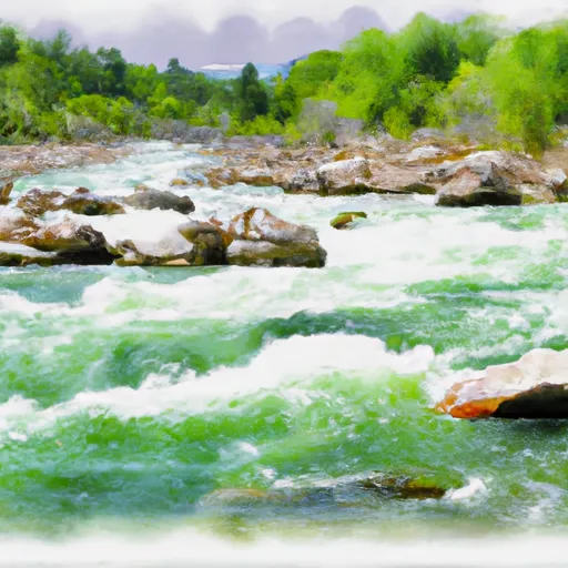
Barrett Dam

Barrett
Barrett, J. Dam, located in Grant, Montana, is a privately owned structure designed by USDA NRCS for the primary purpose of irrigation. Completed in 1962, this earth dam stands at a height of 35 feet and has a storage capacity of 158 acre-feet. Sitting on the Rape Creek, the dam serves a drainage area of 7.34 square miles and has a maximum discharge rate of 50 cubic feet per second. With a surface area of 6 acres, Barrett, J. Dam plays a crucial role in managing water resources in the Beaverhead County.
Despite being classified as having a low hazard potential and not having a current condition assessment rating, Barrett, J. Dam remains regulated by the state of Montana through the Department of Natural Resources Conservation. While it has not undergone recent inspections or assessments, the dam is still in operation and continues to provide essential irrigation water to the surrounding agricultural lands. With its strategic location and design, the dam contributes to the overall water management and climate resilience efforts in the region.
As water resource and climate enthusiasts, understanding the significance of Barrett, J. Dam in the context of water security and agricultural sustainability in Montana is crucial. This structure, with its modest height and storage capacity, symbolizes the intricate balance between water management, infrastructure development, and environmental conservation. By recognizing the role of dams like Barrett, J. Dam in supporting local economies and ecosystems, we can appreciate the interconnectedness of water resources and climate resilience in the face of changing environmental conditions.
Plan around the weather
Same NOAA / yr.no feed Snoflo's iOS app uses. Watch the precipitation column on the meteogram -- rain on the basin upstream typically lifts inflow 24-72 hours later.
Next 5 days, hour by hour
Temperature line with weather symbols on top, snow + rain accumulation as columns, humidity as a dotted line.
5-day forecast table
Every 3 hours, broken out across temperature, snow, rain, humidity, and wind. Each cell is colour-coded relative to the column min/max.
| Time | Condition | Temp (°F) | Snow (in) | Rain (in) | Humidity (%) | Wind (mps) | Wind dir |
|---|---|---|---|---|---|---|---|
| Loading detailed forecast… | |||||||
15-day temperature & precipitation
Daily temperatures, snow, and rain projected over the next two weeks.
Nearby streamflow gauges
USGS streamgauges around Barrett -- inflows here typically show up in storage 24-72 hours later.
| Streamgauge | Discharge | View |
|---|---|---|
| Big Hole River Near Jackson Mt | 25 cfs | → |
| Lemhi River Nr Lemhi Id | 121 cfs | → |
| Beaverhead River At Barretts Mt | 554 cfs | → |
| Beaverhead River At Dillon Mt | 135 cfs | → |
| Lemhi River Below L5 Diversion Near Salmon | 40 cfs | → |
| Salmon River At Salmon Id | 1,370 cfs | → |


About Barrett
Where does the data for Barrett come from?
Structural and regulatory data come from the U.S. Army Corps of Engineers' National Inventory of Dams (NID). Weather forecast comes from NOAA / yr.no -- the same feed Snoflo's iOS app uses.
How often is the report updated?
NID structural data refreshes annually as the Corps publishes updated assessments. The weather forecast refreshes throughout the day.
What does the Low hazard rating mean?
The Corps of Engineers' hazard potential classification grades probable consequences if the dam fails: High = probable loss of human life; Significant = no probable loss of human life but possible economic loss / environmental damage; Low = no probable loss of human life, only minor economic / environmental losses. See the Dam Data Reference card below for the full definitions.
What's "% of normal"?
The current storage value compared to the historical average storage on this calendar day. 100% = right on average; values above 100% mean above-normal storage (wet year); values below mean below-normal (dry year or drought).
Can I get alerts when storage crosses a threshold?
Yes -- alerts are managed in the Snoflo iOS app. Favorite this dam, set a threshold, and you'll get a push the moment conditions cross.
Dam data reference
Condition Assessment
- Satisfactory
- No existing or potential dam safety deficiencies are recognized. Acceptable performance is expected under all loading conditions (static, hydrologic, seismic) in accordance with the minimum applicable state or federal regulatory criteria or tolerable risk guidelines.
- Fair
- No existing dam safety deficiencies are recognized for normal operating conditions. Rare or extreme hydrologic and/or seismic events may result in a dam safety deficiency. Risk may be in the range to take further action.
- Poor
- A dam safety deficiency is recognized for normal operating conditions which may realistically occur. Remedial action is necessary. POOR may also be used when uncertainties exist as to critical analysis parameters which identify a potential dam safety deficiency.
- Unsatisfactory
- A dam safety deficiency is recognized that requires immediate or emergency remedial action for problem resolution.
- Not Rated
- The dam has not been inspected, is not under state or federal jurisdiction, or has been inspected but, for whatever reason, has not been rated.
Hazard Potential Classification
- High
- Dams assigned the high hazard potential classification are those where failure or mis-operation will probably cause loss of human life.
- Significant
- Dams assigned the significant hazard potential classification are those dams where failure or mis-operation results in no probable loss of human life but can cause economic loss, environmental damage, disruption of lifeline facilities, or impact other concerns. Significant hazard potential classification dams are often located in predominantly rural or agricultural areas but could be in areas with population and significant infrastructure.
- Low
- Dams assigned the low hazard potential classification are those where failure or mis-operation results in no probable loss of human life and low economic and/or environmental losses. Losses are principally limited to the owner's property.
- Undetermined
- Dams for which a downstream hazard potential has not been designated or is not provided.