Kulish Dam; Gerald Dam

Kulish Dam; Gerald
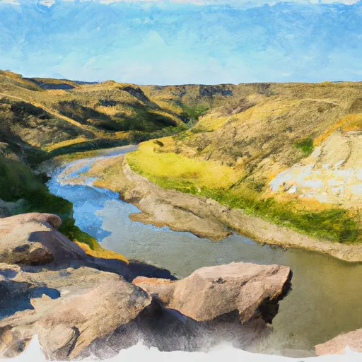
Located in Dunn, North Dakota, the Kulish Dam, also known as Wetland #1, was completed in 1995 by USFWS with a primary purpose of providing fire protection, stock, or a small fish pond. This private dam stands at a height of 12.1 feet and spans 532 feet in length, with a storage capacity of 115.5 acre-feet and a surface area of 12 acres. It is regulated by the North Dakota State Water Commission and is equipped with an uncontrolled spillway measuring 150 feet in width.
The Kulish Dam plays a crucial role in enhancing water resource management and climate resilience in the region, particularly for fire protection and agricultural purposes. Despite being rated as low hazard potential, the dam's moderate risk assessment underscores the importance of ongoing monitoring and maintenance to ensure its structural integrity and safety. With its strategic location along Spring Creek, this earth dam serves as a vital water infrastructure component in the area, contributing to the overall water availability and ecosystem health in Dunn County.
As a key feature in the local water resource landscape, the Kulish Dam serves as a testament to the collaborative efforts between private owners and state regulators in managing water resources effectively. Its design and functionality reflect a balance between human needs and environmental considerations, making it a noteworthy site for water resource and climate enthusiasts interested in sustainable water management practices. In the face of changing climate patterns, the Kulish Dam stands as a resilient structure that underscores the importance of proactive measures in safeguarding water resources for the future.
Plan around the weather
Same NOAA / yr.no feed Snoflo's iOS app uses. Watch the precipitation column on the meteogram -- rain on the basin upstream typically lifts inflow 24-72 hours later.
Next 5 days, hour by hour
Temperature line with weather symbols on top, snow + rain accumulation as columns, humidity as a dotted line.
5-day forecast table
Every 3 hours, broken out across temperature, snow, rain, humidity, and wind. Each cell is colour-coded relative to the column min/max.
| Time | Condition | Temp (°F) | Snow (in) | Rain (in) | Humidity (%) | Wind (mps) | Wind dir |
|---|---|---|---|---|---|---|---|
| Loading detailed forecast… | |||||||
15-day temperature & precipitation
Daily temperatures, snow, and rain projected over the next two weeks.
Nearby streamflow gauges
USGS streamgauges around Kulish Dam; Gerald -- inflows here typically show up in storage 24-72 hours later.
| Streamgauge | Discharge | View |
|---|---|---|
| Knife River At Manning | 2 cfs | → |
| Green River Nr New Hradec | · | → |
| Little Missouri River Nr Watford City | 106 cfs | → |
| Bear Den Creek Nr Mandaree | 1 cfs | → |
| Heart River Nr South Heart | · | → |
| Knife River Nr Golden Valley | 5 cfs | → |


About Kulish Dam; Gerald
Where does the data for Kulish Dam; Gerald come from?
Structural and regulatory data come from the U.S. Army Corps of Engineers' National Inventory of Dams (NID). Weather forecast comes from NOAA / yr.no -- the same feed Snoflo's iOS app uses.
How often is the report updated?
NID structural data refreshes annually as the Corps publishes updated assessments. The weather forecast refreshes throughout the day.
What does the Low hazard rating mean?
The Corps of Engineers' hazard potential classification grades probable consequences if the dam fails: High = probable loss of human life; Significant = no probable loss of human life but possible economic loss / environmental damage; Low = no probable loss of human life, only minor economic / environmental losses. See the Dam Data Reference card below for the full definitions.
What's "% of normal"?
The current storage value compared to the historical average storage on this calendar day. 100% = right on average; values above 100% mean above-normal storage (wet year); values below mean below-normal (dry year or drought).
Can I get alerts when storage crosses a threshold?
Yes -- alerts are managed in the Snoflo iOS app. Favorite this dam, set a threshold, and you'll get a push the moment conditions cross.
Dam data reference
Condition Assessment
- Satisfactory
- No existing or potential dam safety deficiencies are recognized. Acceptable performance is expected under all loading conditions (static, hydrologic, seismic) in accordance with the minimum applicable state or federal regulatory criteria or tolerable risk guidelines.
- Fair
- No existing dam safety deficiencies are recognized for normal operating conditions. Rare or extreme hydrologic and/or seismic events may result in a dam safety deficiency. Risk may be in the range to take further action.
- Poor
- A dam safety deficiency is recognized for normal operating conditions which may realistically occur. Remedial action is necessary. POOR may also be used when uncertainties exist as to critical analysis parameters which identify a potential dam safety deficiency.
- Unsatisfactory
- A dam safety deficiency is recognized that requires immediate or emergency remedial action for problem resolution.
- Not Rated
- The dam has not been inspected, is not under state or federal jurisdiction, or has been inspected but, for whatever reason, has not been rated.
Hazard Potential Classification
- High
- Dams assigned the high hazard potential classification are those where failure or mis-operation will probably cause loss of human life.
- Significant
- Dams assigned the significant hazard potential classification are those dams where failure or mis-operation results in no probable loss of human life but can cause economic loss, environmental damage, disruption of lifeline facilities, or impact other concerns. Significant hazard potential classification dams are often located in predominantly rural or agricultural areas but could be in areas with population and significant infrastructure.
- Low
- Dams assigned the low hazard potential classification are those where failure or mis-operation results in no probable loss of human life and low economic and/or environmental losses. Losses are principally limited to the owner's property.
- Undetermined
- Dams for which a downstream hazard potential has not been designated or is not provided.