Ozzie Cobb Lake Dam

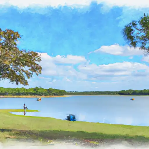
Ozzie Cobb Lake
Ozzie Cobb Lake, located in Pushmataha County, Oklahoma, is a state-regulated reservoir with a primary purpose of recreation. Constructed in 1958, this Earth dam stands at a height of 24 feet and spans 1500 feet in length, providing a surface area of 116 acres for outdoor enthusiasts to enjoy. With a storage capacity of 1200 acre-feet, the lake offers a tranquil escape for fishing, boating, and other water-based activities.
Managed by the Oklahoma Water Resources Board, Ozzie Cobb Lake boasts a controlled spillway system and a low hazard potential, making it a safe and reliable water source for the surrounding community. The dam is inspected every 5 years to ensure its structural integrity and compliance with state regulations. Despite being classified as "Very High (1)" on the risk assessment scale, the lake has not been rated for its condition, and emergency preparedness plans are yet to be fully developed.
With its picturesque location along the Rock Creek, Ozzie Cobb Lake is a popular destination for residents and visitors alike. As a vital resource for recreation and water supply in the region, this reservoir serves as a reminder of the importance of sustainable water management practices and environmental stewardship in the face of climate change challenges.
Plan around the weather
Same NOAA / yr.no feed Snoflo's iOS app uses. Watch the precipitation column on the meteogram -- rain on the basin upstream typically lifts inflow 24-72 hours later.
Next 5 days, hour by hour
Temperature line with weather symbols on top, snow + rain accumulation as columns, humidity as a dotted line.
5-day forecast table
Every 3 hours, broken out across temperature, snow, rain, humidity, and wind. Each cell is colour-coded relative to the column min/max.
| Time | Condition | Temp (°F) | Snow (in) | Rain (in) | Humidity (%) | Wind (mps) | Wind dir |
|---|---|---|---|---|---|---|---|
| Loading detailed forecast… | |||||||
15-day temperature & precipitation
Daily temperatures, snow, and rain projected over the next two weeks.
Nearby streamflow gauges
USGS streamgauges around Ozzie Cobb Lake -- inflows here typically show up in storage 24-72 hours later.
| Streamgauge | Discharge | View |
|---|---|---|
| Kiamichi River Near Antlers | 28 cfs | → |
| Kiamichi River Near Clayton | 10 cfs | → |
| Muddy Boggy Creek Near Unger | 53 cfs | → |
| Red River At Arthur City | 1,200 cfs | → |
| Glover River Near Glover | 12 cfs | → |
| Muddy Boggy Creek Near Farris | 15 cfs | → |


About Ozzie Cobb Lake
Where does the data for Ozzie Cobb Lake come from?
Structural and regulatory data come from the U.S. Army Corps of Engineers' National Inventory of Dams (NID). Weather forecast comes from NOAA / yr.no -- the same feed Snoflo's iOS app uses.
How often is the report updated?
NID structural data refreshes annually as the Corps publishes updated assessments. The weather forecast refreshes throughout the day.
What does the Low hazard rating mean?
The Corps of Engineers' hazard potential classification grades probable consequences if the dam fails: High = probable loss of human life; Significant = no probable loss of human life but possible economic loss / environmental damage; Low = no probable loss of human life, only minor economic / environmental losses. See the Dam Data Reference card below for the full definitions.
What's "% of normal"?
The current storage value compared to the historical average storage on this calendar day. 100% = right on average; values above 100% mean above-normal storage (wet year); values below mean below-normal (dry year or drought).
Can I get alerts when storage crosses a threshold?
Yes -- alerts are managed in the Snoflo iOS app. Favorite this dam, set a threshold, and you'll get a push the moment conditions cross.
Dam data reference
Condition Assessment
- Satisfactory
- No existing or potential dam safety deficiencies are recognized. Acceptable performance is expected under all loading conditions (static, hydrologic, seismic) in accordance with the minimum applicable state or federal regulatory criteria or tolerable risk guidelines.
- Fair
- No existing dam safety deficiencies are recognized for normal operating conditions. Rare or extreme hydrologic and/or seismic events may result in a dam safety deficiency. Risk may be in the range to take further action.
- Poor
- A dam safety deficiency is recognized for normal operating conditions which may realistically occur. Remedial action is necessary. POOR may also be used when uncertainties exist as to critical analysis parameters which identify a potential dam safety deficiency.
- Unsatisfactory
- A dam safety deficiency is recognized that requires immediate or emergency remedial action for problem resolution.
- Not Rated
- The dam has not been inspected, is not under state or federal jurisdiction, or has been inspected but, for whatever reason, has not been rated.
Hazard Potential Classification
- High
- Dams assigned the high hazard potential classification are those where failure or mis-operation will probably cause loss of human life.
- Significant
- Dams assigned the significant hazard potential classification are those dams where failure or mis-operation results in no probable loss of human life but can cause economic loss, environmental damage, disruption of lifeline facilities, or impact other concerns. Significant hazard potential classification dams are often located in predominantly rural or agricultural areas but could be in areas with population and significant infrastructure.
- Low
- Dams assigned the low hazard potential classification are those where failure or mis-operation results in no probable loss of human life and low economic and/or environmental losses. Losses are principally limited to the owner's property.
- Undetermined
- Dams for which a downstream hazard potential has not been designated or is not provided.