Fopiano Reservoir Dam

Fopiano Reservoir
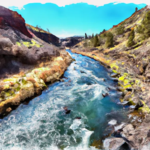
Fopiano Reservoir, located in Kimberly, Oregon, is a privately owned dam that serves the primary purpose of irrigation. Built in 1960, this earth dam stands at a height of 36 feet and has a storage capacity of 200 acre-feet. With a surface area of 30.6 acres and a drainage area of 13.5 square miles, this reservoir plays a vital role in water resource management in Wheeler County.
The reservoir is fed by North Fopiano and South Fopiano Creek, with a maximum discharge capacity of 1500 cubic feet per second. It features needle outlet gates and has a low hazard potential, making it a key component of the local water infrastructure. Although the condition assessment is currently not rated, the dam undergoes regular inspections every six years to ensure its safety and functionality.
Fopiano Reservoir, nestled within the Portland District, contributes to the agricultural landscape of the region by providing essential water resources for irrigation purposes. With its strategic location and efficient water management system, this reservoir stands as a testament to sustainable water utilization in the face of changing climate patterns. As water resource and climate enthusiasts, the Fopiano Reservoir offers a fascinating insight into the intersection of human engineering with natural ecosystems in the quest for water security.
Plan around the weather
Same NOAA / yr.no feed Snoflo's iOS app uses. Watch the precipitation column on the meteogram -- rain on the basin upstream typically lifts inflow 24-72 hours later.
Next 5 days, hour by hour
Temperature line with weather symbols on top, snow + rain accumulation as columns, humidity as a dotted line.
5-day forecast table
Every 3 hours, broken out across temperature, snow, rain, humidity, and wind. Each cell is colour-coded relative to the column min/max.
| Time | Condition | Temp (°F) | Snow (in) | Rain (in) | Humidity (%) | Wind (mps) | Wind dir |
|---|---|---|---|---|---|---|---|
| Loading detailed forecast… | |||||||
15-day temperature & precipitation
Daily temperatures, snow, and rain projected over the next two weeks.
Nearby streamflow gauges
USGS streamgauges around Fopiano Reservoir -- inflows here typically show up in storage 24-72 hours later.
| Streamgauge | Discharge | View |
|---|---|---|
| John Day River At Service Creek | 79 cfs | → |
| Bridge Cr Abv Coyote Canyon Nr Mitchell | 0 cfs | → |
| North Fork John Day River At Monument | 71 cfs | → |
| Pine Creek Near Clarno | 8 cfs | → |
| M Fk John Day R At Ritter | 17 cfs | → |
| John Day River Near John Day | 33 cfs | → |


About Fopiano Reservoir
Where does the data for Fopiano Reservoir come from?
Structural and regulatory data come from the U.S. Army Corps of Engineers' National Inventory of Dams (NID). Weather forecast comes from NOAA / yr.no -- the same feed Snoflo's iOS app uses.
How often is the report updated?
NID structural data refreshes annually as the Corps publishes updated assessments. The weather forecast refreshes throughout the day.
What does the Low hazard rating mean?
The Corps of Engineers' hazard potential classification grades probable consequences if the dam fails: High = probable loss of human life; Significant = no probable loss of human life but possible economic loss / environmental damage; Low = no probable loss of human life, only minor economic / environmental losses. See the Dam Data Reference card below for the full definitions.
What's "% of normal"?
The current storage value compared to the historical average storage on this calendar day. 100% = right on average; values above 100% mean above-normal storage (wet year); values below mean below-normal (dry year or drought).
Can I get alerts when storage crosses a threshold?
Yes -- alerts are managed in the Snoflo iOS app. Favorite this dam, set a threshold, and you'll get a push the moment conditions cross.
Dam data reference
Condition Assessment
- Satisfactory
- No existing or potential dam safety deficiencies are recognized. Acceptable performance is expected under all loading conditions (static, hydrologic, seismic) in accordance with the minimum applicable state or federal regulatory criteria or tolerable risk guidelines.
- Fair
- No existing dam safety deficiencies are recognized for normal operating conditions. Rare or extreme hydrologic and/or seismic events may result in a dam safety deficiency. Risk may be in the range to take further action.
- Poor
- A dam safety deficiency is recognized for normal operating conditions which may realistically occur. Remedial action is necessary. POOR may also be used when uncertainties exist as to critical analysis parameters which identify a potential dam safety deficiency.
- Unsatisfactory
- A dam safety deficiency is recognized that requires immediate or emergency remedial action for problem resolution.
- Not Rated
- The dam has not been inspected, is not under state or federal jurisdiction, or has been inspected but, for whatever reason, has not been rated.
Hazard Potential Classification
- High
- Dams assigned the high hazard potential classification are those where failure or mis-operation will probably cause loss of human life.
- Significant
- Dams assigned the significant hazard potential classification are those dams where failure or mis-operation results in no probable loss of human life but can cause economic loss, environmental damage, disruption of lifeline facilities, or impact other concerns. Significant hazard potential classification dams are often located in predominantly rural or agricultural areas but could be in areas with population and significant infrastructure.
- Low
- Dams assigned the low hazard potential classification are those where failure or mis-operation results in no probable loss of human life and low economic and/or environmental losses. Losses are principally limited to the owner's property.
- Undetermined
- Dams for which a downstream hazard potential has not been designated or is not provided.