Pelton Dam

Pelton
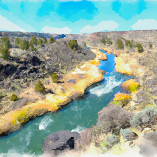
Pelton, located in Warm Springs, Oregon, is a captivating hydroelectric dam situated on the Deschutes River. Constructed in 1957, this arch-type dam stands at a height of 204 feet, with a hydraulic height of 195 feet, making it a significant structure for water resource and climate enthusiasts. With a storage capacity of 31,800 acre-feet and a maximum discharge of 23,500 cubic feet per second, Pelton plays a crucial role in water management and renewable energy production in the region.
The dam's primary purpose is hydroelectric power generation, but it also offers recreational opportunities for visitors. Its controlled spillway, with a width of 76 feet, ensures safe water release during high-flow events. Despite its high hazard potential, Pelton has not undergone recent condition assessments, highlighting the need for continued monitoring and maintenance to ensure its safety and resilience to potential risks. With the Federal Energy Regulatory Commission overseeing its regulation and inspections, Pelton remains an essential infrastructure for sustainable water resource management and climate mitigation efforts in Oregon.
Pelton's strategic location, structural design, and operational capacity make it a key player in the region's water resource and climate resilience strategies. As a critical piece of the Deschutes River ecosystem, Pelton provides not only clean energy but also valuable recreational opportunities and flood control measures. With its high hazard potential and very high risk assessment rating, ongoing monitoring and risk management measures are essential to safeguarding this vital infrastructure for future generations. As climate change impacts continue to affect water resources, Pelton's role in sustainable water management and renewable energy production will only grow in importance.
Plan around the weather
Same NOAA / yr.no feed Snoflo's iOS app uses. Watch the precipitation column on the meteogram -- rain on the basin upstream typically lifts inflow 24-72 hours later.
Next 5 days, hour by hour
Temperature line with weather symbols on top, snow + rain accumulation as columns, humidity as a dotted line.
5-day forecast table
Every 3 hours, broken out across temperature, snow, rain, humidity, and wind. Each cell is colour-coded relative to the column min/max.
| Time | Condition | Temp (°F) | Snow (in) | Rain (in) | Humidity (%) | Wind (mps) | Wind dir |
|---|---|---|---|---|---|---|---|
| Loading detailed forecast… | |||||||
15-day temperature & precipitation
Daily temperatures, snow, and rain projected over the next two weeks.
Nearby streamflow gauges
USGS streamgauges around Pelton -- inflows here typically show up in storage 24-72 hours later.
| Streamgauge | Discharge | View |
|---|---|---|
| Deschutes River Near Madras | 3,480 cfs | → |
| Shitike Creek Near Warm Springs | 42 cfs | → |
| Warm Springs River Near Kahneeta Hot Springs | 199 cfs | → |
| Metolius River Near Grandview | 1,250 cfs | → |
| Deschutes River Near Culver | 515 cfs | → |
| Crooked River Below Opal Springs | 1,150 cfs | → |
Make a day of it
Boat launches, lakeside camping, fishing access, and other reservoirs near Pelton.
Boat launches
See all →


Campgrounds
See all →


River runs
See all →


More reservoirs
See all →
About Pelton
Where does the data for Pelton come from?
Structural and regulatory data come from the U.S. Army Corps of Engineers' National Inventory of Dams (NID). Weather forecast comes from NOAA / yr.no -- the same feed Snoflo's iOS app uses.
How often is the report updated?
NID structural data refreshes annually as the Corps publishes updated assessments. The weather forecast refreshes throughout the day.
What does the High hazard rating mean?
The Corps of Engineers' hazard potential classification grades probable consequences if the dam fails: High = probable loss of human life; Significant = no probable loss of human life but possible economic loss / environmental damage; Low = no probable loss of human life, only minor economic / environmental losses. See the Dam Data Reference card below for the full definitions.
What's "% of normal"?
The current storage value compared to the historical average storage on this calendar day. 100% = right on average; values above 100% mean above-normal storage (wet year); values below mean below-normal (dry year or drought).
Can I get alerts when storage crosses a threshold?
Yes -- alerts are managed in the Snoflo iOS app. Favorite this dam, set a threshold, and you'll get a push the moment conditions cross.
Dam data reference
Condition Assessment
- Satisfactory
- No existing or potential dam safety deficiencies are recognized. Acceptable performance is expected under all loading conditions (static, hydrologic, seismic) in accordance with the minimum applicable state or federal regulatory criteria or tolerable risk guidelines.
- Fair
- No existing dam safety deficiencies are recognized for normal operating conditions. Rare or extreme hydrologic and/or seismic events may result in a dam safety deficiency. Risk may be in the range to take further action.
- Poor
- A dam safety deficiency is recognized for normal operating conditions which may realistically occur. Remedial action is necessary. POOR may also be used when uncertainties exist as to critical analysis parameters which identify a potential dam safety deficiency.
- Unsatisfactory
- A dam safety deficiency is recognized that requires immediate or emergency remedial action for problem resolution.
- Not Rated
- The dam has not been inspected, is not under state or federal jurisdiction, or has been inspected but, for whatever reason, has not been rated.
Hazard Potential Classification
- High
- Dams assigned the high hazard potential classification are those where failure or mis-operation will probably cause loss of human life.
- Significant
- Dams assigned the significant hazard potential classification are those dams where failure or mis-operation results in no probable loss of human life but can cause economic loss, environmental damage, disruption of lifeline facilities, or impact other concerns. Significant hazard potential classification dams are often located in predominantly rural or agricultural areas but could be in areas with population and significant infrastructure.
- Low
- Dams assigned the low hazard potential classification are those where failure or mis-operation results in no probable loss of human life and low economic and/or environmental losses. Losses are principally limited to the owner's property.
- Undetermined
- Dams for which a downstream hazard potential has not been designated or is not provided.