Cove Palisades Marina boat launch
Community Reviews
Been here? Share the conditions.
Reviews, ratings & photos are added in the free Snoflo iOS app — rate a spot, tag the conditions, and your visit is verified by location. Add or manage your reviews from the app.
Cove Palisades Marina
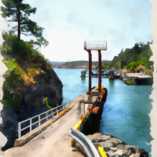
Cove Palisades Marina boat ramp provides access to Lake Billy Chinook, a popular destination for boaters, fishermen, and other water sports enthusiasts. The lake covers approximately 3,900 acres and has a maximum depth of 415 feet. The lake is a popular spot for fishing, with species such as rainbow trout, brown trout, kokanee salmon, and smallmouth bass.
As per the latest information available, the Cove Palisades Marina boat ramp permits all types of watercraft, including powerboats, sailboats, kayaks, and canoes. However, it is essential to note that there are restrictions on the use of personal watercraft, such as Jet Skis. These restrictions are in place to ensure the safety of all lake users.
In conclusion, the Cove Palisades Marina boat ramp is a concrete ramp that provides access to Lake Billy Chinook in central Oregon. It is 20 feet wide, and all types of watercraft, except for Jet Skis, are permitted on the water. The lake is an excellent spot for fishing and other water sports and attracts many visitors each year.
Plan your launch down to the hour
Same weather feed Snoflo's iOS app uses -- updated continuously from NOAA / yr.no.
Next 5 days, hour by hour
Temperature line with weather symbols on top, snow + rain accumulation as columns, humidity as a dotted line.
5-day forecast table
Every 3 hours, broken out across temperature, snow, rain, humidity, and wind.
| Time | Condition | Temp (°F) | Snow (in) | Rain (in) | Humidity (%) | Wind (mps) | Wind dir |
|---|---|---|---|---|---|---|---|
| Loading detailed forecast… | |||||||
15-day temperature & precipitation
Daily temperatures, snow, and rain projected over the next two weeks.
Area streamflow levels
USGS streamgauges around Cove Palisades Marina -- the same readings that determine whether your launch is safe and your boat is the right craft.
| Streamgauge | Discharge | View |
|---|---|---|
| Crooked River Below Opal Springs | 1,260 cfs | → |
| Deschutes River Near Culver | 507 cfs | → |
| Crooked River Blw Osborne Canyon | 114 cfs | → |
| Deschutes River Near Madras | 3,480 cfs | → |
| Metolius River Near Grandview | 1,240 cfs | → |
| Shitike Creek Near Warm Springs | 40 cfs | → |
Plan a longer trip
The closest paddle runs, fishing spots, and other boat launches so you can extend a day on the water.
River runs
- Crooked River National Grassland Boundary To Confluence With Deschutes River
- Warm Springs To Sherars Falls
- Canyon Run (Lower Bridge To Billy Chinook Res.)
- Source To Confluence With Metolius River
- Cline Falls State Park To Lower Bridge
- Tumalo State Park To Cline Falls State Park
Boating safety & etiquette
- Check the conditions before you launch
- Use the streamflow numbers, weather, and wind forecast on this page. High-cfs whitewater requires whitewater-specific craft and skill.
- Wear your life jacket
- Statistically the single biggest survival factor in a boating incident. State law often requires one per passenger.
- File a float plan
- Tell someone on shore your put-in, take-out, and expected return time. Especially for multi-day or remote trips.
- Yield at the ramp
- Prep gear in the parking lot, not on the ramp. Launch and clear quickly so others can use the lane.
- Clean, drain, dry
- Inspect, clean, drain and dry your boat between waters to prevent the spread of aquatic invasive species.
Set push alerts in the Snoflo app
Save Cove Palisades Marina as a favorite, set a discharge threshold or a wind/precipitation alert, and the iOS app will push the moment conditions cross.
About Cove Palisades Marina
Can I launch a motorboat here?
Most Snoflo-tracked launches support motorboats; check the operator for any horsepower restrictions, paddle-only zones, or seasonal closures.
How fresh is the streamflow data?
USGS streamgauges report continuously (every 15 minutes); the table on this page pulls the latest reading at page load.
Is there a fee?
Many federal and state boat launches charge a day-use fee. Check the operator's site before driving out.
What boat is right for these conditions?
Use the nearby streamflow numbers and river-run panel on this page to gauge current conditions. Wider, slower water is friendly for casual paddling and powerboats; high-cfs whitewater requires whitewater-specific craft and skill.
Can I get alerts when conditions change?
Yes -- alerts are managed in the Snoflo iOS app. Favorite this launch, set a threshold (discharge, wind), and you'll get a push the moment it crosses.
Other launches near here
Snoflo-tracked boat launches within driving distance of Cove Palisades Marina.