


Goldendale Wastewater Pond 1b Reservoir Report
Last Updated: May 2, 2026
°F
°F
mph
Wind
%
Humidity
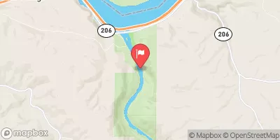
Goldendale Wastewater Pond 1b in Wahkiacus, Washington, is a local government-owned Earth dam structure completed in 1983 with a primary purpose of "Other." The dam, standing at a hydraulic height of 19 feet and a structural height of 19 feet, plays a crucial role in managing wastewater and storing water for the area.
Summary
With a storage capacity of 114 acre-feet and a normal storage level of 87 acre-feet, the pond covers a surface area of 12 acres and serves a drainage area of 0.22 square miles.
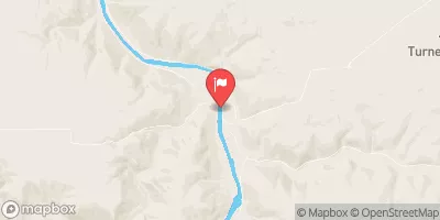
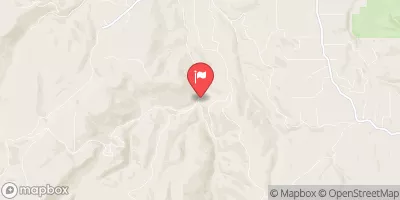
Located in Klickitat County, Washington, the Goldendale Wastewater Pond 1b is regulated by the Washington Department of Ecology and is subject to state permitting, inspection, and enforcement. Despite being categorized as low hazard potential and not yet rated for condition assessment, the dam serves as a vital infrastructure for the community, ensuring proper wastewater management and water storage. The dam is situated on Tr-Klickitat-Offstream river or stream and falls under the jurisdiction of the Portland District and Congressional District 03 of Washington, represented by Jaime Herrera Beutler (R).
Overall, Goldendale Wastewater Pond 1b is an essential structure for water resource management in the region, providing crucial services for the local community. With its strategic location, regulated operations, and low hazard potential, the dam contributes to the sustainability and resilience of the area's water infrastructure. As a key component of the local government's water management system, the pond plays a significant role in ensuring the efficient and effective use of water resources in the Wahkiacus area.
Regional Streamflow Levels
 Deschutes River At Moody
|
3780cfs |
 Klickitat River Bl Summit Creek Near Glenwood
|
1100cfs |
 Klickitat River Near Pitt
|
1410cfs |
 Columbia River At The Dalles
|
203000cfs |
 John Day River At Mcdonald Ferry
|
2810cfs |
 Mosier Creek Near Mosier
|
5cfs |
15-Day Long Term Forecast
Year Completed |
1983 |
Dam Length |
3220 |
River Or Stream |
Tr-Klickitat-Offstream |
Primary Dam Type |
Earth |
Surface Area |
12 |
Hydraulic Height |
19 |
Drainage Area |
0.22 |
Nid Storage |
114 |
Structural Height |
19 |
Hazard Potential |
Low |
Foundations |
Rock, Soil |
Nid Height |
19 |
Seasonal Comparison
5-Day Hourly Forecast Detail
Dam Data Reference
Condition Assessment
SatisfactoryNo existing or potential dam safety deficiencies are recognized. Acceptable performance is expected under all loading conditions (static, hydrologic, seismic) in accordance with the minimum applicable state or federal regulatory criteria or tolerable risk guidelines.
Fair
No existing dam safety deficiencies are recognized for normal operating conditions. Rare or extreme hydrologic and/or seismic events may result in a dam safety deficiency. Risk may be in the range to take further action. Note: Rare or extreme event is defined by the regulatory agency based on their minimum
Poor A dam safety deficiency is recognized for normal operating conditions which may realistically occur. Remedial action is necessary. POOR may also be used when uncertainties exist as to critical analysis parameters which identify a potential dam safety deficiency. Investigations and studies are necessary.
Unsatisfactory
A dam safety deficiency is recognized that requires immediate or emergency remedial action for problem resolution.
Not Rated
The dam has not been inspected, is not under state or federal jurisdiction, or has been inspected but, for whatever reason, has not been rated.
Not Available
Dams for which the condition assessment is restricted to approved government users.
Hazard Potential Classification
HighDams assigned the high hazard potential classification are those where failure or mis-operation will probably cause loss of human life.
Significant
Dams assigned the significant hazard potential classification are those dams where failure or mis-operation results in no probable loss of human life but can cause economic loss, environment damage, disruption of lifeline facilities, or impact other concerns. Significant hazard potential classification dams are often located in predominantly rural or agricultural areas but could be in areas with population and significant infrastructure.
Low
Dams assigned the low hazard potential classification are those where failure or mis-operation results in no probable loss of human life and low economic and/or environmental losses. Losses are principally limited to the owner's property.
Undetermined
Dams for which a downstream hazard potential has not been designated or is not provided.
Not Available
Dams for which the downstream hazard potential is restricted to approved government users.
Area Campgrounds
| Location | Reservations | Toilets |
|---|---|---|
 Maryhill State Park
|
||
 Cliffs Park (Army Corps of Engineers)
|
||
 Giles French
|
||
 Cliffs Park - Columbia River Gorge
|
||
 LePage Park
|
||
 Celilo
|
 Bull Run Lake Near Brightwood
 Heritage Landing
 Summit Creek To Mouth Of Little Klickitat
 Rock Creek Complex (Klickitat County)
 Klickitat River