


Lake Louise Dam Reservoir Report
Last Updated: April 26, 2026
°F
°F
mph
Wind
%
Humidity
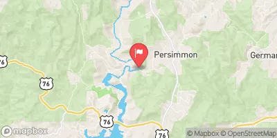
Lake Louise Dam, located in Mount Airy, Georgia, is a privately-owned structure on Walton Creek completed in 1937 primarily for recreational purposes.
Summary
The dam stands at a height of 68 feet and spans 1500 feet, with a storage capacity of 9175 acre-feet and a surface area of 170 acres. Despite being unregulated by the state, the dam is inspected regularly with a low hazard potential and a moderate risk assessment rating.
The dam's design, an earth buttress type, reflects its focus on providing recreational opportunities for visitors in Stephens County. With a normal storage capacity of 5363 acre-feet and a drainage area of 1920 acres, Lake Louise Dam offers a picturesque setting for outdoor activities such as fishing, boating, and hiking. While it does not have controlled spillways or outlet gates, the dam's uncontrolled spillway type and inspection frequency of every five years contribute to its overall safe operation and management.
In the scenic surroundings of Lake Louise Dam, water resource and climate enthusiasts can appreciate the balance between human recreation and environmental stewardship. With its historical significance and ongoing maintenance, this dam serves as a testament to the importance of responsible water management and the preservation of natural landscapes for future generations to enjoy.
Regional Streamflow Levels
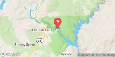 Tallulah River Ab Powerhouse
|
39cfs |
 Chattooga River Near Clayton
|
258cfs |
 Chattahoochee River Near Cornelia
|
314cfs |
 Chattahoochee River Near Leaf
|
175cfs |
 Tallulah River Near Clayton
|
70cfs |
 Chattahoochee River At Helen
|
68cfs |
15-Day Long Term Forecast
Year Completed |
1937 |
Dam Length |
1500 |
Dam Height |
68 |
River Or Stream |
WALTON CREEK |
Primary Dam Type |
Earth |
Surface Area |
170 |
Drainage Area |
1920 |
Nid Storage |
9175 |
Outlet Gates |
Uncontrolled |
Hazard Potential |
Low |
Foundations |
Unlisted/Unknown |
Nid Height |
68 |
Seasonal Comparison
5-Day Hourly Forecast Detail
Dam Data Reference
Condition Assessment
SatisfactoryNo existing or potential dam safety deficiencies are recognized. Acceptable performance is expected under all loading conditions (static, hydrologic, seismic) in accordance with the minimum applicable state or federal regulatory criteria or tolerable risk guidelines.
Fair
No existing dam safety deficiencies are recognized for normal operating conditions. Rare or extreme hydrologic and/or seismic events may result in a dam safety deficiency. Risk may be in the range to take further action. Note: Rare or extreme event is defined by the regulatory agency based on their minimum
Poor A dam safety deficiency is recognized for normal operating conditions which may realistically occur. Remedial action is necessary. POOR may also be used when uncertainties exist as to critical analysis parameters which identify a potential dam safety deficiency. Investigations and studies are necessary.
Unsatisfactory
A dam safety deficiency is recognized that requires immediate or emergency remedial action for problem resolution.
Not Rated
The dam has not been inspected, is not under state or federal jurisdiction, or has been inspected but, for whatever reason, has not been rated.
Not Available
Dams for which the condition assessment is restricted to approved government users.
Hazard Potential Classification
HighDams assigned the high hazard potential classification are those where failure or mis-operation will probably cause loss of human life.
Significant
Dams assigned the significant hazard potential classification are those dams where failure or mis-operation results in no probable loss of human life but can cause economic loss, environment damage, disruption of lifeline facilities, or impact other concerns. Significant hazard potential classification dams are often located in predominantly rural or agricultural areas but could be in areas with population and significant infrastructure.
Low
Dams assigned the low hazard potential classification are those where failure or mis-operation results in no probable loss of human life and low economic and/or environmental losses. Losses are principally limited to the owner's property.
Undetermined
Dams for which a downstream hazard potential has not been designated or is not provided.
Not Available
Dams for which the downstream hazard potential is restricted to approved government users.
Area Campgrounds
| Location | Reservations | Toilets |
|---|---|---|
 Toccoa Falls College RV Park
|
||
 Lake Yonah County Park
|
||
 Chau Ram County Park
|
||
 Tallulah Gorge State Park
|
River Runs
-
 Confluence Of Brasstown Creek And Little Brasstown Creek Just South Of Brasstown Falls Road (Fs 751) To Confluence Of Mill Branch, Brasstown Creek And Boatwright Creek Near Boatwright Road (Fs 753)
-
 Confluence Of Cedar Creek To 1/4 Mile Below The Nf Boundary And Fh 110, Cobbs Bridge Road
-
 1/4 Mile Below Fs 745 And Cassidy Bridge Hunt Camp To Confluence Of Cedar Creek
-
 South Of Cedar Creek Rifle Range To Confluence With Chauga River