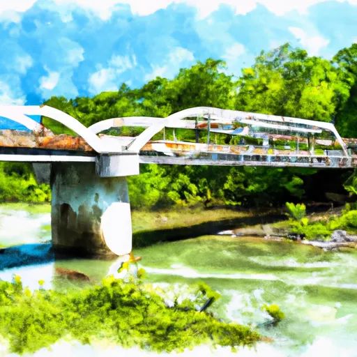
Johnson Lake Dam

Johnson Lake
Johnson Lake in Hickman, Tennessee, is a private water resource that offers a serene and picturesque escape for water resource and climate enthusiasts. With a surface area of 6 acres and a maximum storage capacity of 105 acre-feet, this earth dam serves a primary purpose of "Other" and is noted for its significant hazard potential. The dam stands at a structural height of 40 feet and spans 300 feet in length, providing a vital water source in the region.
Managed by the Nashville District of the US Army Corps of Engineers, Johnson Lake boasts an uncontrolled spillway type and has a history of regular inspections, with the last inspection conducted in October 2016. The risk assessment for the dam is rated as moderate, and while the condition assessment is currently listed as "Not Rated," the structure's overall risk management measures are in place. Despite its private ownership, Johnson Lake plays a crucial role in the local water ecosystem and serves as a valuable asset for the community.
As an essential component of the water infrastructure in Hickman, Tennessee, Johnson Lake offers a glimpse into the careful balance between water resource management and environmental stewardship. With its tranquil waters and lush surroundings, the lake provides a haven for wildlife and a recreational retreat for visitors. As climate change continues to impact water resources, Johnson Lake remains a symbol of resilience and adaptability in the face of evolving environmental challenges, making it a must-visit destination for those passionate about water conservation and sustainability.
Plan around the weather
Same NOAA / yr.no feed Snoflo's iOS app uses. Watch the precipitation column on the meteogram -- rain on the basin upstream typically lifts inflow 24-72 hours later.
Next 5 days, hour by hour
Temperature line with weather symbols on top, snow + rain accumulation as columns, humidity as a dotted line.
5-day forecast table
Every 3 hours, broken out across temperature, snow, rain, humidity, and wind. Each cell is colour-coded relative to the column min/max.
| Time | Condition | Temp (°F) | Snow (in) | Rain (in) | Humidity (%) | Wind (mps) | Wind dir |
|---|---|---|---|---|---|---|---|
| Loading detailed forecast… | |||||||
15-day temperature & precipitation
Daily temperatures, snow, and rain projected over the next two weeks.
Nearby streamflow gauges
USGS streamgauges around Johnson Lake -- inflows here typically show up in storage 24-72 hours later.
| Streamgauge | Discharge | View |
|---|---|---|
| Copperas Branch Near Kingfield | 1 cfs | → |
| Duck River At Hwy 100 At Centerville | 1,440 cfs | → |
| Piney River At Vernon | 203 cfs | → |
| Duck River At Columbia | 415 cfs | → |
| Harpeth River Below Franklin | 107 cfs | → |
| Harpeth River At Franklin | 56 cfs | → |


About Johnson Lake
Where does the data for Johnson Lake come from?
Structural and regulatory data come from the U.S. Army Corps of Engineers' National Inventory of Dams (NID). Weather forecast comes from NOAA / yr.no -- the same feed Snoflo's iOS app uses.
How often is the report updated?
NID structural data refreshes annually as the Corps publishes updated assessments. The weather forecast refreshes throughout the day.
What does the Significant hazard rating mean?
The Corps of Engineers' hazard potential classification grades probable consequences if the dam fails: High = probable loss of human life; Significant = no probable loss of human life but possible economic loss / environmental damage; Low = no probable loss of human life, only minor economic / environmental losses. See the Dam Data Reference card below for the full definitions.
What's "% of normal"?
The current storage value compared to the historical average storage on this calendar day. 100% = right on average; values above 100% mean above-normal storage (wet year); values below mean below-normal (dry year or drought).
Can I get alerts when storage crosses a threshold?
Yes -- alerts are managed in the Snoflo iOS app. Favorite this dam, set a threshold, and you'll get a push the moment conditions cross.
Dam data reference
Condition Assessment
- Satisfactory
- No existing or potential dam safety deficiencies are recognized. Acceptable performance is expected under all loading conditions (static, hydrologic, seismic) in accordance with the minimum applicable state or federal regulatory criteria or tolerable risk guidelines.
- Fair
- No existing dam safety deficiencies are recognized for normal operating conditions. Rare or extreme hydrologic and/or seismic events may result in a dam safety deficiency. Risk may be in the range to take further action.
- Poor
- A dam safety deficiency is recognized for normal operating conditions which may realistically occur. Remedial action is necessary. POOR may also be used when uncertainties exist as to critical analysis parameters which identify a potential dam safety deficiency.
- Unsatisfactory
- A dam safety deficiency is recognized that requires immediate or emergency remedial action for problem resolution.
- Not Rated
- The dam has not been inspected, is not under state or federal jurisdiction, or has been inspected but, for whatever reason, has not been rated.
Hazard Potential Classification
- High
- Dams assigned the high hazard potential classification are those where failure or mis-operation will probably cause loss of human life.
- Significant
- Dams assigned the significant hazard potential classification are those dams where failure or mis-operation results in no probable loss of human life but can cause economic loss, environmental damage, disruption of lifeline facilities, or impact other concerns. Significant hazard potential classification dams are often located in predominantly rural or agricultural areas but could be in areas with population and significant infrastructure.
- Low
- Dams assigned the low hazard potential classification are those where failure or mis-operation results in no probable loss of human life and low economic and/or environmental losses. Losses are principally limited to the owner's property.
- Undetermined
- Dams for which a downstream hazard potential has not been designated or is not provided.