Egger Lake Dam

Egger Lake Dam
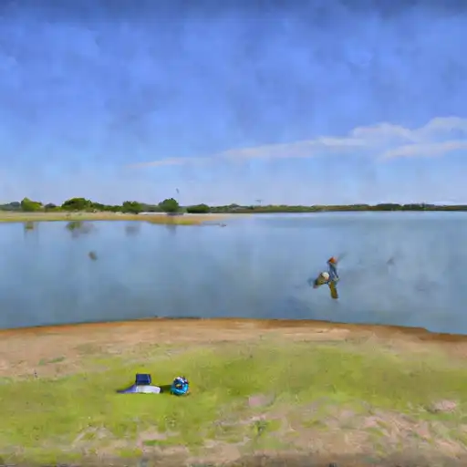
Egger Lake Dam, located in Bastrop, Texas, was completed in 1957 and serves multiple purposes including fire protection, stock, and small fish pond management. This private earth dam stands at a height of 22 feet and has a length of 525 feet, with a storage capacity of 435 acre-feet. The dam is situated on TR-ALUM CREEK and is owned privately with state permitting and inspection in place.
Despite its relatively small size, Egger Lake Dam poses a high risk (level 2) according to the data available. The dam does not have a spillway and is rated as 'Not Rated' in terms of condition assessment. The dam is not regulated by the state and lacks an Emergency Action Plan (EAP) as well as updated contact information for emergency situations. With the risk assessment indicating a high potential hazard and the lack of certain safety measures, the management and maintenance of Egger Lake Dam are crucial for the surrounding community and environment.
Water resource and climate enthusiasts will find Egger Lake Dam an interesting subject of study due to its unique design features, multiple uses, and high-risk classification. The dam's location in Texas, along with its history of completion and current operational status, provide valuable insights into the management and safety considerations of smaller-scale dams in the region. Further research and monitoring of Egger Lake Dam's condition and risk management measures could contribute to the broader understanding of water resource infrastructure in the area.
Plan around the weather
Same NOAA / yr.no feed Snoflo's iOS app uses. Watch the precipitation column on the meteogram -- rain on the basin upstream typically lifts inflow 24-72 hours later.
Next 5 days, hour by hour
Temperature line with weather symbols on top, snow + rain accumulation as columns, humidity as a dotted line.
5-day forecast table
Every 3 hours, broken out across temperature, snow, rain, humidity, and wind. Each cell is colour-coded relative to the column min/max.
| Time | Condition | Temp (°F) | Snow (in) | Rain (in) | Humidity (%) | Wind (mps) | Wind dir |
|---|---|---|---|---|---|---|---|
| Loading detailed forecast… | |||||||
15-day temperature & precipitation
Daily temperatures, snow, and rain projected over the next two weeks.
Nearby streamflow gauges
USGS streamgauges around Egger Lake Dam -- inflows here typically show up in storage 24-72 hours later.
| Streamgauge | Discharge | View |
|---|---|---|
| Colorado Rv At Bastrop | 4,920 cfs | → |
| Colorado Rv At Smithville | 5,750 cfs | → |
| Middle Yegua Ck Nr Dime Box | 1 cfs | → |
| Colorado Rv Abv La Grange | 6,450 cfs | → |
| Walnut Ck At Webberville Rd | 2 cfs | → |
| Onion Ck At Us Hwy 183 | 3 cfs | → |


About Egger Lake Dam
Where does the data for Egger Lake Dam come from?
Structural and regulatory data come from the U.S. Army Corps of Engineers' National Inventory of Dams (NID). Weather forecast comes from NOAA / yr.no -- the same feed Snoflo's iOS app uses.
How often is the report updated?
NID structural data refreshes annually as the Corps publishes updated assessments. The weather forecast refreshes throughout the day.
What does the Not Available hazard rating mean?
The Corps of Engineers' hazard potential classification grades probable consequences if the dam fails: High = probable loss of human life; Significant = no probable loss of human life but possible economic loss / environmental damage; Low = no probable loss of human life, only minor economic / environmental losses. See the Dam Data Reference card below for the full definitions.
What's "% of normal"?
The current storage value compared to the historical average storage on this calendar day. 100% = right on average; values above 100% mean above-normal storage (wet year); values below mean below-normal (dry year or drought).
Can I get alerts when storage crosses a threshold?
Yes -- alerts are managed in the Snoflo iOS app. Favorite this dam, set a threshold, and you'll get a push the moment conditions cross.
Dam data reference
Condition Assessment
- Satisfactory
- No existing or potential dam safety deficiencies are recognized. Acceptable performance is expected under all loading conditions (static, hydrologic, seismic) in accordance with the minimum applicable state or federal regulatory criteria or tolerable risk guidelines.
- Fair
- No existing dam safety deficiencies are recognized for normal operating conditions. Rare or extreme hydrologic and/or seismic events may result in a dam safety deficiency. Risk may be in the range to take further action.
- Poor
- A dam safety deficiency is recognized for normal operating conditions which may realistically occur. Remedial action is necessary. POOR may also be used when uncertainties exist as to critical analysis parameters which identify a potential dam safety deficiency.
- Unsatisfactory
- A dam safety deficiency is recognized that requires immediate or emergency remedial action for problem resolution.
- Not Rated
- The dam has not been inspected, is not under state or federal jurisdiction, or has been inspected but, for whatever reason, has not been rated.
Hazard Potential Classification
- High
- Dams assigned the high hazard potential classification are those where failure or mis-operation will probably cause loss of human life.
- Significant
- Dams assigned the significant hazard potential classification are those dams where failure or mis-operation results in no probable loss of human life but can cause economic loss, environmental damage, disruption of lifeline facilities, or impact other concerns. Significant hazard potential classification dams are often located in predominantly rural or agricultural areas but could be in areas with population and significant infrastructure.
- Low
- Dams assigned the low hazard potential classification are those where failure or mis-operation results in no probable loss of human life and low economic and/or environmental losses. Losses are principally limited to the owner's property.
- Undetermined
- Dams for which a downstream hazard potential has not been designated or is not provided.