Ryder Pond Reservoir Report
Nearby: Jacksonville Pond Lake Clara
Last Updated: February 25, 2026
Ryder Pond, located in Whitingham, Vermont, is a private recreational water resource situated on the East Branch North River.
Summary
Constructed in 1972, this earth dam stands at 17 feet in height and spans 125 feet in length, with a storage capacity of 170 acre-feet. The pond covers a surface area of 14 acres and serves as a popular spot for water enthusiasts in Windham County.
Despite its scenic beauty and recreational value, Ryder Pond's condition assessment was deemed poor during its last inspection in June 2014. Classified with a significant hazard potential, the dam is in need of attention to ensure its safety and longevity. With its state-regulated status and history of enforcement and inspection by the Vermont Department of Environmental Conservation, efforts to improve the dam's condition and emergency preparedness are crucial to safeguarding this beloved water resource for future generations of climate and water resource enthusiasts.
°F
°F
mph
Wind
%
Humidity
15-Day Weather Outlook
Year Completed |
1972 |
Dam Length |
125 |
Dam Height |
17 |
River Or Stream |
EAST BRANCH NORTH RIVER |
Primary Dam Type |
Earth |
Surface Area |
14 |
Hydraulic Height |
17 |
Drainage Area |
0.26 |
Nid Storage |
170 |
Structural Height |
17 |
Hazard Potential |
Significant |
Foundations |
Soil |
Nid Height |
17 |
Seasonal Comparison
5-Day Hourly Forecast Detail
Nearby Streamflow Levels
Dam Data Reference
Condition Assessment
SatisfactoryNo existing or potential dam safety deficiencies are recognized. Acceptable performance is expected under all loading conditions (static, hydrologic, seismic) in accordance with the minimum applicable state or federal regulatory criteria or tolerable risk guidelines.
Fair
No existing dam safety deficiencies are recognized for normal operating conditions. Rare or extreme hydrologic and/or seismic events may result in a dam safety deficiency. Risk may be in the range to take further action. Note: Rare or extreme event is defined by the regulatory agency based on their minimum
Poor A dam safety deficiency is recognized for normal operating conditions which may realistically occur. Remedial action is necessary. POOR may also be used when uncertainties exist as to critical analysis parameters which identify a potential dam safety deficiency. Investigations and studies are necessary.
Unsatisfactory
A dam safety deficiency is recognized that requires immediate or emergency remedial action for problem resolution.
Not Rated
The dam has not been inspected, is not under state or federal jurisdiction, or has been inspected but, for whatever reason, has not been rated.
Not Available
Dams for which the condition assessment is restricted to approved government users.
Hazard Potential Classification
HighDams assigned the high hazard potential classification are those where failure or mis-operation will probably cause loss of human life.
Significant
Dams assigned the significant hazard potential classification are those dams where failure or mis-operation results in no probable loss of human life but can cause economic loss, environment damage, disruption of lifeline facilities, or impact other concerns. Significant hazard potential classification dams are often located in predominantly rural or agricultural areas but could be in areas with population and significant infrastructure.
Low
Dams assigned the low hazard potential classification are those where failure or mis-operation results in no probable loss of human life and low economic and/or environmental losses. Losses are principally limited to the owner's property.
Undetermined
Dams for which a downstream hazard potential has not been designated or is not provided.
Not Available
Dams for which the downstream hazard potential is restricted to approved government users.
Area Campgrounds
| Location | Reservations | Toilets |
|---|---|---|
 Molly Stark State Park Campsites
|
||
 Molly Stark State Park
|
||
 Red Mill Brook
|
||
 Woodford State Park
|

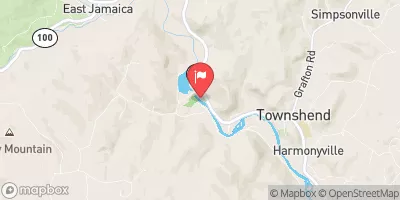
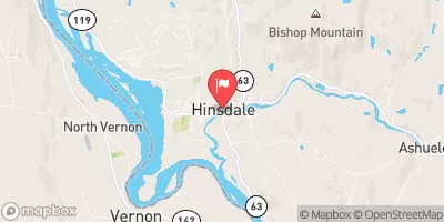
 Ryder Pond
 Headwaters To North Of Searsburg Reservoir
 Headwaters To Confluence With West River (End Of Sherman Road)
 Stamford Town Line To Confluence With City Stream