Con Agra Foods New Storage Basin Dam

Con Agra Foods New Storage Basin
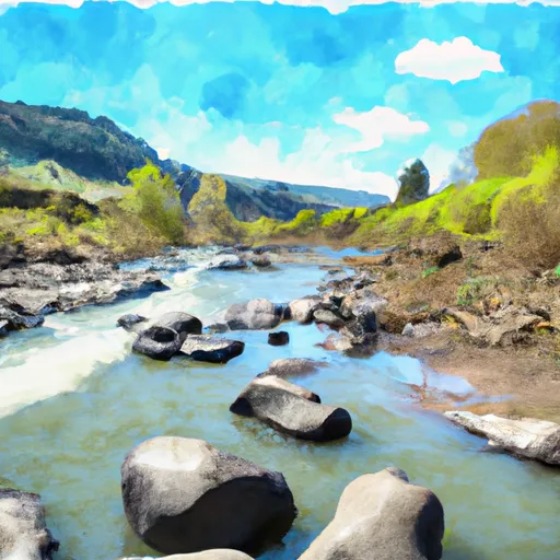
Located in Franklin, Washington, the Con Agra Foods New Storage Basin is a private storage facility designed by Cascade Earth Sciences for water resource management. Completed in 2006, this earth-type dam has a hydraulic height of 13 feet and a storage capacity of 150 acre-feet, with a normal storage level of 130 acre-feet. The basin covers an area of 9.3 acres and is regulated by the Washington Dept of Ecology.
This low-hazard dam serves as an offstream storage solution for Esquatzel Coulee, providing water storage and management options for agricultural and environmental purposes in the region. With a maximum discharge of 15 cubic feet per second, the Con Agra Foods New Storage Basin plays a crucial role in water resource sustainability and climate resilience efforts in the area. Its location in S35 T14 R31E is within the jurisdiction of the state of Washington, ensuring proper regulation, inspection, and enforcement measures are in place.
As a key component of the water infrastructure in the region, the Con Agra Foods New Storage Basin contributes to the overall water management strategy in Franklin County. With its strategic design and capacity, this facility enhances water supply reliability, flood control measures, and environmental conservation efforts. Climate enthusiasts and water resource experts can appreciate the role of this private storage basin in promoting sustainable water use and resilience in the face of changing climate conditions in the area.
Plan around the weather
Same NOAA / yr.no feed Snoflo's iOS app uses. Watch the precipitation column on the meteogram -- rain on the basin upstream typically lifts inflow 24-72 hours later.
Next 5 days, hour by hour
Temperature line with weather symbols on top, snow + rain accumulation as columns, humidity as a dotted line.
5-day forecast table
Every 3 hours, broken out across temperature, snow, rain, humidity, and wind. Each cell is colour-coded relative to the column min/max.
| Time | Condition | Temp (°F) | Snow (in) | Rain (in) | Humidity (%) | Wind (mps) | Wind dir |
|---|---|---|---|---|---|---|---|
| Loading detailed forecast… | |||||||
15-day temperature & precipitation
Daily temperatures, snow, and rain projected over the next two weeks.
Nearby streamflow gauges
USGS streamgauges around Con Agra Foods New Storage Basin -- inflows here typically show up in storage 24-72 hours later.
| Streamgauge | Discharge | View |
|---|---|---|
| Palouse River At Hooper | 48 cfs | → |
| Yakima River At Kiona | 864 cfs | → |
| Tucannon River Near Starbuck | 52 cfs | → |
| Crab Creek Near Moses Lake | 70 cfs | → |
| Walla Walla River Near Touchet | 35 cfs | → |
| Crab Creek Near Beverly | 107 cfs | → |


About Con Agra Foods New Storage Basin
Where does the data for Con Agra Foods New Storage Basin come from?
Structural and regulatory data come from the U.S. Army Corps of Engineers' National Inventory of Dams (NID). Weather forecast comes from NOAA / yr.no -- the same feed Snoflo's iOS app uses.
How often is the report updated?
NID structural data refreshes annually as the Corps publishes updated assessments. The weather forecast refreshes throughout the day.
What does the Low hazard rating mean?
The Corps of Engineers' hazard potential classification grades probable consequences if the dam fails: High = probable loss of human life; Significant = no probable loss of human life but possible economic loss / environmental damage; Low = no probable loss of human life, only minor economic / environmental losses. See the Dam Data Reference card below for the full definitions.
What's "% of normal"?
The current storage value compared to the historical average storage on this calendar day. 100% = right on average; values above 100% mean above-normal storage (wet year); values below mean below-normal (dry year or drought).
Can I get alerts when storage crosses a threshold?
Yes -- alerts are managed in the Snoflo iOS app. Favorite this dam, set a threshold, and you'll get a push the moment conditions cross.
Dam data reference
Condition Assessment
- Satisfactory
- No existing or potential dam safety deficiencies are recognized. Acceptable performance is expected under all loading conditions (static, hydrologic, seismic) in accordance with the minimum applicable state or federal regulatory criteria or tolerable risk guidelines.
- Fair
- No existing dam safety deficiencies are recognized for normal operating conditions. Rare or extreme hydrologic and/or seismic events may result in a dam safety deficiency. Risk may be in the range to take further action.
- Poor
- A dam safety deficiency is recognized for normal operating conditions which may realistically occur. Remedial action is necessary. POOR may also be used when uncertainties exist as to critical analysis parameters which identify a potential dam safety deficiency.
- Unsatisfactory
- A dam safety deficiency is recognized that requires immediate or emergency remedial action for problem resolution.
- Not Rated
- The dam has not been inspected, is not under state or federal jurisdiction, or has been inspected but, for whatever reason, has not been rated.
Hazard Potential Classification
- High
- Dams assigned the high hazard potential classification are those where failure or mis-operation will probably cause loss of human life.
- Significant
- Dams assigned the significant hazard potential classification are those dams where failure or mis-operation results in no probable loss of human life but can cause economic loss, environmental damage, disruption of lifeline facilities, or impact other concerns. Significant hazard potential classification dams are often located in predominantly rural or agricultural areas but could be in areas with population and significant infrastructure.
- Low
- Dams assigned the low hazard potential classification are those where failure or mis-operation results in no probable loss of human life and low economic and/or environmental losses. Losses are principally limited to the owner's property.
- Undetermined
- Dams for which a downstream hazard potential has not been designated or is not provided.