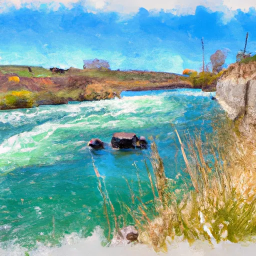
Pathfinder Dam

Pathfinder
Pathfinder is a significant federal-owned structure located in Natrona, Wyoming, along the North Platte River. Built in 1909 by the Bureau of Reclamation, this masonry dam stands at 214 feet tall and serves multiple purposes, including hydroelectric power generation and irrigation. With a storage capacity of over 1 million acre-feet and a maximum discharge of 50,310 cubic feet per second, Pathfinder plays a crucial role in water resource management in the region.
The dam has a high hazard potential and is regulated by the Bureau of Reclamation, which also conducts inspections and operations. Despite its age, Pathfinder's condition assessment is listed as "Not Available," highlighting the need for ongoing monitoring and maintenance to ensure its structural integrity. The dam's emergency action plan was last revised in April 2020, emphasizing the importance of preparedness for potential risks and emergencies associated with the structure.
Pathfinder's presence on the North Platte River not only contributes to the region's water supply and energy needs but also underscores the intersection of water resource management and climate resilience. As climate change continues to impact water availability and extreme weather events, the role of infrastructure like Pathfinder in ensuring water security and safety becomes increasingly vital. Efforts to enhance risk assessment, emergency preparedness, and maintenance will be crucial in safeguarding this critical water resource infrastructure for the future.
Plan around the weather
Same NOAA / yr.no feed Snoflo's iOS app uses. Watch the precipitation column on the meteogram -- rain on the basin upstream typically lifts inflow 24-72 hours later.
Next 5 days, hour by hour
Temperature line with weather symbols on top, snow + rain accumulation as columns, humidity as a dotted line.
5-day forecast table
Every 3 hours, broken out across temperature, snow, rain, humidity, and wind. Each cell is colour-coded relative to the column min/max.
| Time | Condition | Temp (°F) | Snow (in) | Rain (in) | Humidity (%) | Wind (mps) | Wind dir |
|---|---|---|---|---|---|---|---|
| Loading detailed forecast… | |||||||
15-day temperature & precipitation
Daily temperatures, snow, and rain projected over the next two weeks.
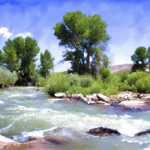
Nearby streamflow gauges
USGS streamgauges around Pathfinder -- inflows here typically show up in storage 24-72 hours later.
| Streamgauge | Discharge | View |
|---|---|---|
| Sweetwater River Near Alcova | 27 cfs | → |
| Medicine Bow R Ab Seminoe Reservoir | 58 cfs | → |
| N Platte Riv Ab Seminoe Reservoir | 123 cfs | → |
| Deer Creek In Canyon | 1 cfs | → |
| L Medicine Bow R At Boles Spring | 30 cfs | → |
| Box Elder Creek At Boxelder | 26 cfs | → |


About Pathfinder
Where does the data for Pathfinder come from?
Structural and regulatory data come from the U.S. Army Corps of Engineers' National Inventory of Dams (NID). Weather forecast comes from NOAA / yr.no -- the same feed Snoflo's iOS app uses.
How often is the report updated?
NID structural data refreshes annually as the Corps publishes updated assessments. The weather forecast refreshes throughout the day.
What does the High hazard rating mean?
The Corps of Engineers' hazard potential classification grades probable consequences if the dam fails: High = probable loss of human life; Significant = no probable loss of human life but possible economic loss / environmental damage; Low = no probable loss of human life, only minor economic / environmental losses. See the Dam Data Reference card below for the full definitions.
What's "% of normal"?
The current storage value compared to the historical average storage on this calendar day. 100% = right on average; values above 100% mean above-normal storage (wet year); values below mean below-normal (dry year or drought).
Can I get alerts when storage crosses a threshold?
Yes -- alerts are managed in the Snoflo iOS app. Favorite this dam, set a threshold, and you'll get a push the moment conditions cross.
Dam data reference
Condition Assessment
- Satisfactory
- No existing or potential dam safety deficiencies are recognized. Acceptable performance is expected under all loading conditions (static, hydrologic, seismic) in accordance with the minimum applicable state or federal regulatory criteria or tolerable risk guidelines.
- Fair
- No existing dam safety deficiencies are recognized for normal operating conditions. Rare or extreme hydrologic and/or seismic events may result in a dam safety deficiency. Risk may be in the range to take further action.
- Poor
- A dam safety deficiency is recognized for normal operating conditions which may realistically occur. Remedial action is necessary. POOR may also be used when uncertainties exist as to critical analysis parameters which identify a potential dam safety deficiency.
- Unsatisfactory
- A dam safety deficiency is recognized that requires immediate or emergency remedial action for problem resolution.
- Not Rated
- The dam has not been inspected, is not under state or federal jurisdiction, or has been inspected but, for whatever reason, has not been rated.
Hazard Potential Classification
- High
- Dams assigned the high hazard potential classification are those where failure or mis-operation will probably cause loss of human life.
- Significant
- Dams assigned the significant hazard potential classification are those dams where failure or mis-operation results in no probable loss of human life but can cause economic loss, environmental damage, disruption of lifeline facilities, or impact other concerns. Significant hazard potential classification dams are often located in predominantly rural or agricultural areas but could be in areas with population and significant infrastructure.
- Low
- Dams assigned the low hazard potential classification are those where failure or mis-operation results in no probable loss of human life and low economic and/or environmental losses. Losses are principally limited to the owner's property.
- Undetermined
- Dams for which a downstream hazard potential has not been designated or is not provided.