Mammoth Pool Rd, California Boat Launch
Community Reviews
Been here? Share the conditions.
Reviews, ratings & photos are added in the free Snoflo iOS app — rate a spot, tag the conditions, and your visit is verified by location. Add or manage your reviews from the app.
Mammoth Pool Rd, California
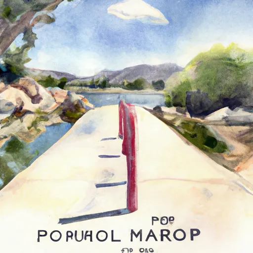
The boat ramp at Mammoth Pool Rd is a concrete structure that provides easy access to the water. It is 27 feet wide and has a gentle slope, making it suitable for a wide range of boats. The ramp is well-maintained and regularly inspected to ensure that it meets safety standards.
The Mammoth Pool Reservoir is open to a variety of watercraft, including motorized boats, sailboats, kayaks, and canoes. However, it is important to note that speed limits and other regulations may apply, depending on the type of vessel being used.
In terms of the latest information available, it is recommended that boaters check with local authorities before using the Mammoth Pool Rd Boat Ramp. This is because water levels and other conditions may vary depending on the time of year and other factors. Additionally, it is important to follow all safety guidelines and regulations while boating on the Mammoth Pool Reservoir.
Plan your launch down to the hour
Same weather feed Snoflo's iOS app uses -- updated continuously from NOAA / yr.no.
Next 5 days, hour by hour
Temperature line with weather symbols on top, snow + rain accumulation as columns, humidity as a dotted line.
5-day forecast table
Every 3 hours, broken out across temperature, snow, rain, humidity, and wind.
| Time | Condition | Temp (°F) | Snow (in) | Rain (in) | Humidity (%) | Wind (mps) | Wind dir |
|---|---|---|---|---|---|---|---|
| Loading detailed forecast… | |||||||
15-day temperature & precipitation
Daily temperatures, snow, and rain projected over the next two weeks.
Area streamflow levels
USGS streamgauges around Mammoth Pool Rd, California -- the same readings that determine whether your launch is safe and your boat is the right craft.
| Streamgauge | Discharge | View |
|---|---|---|
| Nf Willow C Nr Sugar Pine Ca | 416 cfs | → |
| Big C Div Nr Fish Camp Ca | 0 cfs | → |
| Mf San Joaquin R Nr Mammoth Lakes Ca | 56 cfs | → |
| Merced R A Happy Isles Bridge Nr Yosemite Ca | 74 cfs | → |
Plan a longer trip
The closest paddle runs, fishing spots, and other boat launches so you can extend a day on the water.
River runs
- Confluence With North Fork San Joaquin River To Hells Half Acre
- Rainbow Falls To Confluence With North Fork San Joaquin River
- Cora Creek To Confluence With San Joaquin River
- Hemlock Crossing To Confluence With Cora Creek
- Headwaters In Sec 8, T3s, R25 E To Hemlock Crossing
- Blarney Meadows To South End Of Florence Lake
Nearby fishing
Boating safety & etiquette
- Check the conditions before you launch
- Use the streamflow numbers, weather, and wind forecast on this page. High-cfs whitewater requires whitewater-specific craft and skill.
- Wear your life jacket
- Statistically the single biggest survival factor in a boating incident. State law often requires one per passenger.
- File a float plan
- Tell someone on shore your put-in, take-out, and expected return time. Especially for multi-day or remote trips.
- Yield at the ramp
- Prep gear in the parking lot, not on the ramp. Launch and clear quickly so others can use the lane.
- Clean, drain, dry
- Inspect, clean, drain and dry your boat between waters to prevent the spread of aquatic invasive species.
Set push alerts in the Snoflo app
Save Mammoth Pool Rd, California as a favorite, set a discharge threshold or a wind/precipitation alert, and the iOS app will push the moment conditions cross.
About Mammoth Pool Rd, California
Can I launch a motorboat here?
Most Snoflo-tracked launches support motorboats; check the operator for any horsepower restrictions, paddle-only zones, or seasonal closures.
How fresh is the streamflow data?
USGS streamgauges report continuously (every 15 minutes); the table on this page pulls the latest reading at page load.
Is there a fee?
Many federal and state boat launches charge a day-use fee. Check the operator's site before driving out.
What boat is right for these conditions?
Use the nearby streamflow numbers and river-run panel on this page to gauge current conditions. Wider, slower water is friendly for casual paddling and powerboats; high-cfs whitewater requires whitewater-specific craft and skill.
Can I get alerts when conditions change?
Yes -- alerts are managed in the Snoflo iOS app. Favorite this launch, set a threshold (discharge, wind), and you'll get a push the moment it crosses.
Other launches near here
Snoflo-tracked boat launches within driving distance of Mammoth Pool Rd, California.