Mosquito Ridge Rd, California Boat Launch
Community Reviews
Been here? Share the conditions.
Reviews, ratings & photos are added in the free Snoflo iOS app — rate a spot, tag the conditions, and your visit is verified by location. Add or manage your reviews from the app.
Mosquito Ridge Rd, California
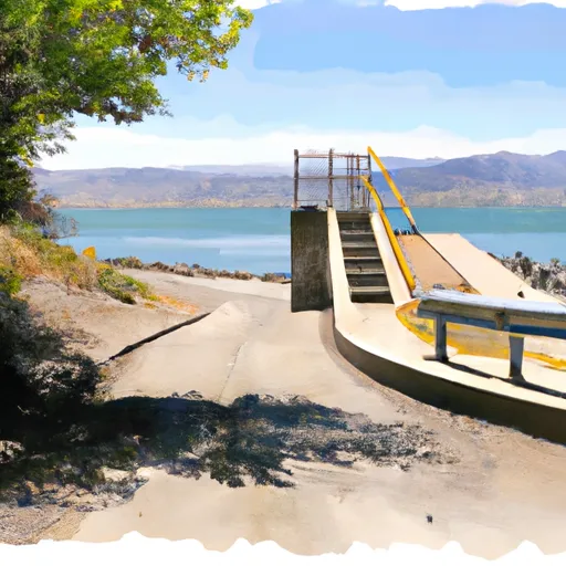
According to the latest information available, the North Fork of the American River is primarily used for recreational activities such as fishing, kayaking, and whitewater rafting. Only non-motorized watercraft are permitted on the river, so you won't see any motorboats or jet skis using this boat ramp. It's worth noting that the river can be quite challenging, with some Class IV and V rapids in certain areas. Therefore, it's recommended that only experienced boaters attempt to navigate the river, and that they do so with caution and appropriate safety gear.
Plan your launch down to the hour
Same weather feed Snoflo's iOS app uses -- updated continuously from NOAA / yr.no.
Next 5 days, hour by hour
Temperature line with weather symbols on top, snow + rain accumulation as columns, humidity as a dotted line.
5-day forecast table
Every 3 hours, broken out across temperature, snow, rain, humidity, and wind.
| Time | Condition | Temp (°F) | Snow (in) | Rain (in) | Humidity (%) | Wind (mps) | Wind dir |
|---|---|---|---|---|---|---|---|
| Loading detailed forecast… | |||||||
15-day temperature & precipitation
Daily temperatures, snow, and rain projected over the next two weeks.
Area streamflow levels
USGS streamgauges around Mosquito Ridge Rd, California -- the same readings that determine whether your launch is safe and your boat is the right craft.
| Streamgauge | Discharge | View |
|---|---|---|
| Blackwood C Nr Tahoe City Ca | 2 cfs | → |
| Ward C At Hwy 89 Nr Tahoe Pines Ca | 1 cfs | → |
| Truckee R A Tahoe City Ca | 295 cfs | → |
| Pilot C Ab Stumpy Meadows Res Ca | 3 cfs | → |
| General C Nr Meeks Bay Ca | 1 cfs | → |
| Pilot C Bl Mutton Canyon Nr Georgetown Ca | 2 cfs | → |
Plan a longer trip
The closest paddle runs, fishing spots, and other boat launches so you can extend a day on the water.
River runs
- Hell Hole Dam To Ellicotts Bridge
- Generation And Giant Gaps (Tadpole To Colfax-Iowa Hill Road)
- Royal Gorge (Soda Springs To Tadpole Creek)
- Ellicots Bridge To Big Grizzly Canyon
- Interbay To Oxbow (End Of The World)
- Tahoe City To River Ranch
Boating safety & etiquette
- Check the conditions before you launch
- Use the streamflow numbers, weather, and wind forecast on this page. High-cfs whitewater requires whitewater-specific craft and skill.
- Wear your life jacket
- Statistically the single biggest survival factor in a boating incident. State law often requires one per passenger.
- File a float plan
- Tell someone on shore your put-in, take-out, and expected return time. Especially for multi-day or remote trips.
- Yield at the ramp
- Prep gear in the parking lot, not on the ramp. Launch and clear quickly so others can use the lane.
- Clean, drain, dry
- Inspect, clean, drain and dry your boat between waters to prevent the spread of aquatic invasive species.
Set push alerts in the Snoflo app
Save Mosquito Ridge Rd, California as a favorite, set a discharge threshold or a wind/precipitation alert, and the iOS app will push the moment conditions cross.
About Mosquito Ridge Rd, California
Can I launch a motorboat here?
Most Snoflo-tracked launches support motorboats; check the operator for any horsepower restrictions, paddle-only zones, or seasonal closures.
How fresh is the streamflow data?
USGS streamgauges report continuously (every 15 minutes); the table on this page pulls the latest reading at page load.
Is there a fee?
Many federal and state boat launches charge a day-use fee. Check the operator's site before driving out.
What boat is right for these conditions?
Use the nearby streamflow numbers and river-run panel on this page to gauge current conditions. Wider, slower water is friendly for casual paddling and powerboats; high-cfs whitewater requires whitewater-specific craft and skill.
Can I get alerts when conditions change?
Yes -- alerts are managed in the Snoflo iOS app. Favorite this launch, set a threshold (discharge, wind), and you'll get a push the moment it crosses.
Other launches near here
Snoflo-tracked boat launches within driving distance of Mosquito Ridge Rd, California.