Myrtle Tree Boat Ramp Boat Launch
Community Reviews
Been here? Share the conditions.
Reviews, ratings & photos are added in the free Snoflo iOS app — rate a spot, tag the conditions, and your visit is verified by location. Add or manage your reviews from the app.
Myrtle Tree Boat Ramp
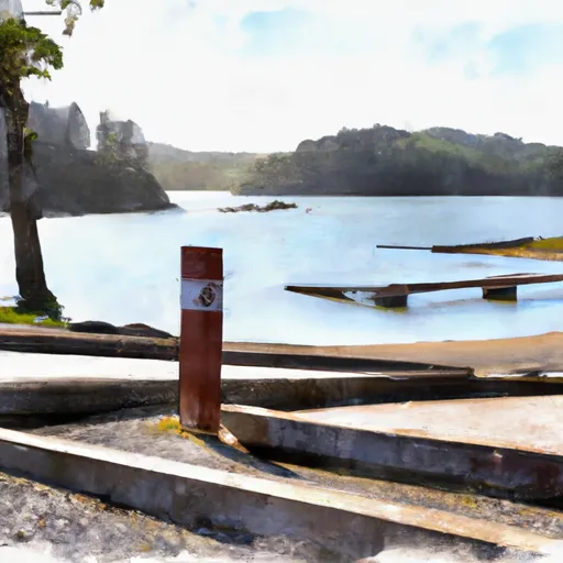
The Myrtle Tree Boat Ramp is around 20 feet wide, with a gradual slope that makes it easy for boats to launch and retrieve. The ramp is made of concrete and is suitable for small to medium-sized boats, including fishing boats, kayaks, canoes, and other recreational watercraft.
According to the most recent information available, the Myrtle Tree Boat Ramp is open and available to the public year-round. Visitors can take advantage of the free parking facilities, which include a large lot suitable for trailers and other vehicles. The boat ramp is managed by the Oregon Department of Fish and Wildlife, which regularly monitors the water quality and safety of the area.
Overall, Myrtle Tree Boat Ramp is a great place for recreational boaters and anglers who want easy access to the Tenmile Creek and surrounding waterways. Its location and facilities make it an ideal destination for families and groups looking to enjoy a day out on the water.
Plan your launch down to the hour
Same weather feed Snoflo's iOS app uses -- updated continuously from NOAA / yr.no.
Next 5 days, hour by hour
Temperature line with weather symbols on top, snow + rain accumulation as columns, humidity as a dotted line.
5-day forecast table
Every 3 hours, broken out across temperature, snow, rain, humidity, and wind.
| Time | Condition | Temp (°F) | Snow (in) | Rain (in) | Humidity (%) | Wind (mps) | Wind dir |
|---|---|---|---|---|---|---|---|
| Loading detailed forecast… | |||||||
15-day temperature & precipitation
Daily temperatures, snow, and rain projected over the next two weeks.
Area streamflow levels
USGS streamgauges around Myrtle Tree Boat Ramp -- the same readings that determine whether your launch is safe and your boat is the right craft.
| Streamgauge | Discharge | View |
|---|---|---|
| Little Wolf Creek Near Tyee | 0 cfs | → |
| Umpqua River Near Elkton | 807 cfs | → |
Plan a longer trip
The closest paddle runs, fishing spots, and other boat launches so you can extend a day on the water.
River runs
- South Fork Coos River
- Eastern Siuslaw Nf Boundary To East Section Line Of Ne1/4se1/4 Of Sec 16, T21s, R10w
- East Section Line Of Ne1/4se1/4 Of Sec 16, T21s, R10w To Confluence With Smith River
- Umpqua River
- South Fork Coquille River
- Sixes River
Other boat launches
Boating safety & etiquette
- Check the conditions before you launch
- Use the streamflow numbers, weather, and wind forecast on this page. High-cfs whitewater requires whitewater-specific craft and skill.
- Wear your life jacket
- Statistically the single biggest survival factor in a boating incident. State law often requires one per passenger.
- File a float plan
- Tell someone on shore your put-in, take-out, and expected return time. Especially for multi-day or remote trips.
- Yield at the ramp
- Prep gear in the parking lot, not on the ramp. Launch and clear quickly so others can use the lane.
- Clean, drain, dry
- Inspect, clean, drain and dry your boat between waters to prevent the spread of aquatic invasive species.
Set push alerts in the Snoflo app
Save Myrtle Tree Boat Ramp as a favorite, set a discharge threshold or a wind/precipitation alert, and the iOS app will push the moment conditions cross.
About Myrtle Tree Boat Ramp
Can I launch a motorboat here?
Most Snoflo-tracked launches support motorboats; check the operator for any horsepower restrictions, paddle-only zones, or seasonal closures.
How fresh is the streamflow data?
USGS streamgauges report continuously (every 15 minutes); the table on this page pulls the latest reading at page load.
Is there a fee?
Many federal and state boat launches charge a day-use fee. Check the operator's site before driving out.
What boat is right for these conditions?
Use the nearby streamflow numbers and river-run panel on this page to gauge current conditions. Wider, slower water is friendly for casual paddling and powerboats; high-cfs whitewater requires whitewater-specific craft and skill.
Can I get alerts when conditions change?
Yes -- alerts are managed in the Snoflo iOS app. Favorite this launch, set a threshold (discharge, wind), and you'll get a push the moment it crosses.
Other launches near here
Snoflo-tracked boat launches within driving distance of Myrtle Tree Boat Ramp.