SOUTH LAVA FLOW

Amenities Weather Recreation


CAMPING OREGON

South Lava Flow


April 28, 2024

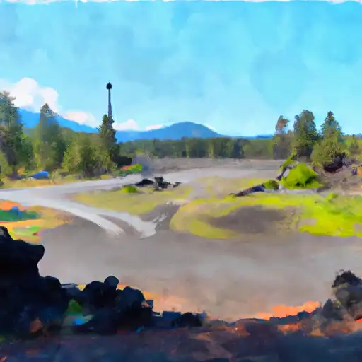
South Lava Flow camping area is located in the state of Oregon and offers several amenities for campers. The campground provides picnic tables, fire rings, and vault toilets for the convenience of visitors. However, it is important to note that there is no access to drinking water, so campers must bring their own or purify water from nearby sources. Additionally, this camping area does not have designated campsites, meaning that visitors have the freedom to choose their preferred spot within the designated camping zone.

Reservations are not accepted at South Lava Flow camping area, making it a first-come, first-served campground. Therefore, it is recommended to arrive early, especially during weekends or peak seasons, to secure a desirable camping spot. The best time of year to visit this camping area is during the summer months, from June to September, when the weather is typically drier and more suitable for camping. However, it is essential to keep an eye on weather forecasts, as sudden storms can occur and make the conditions unfavorable.

One of the main attractions of South Lava Flow camping area is the nearby Lava River Cave. This unique geological feature is a lava tube that offers an adventurous underground exploration experience. Visitors can hike through the cave and witness stunning formations, such as stalactites and stalagmites. However, it is crucial to carry appropriate gear, including flashlights or headlamps, and dress warmly as the cave remains a constant 42 degrees Fahrenheit. Additionally, campers should be cautious of wildlife encounters, such as bears and cougars, and always adhere to proper food storage guidelines.


Weather Outlook


16 Day Long Term Forecast

Seasonal Comparison


Historical Data


Fishing Destinations


Crane Prairie Reservoir

Apache Trout Atlantic Salmon Brown Trout Kelp Bass Largemouth Bass Rainbow Trout

Wickiup Reservoir

Apache Trout Atlantic Salmon Brook Trout Brown Trout Kelp Bass Largemouth Bass Rainbow Trout

Hosmer Lake

Apache Trout Atlantic Salmon Brook Trout Rainbow Trout


Area Boat Ramps

HAMLIN PARK
Mckenzie Watershed, Oregon
NORTH TWIN BOATING SITE
Upper Deschutes Watershed, Oregon
SOUTHWEST SHEVLIN HIXON DRIVE 172, BEND
Upper Deschutes Watershed, Oregon
DESCHUTES RIVER TRAIL DESCHUTES COUNTY
Upper Deschutes Watershed, Oregon
DIAMOND LAKE CAMPGROUND - M LOOP
North Umpqua Watershed, Oregon
DESCHUTES COUNTY
Upper Deschutes Watershed, Oregon
MONA CAMPGROUND
Mckenzie Watershed, Oregon
SOUTH SHORE - DIAMOND LAKE
North Umpqua Watershed, Oregon
SPARKS LAKE BOATING SITE
Upper Deschutes Watershed, Oregon
SOUTH SHORE BOATING SITE (DIAMOND LAKE)
North Umpqua Watershed, Oregon

Rafting & Kayaking

MOLALLA RIVER SEG B
Molalla-Pudding Watershed, Oregon
TIMOTHY LAKE DAM TO SLACKWATER OF HARRIET LAKE
Clackamas Watershed, Oregon
CONFLUENCE WITH UNNAMED CREEK WEST OF BRULER TO WILLAMETTE NF BOUNDARY
South Santiam Watershed, Oregon
BREITENBUSH LAKE TO CONFLUENCE WITH NORTH FORK BREITENBUSH RIVER
North Santiam Watershed, Oregon
LITTLE NORTH SANTIAM RIVER
North Santiam Watershed, Oregon
MT. JEFFERSON WILDERNESS BOUNDARY TO CONFLUENCE WITH BREITENBUSH RIVER
North Santiam Watershed, Oregon
NORTH SANTIAM RIVER
North Santiam Watershed, Oregon
HEADWATERS TO CONFLUENCE WITH UNNAMED CREEK WEST OF BRULER CREEK
South Santiam Watershed, Oregon
BATTLE AXE CREEK TO WILLAMETTE NF BOUNDARY
North Santiam Watershed, Oregon
OPAL LAKE TO CONFLUENCE WITH BATTLE AXE CREEK
North Santiam Watershed, Oregon

Log Your Visit

When was your last visit to South Lava Flow?

Add a Photo

How was it? How were conditions?

Rate the camping


Submit

Leave A Review

South Lava Flow

Submit

Upload an Image

South Lava Flow

Favorite Limit Reached