Larry Forbis Group Site Campground
Community Reviews
Been here? Share the conditions.
Reviews, ratings & photos are added in the free Snoflo iOS app — rate a spot, tag the conditions, and your visit is verified by location. Add or manage your reviews from the app.
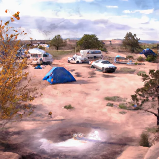
Larry Forbis Group Site
Reservations are required to secure a spot at the Larry Forbis Group Site camping area. It is recommended to make reservations well in advance, as the campground has limited availability. Campers can check the availability and make reservations through the designated reservation system.
The best time to visit this camping area is during the spring and fall seasons when the weather is mild and pleasant. Summers can be extremely hot, so it is not recommended to camp during this time. In terms of attractions, the campground is located near several hiking trails and scenic areas, allowing campers to explore the natural beauty of Arizona. However, it is essential to be cautious of wildlife, such as snakes and scorpions, and take appropriate safety measures while camping in the area.
What's on-site at Larry Forbis Group Site
Key facilities Snoflo tracks for this campground. Confirm with the operator before booking -- amenities can change seasonally.
Plan your trip down to the hour
Same weather feed Snoflo's iOS app uses -- updated continuously from NOAA / yr.no.
Next 5 days, hour by hour
Temperature line with weather symbols on top, snow + rain accumulation as columns, humidity as a dotted line.
5-day forecast table
Every 3 hours, broken out across temperature, snow, rain, humidity, and wind. Each cell is colour-coded relative to the column min/max so trends jump out at a glance.
| Time | Condition | Temp (°F) | Snow (in) | Rain (in) | Humidity (%) | Wind (mps) | Wind dir |
|---|---|---|---|---|---|---|---|
| Loading detailed forecast… | |||||||
15-day temperature & precipitation
Daily temperatures, snow, and rain projected over the next two weeks. Hover any point for the full breakdown.
Other campgrounds in the area
Snoflo-tracked campsites within driving distance of Larry Forbis Group Site, with reservations status.
| Campground | Reservations | Toilets | View |
|---|---|---|---|
| Bulldog Canyon Off-Highway Vehicle Area | ✗ | ✗ | → |
| The Rolls Ohv Area - Pobrecito Access | ✗ | ✗ | → |
| The Rolls Ohv Area - Butcher Jones Access | ✗ | ✗ | → |
| Coon Bluff | ✗ | ✓ | → |
| Coon Bluff Campground | ✗ | ✗ | → |
Nearby streamflow
USGS streamgauges within reach of Larry Forbis Group Site -- pulled live from the National Water Information System.
| Streamgauge | Discharge | View |
|---|---|---|
| Salt River Blw Stewart Mountain Dam | 445 cfs | → |
| Verde River Near Scottsdale | 105 cfs | → |
| Sycamore Creek Near Fort Mcdowell | 11 cfs | → |
| Verde River Blw Bartlett Dam | 164 cfs | → |
| Indian Bend Wash At Curry Road | · | → |
| Salt River At Priest Drive Near Phoenix | · | → |
Nearby snow depths
NRCS SNOTEL stations within reach of Larry Forbis Group Site -- relevant when planning a shoulder-season or alpine trip.
| SNOTEL station | Snowpack | 24h Snowfall | View |
|---|---|---|---|
| Fountain Hills 1.2 Nne | 0.0 in | 0.0 in | → |
| Workman Creek | 0.0 in | 0.0 in | → |
Plan a longer trip
The closest parks, lakes, boat launches, and paddle runs so a camping night can grow into a full weekend.
Parks
- Equestrian Park
- Wilderness Four Peaks
- Lost Dutchman State Park
- Falcon Hill Park
- Red Mountain District Park
- Oasis Community Park
Boat launches
- Rafter Take-Out Parking
- Saguaro - 1
- East Saguaro Del Norte Road 469, Maricopa County
- East Saguaro Del Norte Road Maricopa County
- Apache Trail Maricopa County
- Canyon Lake - 2
Fishing spots
Points of interest
- Phoenix Sign
- Kvva-Fm (Apache Junction)
- Kvit-Fm (Apache Junction)
- River Of Time Museum
- Arizona Commemorative Air Force Museum
- Marcus Landslide Loop
Paddle runs
- Lower Salt
- Boundary Of The Primary Jurisdiction Below Stewart Mountain Dam To Salt River Indian Reservation Boundary
- Salt River Indian Reservation Boundary To Immediately Above Granite Reef Dam Impoundment
- Lower Verde
- Telegraph Creek - Forest Road #4 To Confluence With Arnett Creek
- Arnett Creek - Forest Road #4 To Middle Of Sec 7,T2s, R12e
Camping essentials & Leave No Trace
- Pack it in, pack it out
- Take all trash, food scraps, and gear back with you to keep campsites clean and protect wildlife.
- Respect wildlife
- Observe animals from a distance, store food securely, and never feed wildlife to maintain natural behavior and safety.
- Know before you go
- Check weather, fire restrictions, trail conditions, and permit requirements to ensure a safe and well-planned trip.
- Minimize campfire impact
- Use established fire rings, keep fires small, fully extinguish them, or opt for a camp stove when fires are restricted.
- Leave what you find
- Preserve natural and cultural features by avoiding removal of plants, rocks, artifacts, or other elements of the environment.
Set push alerts in the Snoflo app
Save Larry Forbis Group Site as a favorite, set a custom threshold (precipitation, snowpack, freezing temperatures), and the iOS app will push the moment conditions cross.
About Larry Forbis Group Site
Can I make reservations at Larry Forbis Group Site?
Yes -- this campground accepts reservations. Snoflo recommends booking early for peak season; check the operator (Recreation.gov / state park system / private operator) for the booking window and cancellation policy.
How fresh is the weather data on this page?
The hourly forecast updates throughout the day from the NOAA / yr.no public feeds. Streamflow data is pulled live from USGS streamgauges and snowpack from the NRCS SNOTEL network.
What's the best time of year to visit?
Use the 15-day temperature & precipitation outlook on this page to plan -- pick a window with comfortable temperatures and low precipitation. For longer trips, the 5-day hourly meteogram shows snow + rain accumulation hour-by-hour.
How do I get to Larry Forbis Group Site?
Tap Directions in the hero above to open driving directions in Google Maps, or Open in map to center the Snoflo interactive map on the campground.
Can I get alerts when conditions change?
Yes -- alerts are managed through the Snoflo iOS app. Favorite this campground, set a threshold (temperature, snowpack, precipitation), and you'll get a push the moment it crosses.
Other campgrounds near here
Snoflo-tracked campgrounds within driving distance of Larry Forbis Group Site.