Agua Caliente Campground
Community Reviews
Been here? Share the conditions.
Reviews, ratings & photos are added in the free Snoflo iOS app — rate a spot, tag the conditions, and your visit is verified by location. Add or manage your reviews from the app.
Agua Caliente
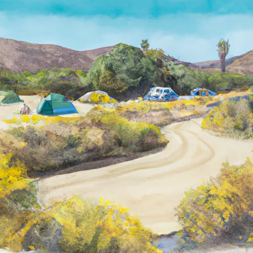
Reservations are accepted at Agua Caliente camping area, making it easy for campers to secure their spot in advance. This is particularly beneficial during peak seasons when the campground tends to be in high demand. The best time to visit Agua Caliente is during the spring and fall seasons when the weather is moderate and pleasant.
While exploring this camping area, there are several notable attractions to be aware of. The Agua Caliente County Park, adjacent to the campground, offers opportunities for hiking, horseback riding, and wildlife viewing. Visitors can also enjoy natural hot springs, which provide a relaxing and rejuvenating experience. However, caution should be exercised while swimming or soaking in these hot springs due to their high temperatures. Additionally, it is essential to stay aware of local wildlife and adhere to proper food storage guidelines to avoid any unwanted encounters.
In summary, Agua Caliente camping area in California provides campers with a comfortable and enjoyable experience. With amenities such as campsites, restrooms, and showers, it caters to the needs of outdoor enthusiasts. Reservations are accepted, and the best time to visit is during the spring and fall seasons. Visitors can explore attractions like the Agua Caliente County Park and natural hot springs, but should exercise caution around high temperatures and wildlife.
What's on-site at Agua Caliente
Key facilities Snoflo tracks for this campground. Confirm with the operator before booking -- amenities can change seasonally.
Plan your trip down to the hour
Same weather feed Snoflo's iOS app uses -- updated continuously from NOAA / yr.no.
Next 5 days, hour by hour
Temperature line with weather symbols on top, snow + rain accumulation as columns, humidity as a dotted line.
5-day forecast table
Every 3 hours, broken out across temperature, snow, rain, humidity, and wind. Each cell is colour-coded relative to the column min/max so trends jump out at a glance.
| Time | Condition | Temp (°F) | Snow (in) | Rain (in) | Humidity (%) | Wind (mps) | Wind dir |
|---|---|---|---|---|---|---|---|
| Loading detailed forecast… | |||||||
15-day temperature & precipitation
Daily temperatures, snow, and rain projected over the next two weeks. Hover any point for the full breakdown.
Other campgrounds in the area
Snoflo-tracked campsites within driving distance of Agua Caliente, with reservations status.
| Campground | Reservations | Toilets | View |
|---|---|---|---|
| Primitive Campsite | ✗ | ✗ | → |
| Bow Willow - Anza Borrego State Park | ✗ | ✓ | → |
| Horse Heaven Group Campground | ✓ | ✗ | → |
| Burntranchcg Pct | ✗ | ✗ | → |
| Burnt Rancheria Campground | ✗ | ✗ | → |
Nearby streamflow
USGS streamgauges within reach of Agua Caliente -- pulled live from the National Water Information System.
| Streamgauge | Discharge | View |
|---|---|---|
| Sweetwater R Nr Descanso Ca | · | → |
| Campo C Nr Campo Ca | · | → |
| Sweetwater R A Dehesa Ca | · | → |
| Santa Ysabel C Nr Ramona Ca | · | → |
| Los Coches C Nr Lakeside Ca | 0 cfs | → |
| Santa Maria C Nr Ramona Ca | · | → |
Nearby snow depths
NRCS SNOTEL stations within reach of Agua Caliente -- relevant when planning a shoulder-season or alpine trip.
| SNOTEL station | Snowpack | 24h Snowfall | View |
|---|---|---|---|
| El Cajon 2.8 Sse | 0.0 in | 0.0 in | → |
| El Centro 2 Ssw | 0.0 in | 0.0 in | → |
| Escondido 0.5 Sse | 0.0 in | 0.0 in | → |
Plan a longer trip
The closest parks, lakes, boat launches, and paddle runs so a camping night can grow into a full weekend.
Parks
- Sawtooth Mountains Wilderness
- Pine Valley Park
- William Heise County Park
- Fish Creek Mountains Wilderness
- Cuyamaca Rancho State Park
- Wilderness Carrizo Gorge
Fishing spots
- Cuyamaca Lake
- Lake Morena
- Barrett Lake (San Diego City)
- Barrett Lake
- El Capitan Reservoir
- Sutherland Reservoir
Points of interest
- Pictograph Trailhead
- Mortero Trailhead
- "Hollywood & Vine" Street Sign
- Well Of Eight Echos
- Mount Laguna Observatory
- Cuyamaca Rancho Park Museum And Area Headquarters
Paddle runs
- Crouch Ranch To Morena Reservoir
- Forest Boundary, Above Zoo Creek Below Spillway (S1/2, Sec 3, T11s, R2e) To La Jolla Indian Reservation Boundary (N1/2, Sec 31, T10s, R2e)
- Confluence Of Fry And Iron Spring Creeks (E1/2, Sec 3, T10s,R1e To Se1/4 Sec 16, T10s, R2e
Camping essentials & Leave No Trace
- Pack it in, pack it out
- Take all trash, food scraps, and gear back with you to keep campsites clean and protect wildlife.
- Respect wildlife
- Observe animals from a distance, store food securely, and never feed wildlife to maintain natural behavior and safety.
- Know before you go
- Check weather, fire restrictions, trail conditions, and permit requirements to ensure a safe and well-planned trip.
- Minimize campfire impact
- Use established fire rings, keep fires small, fully extinguish them, or opt for a camp stove when fires are restricted.
- Leave what you find
- Preserve natural and cultural features by avoiding removal of plants, rocks, artifacts, or other elements of the environment.
Set push alerts in the Snoflo app
Save Agua Caliente as a favorite, set a custom threshold (precipitation, snowpack, freezing temperatures), and the iOS app will push the moment conditions cross.
About Agua Caliente
Can I make reservations at Agua Caliente?
Yes -- this campground accepts reservations. Snoflo recommends booking early for peak season; check the operator (Recreation.gov / state park system / private operator) for the booking window and cancellation policy.
How fresh is the weather data on this page?
The hourly forecast updates throughout the day from the NOAA / yr.no public feeds. Streamflow data is pulled live from USGS streamgauges and snowpack from the NRCS SNOTEL network.
What's the best time of year to visit?
Use the 15-day temperature & precipitation outlook on this page to plan -- pick a window with comfortable temperatures and low precipitation. For longer trips, the 5-day hourly meteogram shows snow + rain accumulation hour-by-hour.
How do I get to Agua Caliente?
Tap Directions in the hero above to open driving directions in Google Maps, or Open in map to center the Snoflo interactive map on the campground.
Can I get alerts when conditions change?
Yes -- alerts are managed through the Snoflo iOS app. Favorite this campground, set a threshold (temperature, snowpack, precipitation), and you'll get a push the moment it crosses.
Other campgrounds near here
Snoflo-tracked campgrounds within driving distance of Agua Caliente.