Arthur W. Way County Memorial Park Campground Campground
Community Reviews
Been here? Share the conditions.
Reviews, ratings & photos are added in the free Snoflo iOS app — rate a spot, tag the conditions, and your visit is verified by location. Add or manage your reviews from the app.
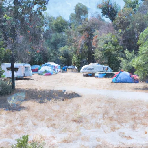
Arthur W. Way County Memorial Park Campground
Reservations are accepted at the Arthur W. Way County Memorial Park Campground, allowing campers to secure their preferred dates and campsites in advance. This ensures a stress-free experience and peace of mind during peak camping seasons. It is recommended to make reservations early, especially during weekends and holidays, as this campground tends to be popular among outdoor enthusiasts.
The best time to visit this campground is during the summer months, from June to August, when the weather is warm and conducive to outdoor activities. The campground provides easy access to the beautiful Trinity River, ideal for fishing and swimming. Additionally, visitors can explore the surrounding area's hiking trails, such as the popular Trinity River Scenic Byway, which offers breathtaking views of the Trinity Alps Wilderness. It is important to be cautious of wildlife, particularly bears, and to properly store food and garbage to avoid any unwanted encounters. Overall, the Arthur W. Way County Memorial Park Campground is a fantastic destination for a peaceful and enjoyable camping experience in the scenic California countryside.
What's on-site at Arthur W. Way County Memorial Park Campground
Key facilities Snoflo tracks for this campground. Confirm with the operator before booking -- amenities can change seasonally.
Plan your trip down to the hour
Same weather feed Snoflo's iOS app uses -- updated continuously from NOAA / yr.no.
Next 5 days, hour by hour
Temperature line with weather symbols on top, snow + rain accumulation as columns, humidity as a dotted line.
5-day forecast table
Every 3 hours, broken out across temperature, snow, rain, humidity, and wind. Each cell is colour-coded relative to the column min/max so trends jump out at a glance.
| Time | Condition | Temp (°F) | Snow (in) | Rain (in) | Humidity (%) | Wind (mps) | Wind dir |
|---|---|---|---|---|---|---|---|
| Loading detailed forecast… | |||||||
15-day temperature & precipitation
Daily temperatures, snow, and rain projected over the next two weeks. Hover any point for the full breakdown.
Other campgrounds in the area
Snoflo-tracked campsites within driving distance of Arthur W. Way County Memorial Park Campground, with reservations status.
| Campground | Reservations | Toilets | View |
|---|---|---|---|
| A.W. Way County Park | ✗ | ✗ | → |
| Cooskie Creek | ✗ | ✗ | → |
| Randall Creek | ✗ | ✗ | → |
| Camp Wolfman | ✗ | ✗ | → |
| Sea Lion Gulch | ✗ | ✗ | → |
Nearby streamflow
USGS streamgauges within reach of Arthur W. Way County Memorial Park Campground -- pulled live from the National Water Information System.
| Streamgauge | Discharge | View |
|---|---|---|
| Mattole R Nr Petrolia Ca | 29 cfs | → |
| Bull C Nr Weott Ca | 1 cfs | → |
| Mattole R Nr Ettersburg Ca | 11 cfs | → |
| Eel R A Scotia Ca | 208 cfs | → |
| Van Duzen R Nr Bridgeville Ca | 11 cfs | → |
| Sf Eel R Nr Miranda Ca | 37 cfs | → |
Plan a longer trip
The closest parks, lakes, boat launches, and paddle runs so a camping night can grow into a full weekend.
Parks
- Grizzly Creek Redwoods State Park
- John B. Dewitt Redwoods State Reserve
- Eel River Wildlife Area
- Owl Creek Ecological Reserve
- Humboldt Redwoods State Park
- King Range National Conservation Area
Points of interest
- George C. Lindley Memorial Bridge
- Punta Gorda Light House
- Tolkan Mtb Terrain Park
- Dyerville Giant
- Founders Tree
- Giant Trees
Paddle runs
- From Headwaters In Sec. 21, T3s, R1w, Hm To To Private Land Boundary In The Nw 1/4 Of Se. 8, T3s, R1w, Hm
- Headwaters In Sec. 27., T2s, R2w, Hm To To Its Junction With The Mattole River
- From Its Headwaters In Sec. 21, T2s, R2w, Hm To To Its Junction With The Mattole River
- From Its Headwaters In Sec. 13, T3s, R2w, Hm To To The Pacific Ocean
- Mattole River
- From Private Land Boundary Between Sec. 8 And 17, T2s, R2w, Hm To To The Pacific Ocean
Camping essentials & Leave No Trace
- Pack it in, pack it out
- Take all trash, food scraps, and gear back with you to keep campsites clean and protect wildlife.
- Respect wildlife
- Observe animals from a distance, store food securely, and never feed wildlife to maintain natural behavior and safety.
- Know before you go
- Check weather, fire restrictions, trail conditions, and permit requirements to ensure a safe and well-planned trip.
- Minimize campfire impact
- Use established fire rings, keep fires small, fully extinguish them, or opt for a camp stove when fires are restricted.
- Leave what you find
- Preserve natural and cultural features by avoiding removal of plants, rocks, artifacts, or other elements of the environment.
Set push alerts in the Snoflo app
Save Arthur W. Way County Memorial Park Campground as a favorite, set a custom threshold (precipitation, snowpack, freezing temperatures), and the iOS app will push the moment conditions cross.
About Arthur W. Way County Memorial Park Campground
Can I make reservations at Arthur W. Way County Memorial Park Campground?
This campground does not appear to accept reservations -- it's typically first-come, first-served. Arrive early on summer weekends.
How fresh is the weather data on this page?
The hourly forecast updates throughout the day from the NOAA / yr.no public feeds. Streamflow data is pulled live from USGS streamgauges and snowpack from the NRCS SNOTEL network.
What's the best time of year to visit?
Use the 15-day temperature & precipitation outlook on this page to plan -- pick a window with comfortable temperatures and low precipitation. For longer trips, the 5-day hourly meteogram shows snow + rain accumulation hour-by-hour.
How do I get to Arthur W. Way County Memorial Park Campground?
Tap Directions in the hero above to open driving directions in Google Maps, or Open in map to center the Snoflo interactive map on the campground.
Can I get alerts when conditions change?
Yes -- alerts are managed through the Snoflo iOS app. Favorite this campground, set a threshold (temperature, snowpack, precipitation), and you'll get a push the moment it crosses.
Other campgrounds near here
Snoflo-tracked campgrounds within driving distance of Arthur W. Way County Memorial Park Campground.