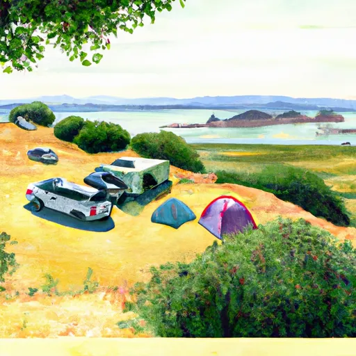
East Bay Sites Campground
Community Reviews
Been here? Share the conditions.
Reviews, ratings & photos are added in the free Snoflo iOS app — rate a spot, tag the conditions, and your visit is verified by location. Add or manage your reviews from the app.
East Bay Sites
What's on-site at East Bay Sites
Key facilities Snoflo tracks for this campground. Confirm with the operator before booking -- amenities can change seasonally.
Plan your trip down to the hour
Same weather feed Snoflo's iOS app uses -- updated continuously from NOAA / yr.no.
Next 5 days, hour by hour
Temperature line with weather symbols on top, snow + rain accumulation as columns, humidity as a dotted line.
5-day forecast table
Every 3 hours, broken out across temperature, snow, rain, humidity, and wind. Each cell is colour-coded relative to the column min/max so trends jump out at a glance.
| Time | Condition | Temp (°F) | Snow (in) | Rain (in) | Humidity (%) | Wind (mps) | Wind dir |
|---|---|---|---|---|---|---|---|
| Loading detailed forecast… | |||||||
15-day temperature & precipitation
Daily temperatures, snow, and rain projected over the next two weeks. Hover any point for the full breakdown.
Other campgrounds in the area
Snoflo-tracked campsites within driving distance of East Bay Sites, with reservations status.
| Campground | Reservations | Toilets | View |
|---|---|---|---|
| Sunrise Sites - Pre Booking Required | ✗ | ✗ | → |
| Kayak Group Camp - Pre Booking Required | ✗ | ✗ | → |
| Kayak Group Camp | ✗ | ✗ | → |
| Site 10 - Pre Booking Required | ✗ | ✗ | → |
| Site 10 | ✗ | ✗ | → |
Nearby streamflow
USGS streamgauges within reach of East Bay Sites -- pulled live from the National Water Information System.
| Streamgauge | Discharge | View |
|---|---|---|
| Redwood C A Hwy 1 Bridge A Muir Beach Ca | 0 cfs | → |
| Corte Madera C A Ross Ca | 0 cfs | → |
| Novato C A Novato Ca | 1 cfs | → |
| San Lorenzo C A San Lorenzo Ca | 2 cfs | → |
| Lagunitas C A Sp Taylor State Pk Ca | 9 cfs | → |
| Cull C Ab Cull C Res Nr Castro Valley Ca | · | → |
Nearby snow depths
NRCS SNOTEL stations within reach of East Bay Sites -- relevant when planning a shoulder-season or alpine trip.
| SNOTEL station | Snowpack | 24h Snowfall | View |
|---|---|---|---|
| Half Moon Bay 0.5 Ssw | 0.0 in | 0.0 in | → |
Plan a longer trip
The closest parks, lakes, boat launches, and paddle runs so a camping night can grow into a full weekend.
Parks
- Angel Island State Park
- Paradise Beach Park
- Alcatraz Island
- Gabrielson Park
- Yee Tock Chee Park
- Tiffany Park
Boat launches
- Angel Island State Park - Ayala Cove
- Turney Street Boat Ramp
- Presidio Yacht Club
- Northpoint Drive 1235, San Francisco
- Clipper Yacht Harbor
- Pan American Esplanade San Francisco
Fishing spots
- Berkeley Yacht Harbor
- Lake Temescal
- Lake Lagunitas
- San Pablo Reservoir
- Lafayette Reservoir
- City Of Benicia Fishing Pier
Points of interest
- Angel Island Immigration Station
- Fort Mcdowell (East Garrison)
- Sf-91l Nike Missile Launch Site
- Battery Drew
- Dining Hall
- Building 64
Paddle runs
- Headwaters To Mouth
- Headwaters To Ends One Quarter Mile South Of Bear Valley Road Bridge Segment 1: Ends 1/4 Mile South Of Bear Valley Road Bridge Segment 2: Caltrans Corporation Yard At Point Reyes Staton.
- Olema Ranch Campground To Caltrans Corporation Yard At Point Reyes Station
Camping essentials & Leave No Trace
- Pack it in, pack it out
- Take all trash, food scraps, and gear back with you to keep campsites clean and protect wildlife.
- Respect wildlife
- Observe animals from a distance, store food securely, and never feed wildlife to maintain natural behavior and safety.
- Know before you go
- Check weather, fire restrictions, trail conditions, and permit requirements to ensure a safe and well-planned trip.
- Minimize campfire impact
- Use established fire rings, keep fires small, fully extinguish them, or opt for a camp stove when fires are restricted.
- Leave what you find
- Preserve natural and cultural features by avoiding removal of plants, rocks, artifacts, or other elements of the environment.
Set push alerts in the Snoflo app
Save East Bay Sites as a favorite, set a custom threshold (precipitation, snowpack, freezing temperatures), and the iOS app will push the moment conditions cross.
About East Bay Sites
Can I make reservations at East Bay Sites?
This campground does not appear to accept reservations -- it's typically first-come, first-served. Arrive early on summer weekends.
How fresh is the weather data on this page?
The hourly forecast updates throughout the day from the NOAA / yr.no public feeds. Streamflow data is pulled live from USGS streamgauges and snowpack from the NRCS SNOTEL network.
What's the best time of year to visit?
Use the 15-day temperature & precipitation outlook on this page to plan -- pick a window with comfortable temperatures and low precipitation. For longer trips, the 5-day hourly meteogram shows snow + rain accumulation hour-by-hour.
How do I get to East Bay Sites?
Tap Directions in the hero above to open driving directions in Google Maps, or Open in map to center the Snoflo interactive map on the campground.
Can I get alerts when conditions change?
Yes -- alerts are managed through the Snoflo iOS app. Favorite this campground, set a threshold (temperature, snowpack, precipitation), and you'll get a push the moment it crosses.
Other campgrounds near here
Snoflo-tracked campgrounds within driving distance of East Bay Sites.