Lower Pines Campground
Community Reviews
Been here? Share the conditions.
Reviews, ratings & photos are added in the free Snoflo iOS app — rate a spot, tag the conditions, and your visit is verified by location. Add or manage your reviews from the app.
Lower Pines
There are plenty of nearby points of interest to explore, including the Yosemite Valley floor, where visitors can hike, bike, and rock climb. Glacier Point, a popular spot for taking in the park's panoramic views, is just a short drive away. Visitors can also enjoy swimming, fishing, and rafting in the Merced River.
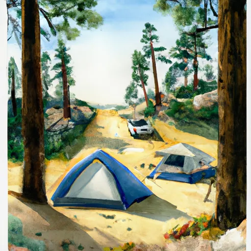
The Lower Pines camping area is equipped with 60 campsites, including 35 tent-only sites and 25 sites for RVs. Amenities include flush toilets, picnic tables, fire rings, and a food storage locker. The campground is open from April to October, and reservations are highly recommended as this area is very popular.
Interesting facts about the area include the fact that it was originally inhabited by the Ahwahneechee tribe, and later by European settlers who used it for logging and mining. Yosemite National Park was established in 1890, and has since become one of the most visited national parks in the country.
The best time of year to visit Lower Pines camping area is in the late spring or early fall, when temperatures are comfortable and crowds are smaller. Average temperatures in May are in the mid-60s during the day and mid-30s at night, while average temperatures in September are in the mid-70s during the day and mid-40s at night. Visitors should be prepared for sudden changes in weather, as temperatures can drop below freezing at night, even in the summer months.
Come visit Lower Pines camping area and experience the beauty and tranquility of Yosemite National Park.
What's on-site at Lower Pines
Key facilities Snoflo tracks for this campground. Confirm with the operator before booking -- amenities can change seasonally.
Plan your trip down to the hour
Same weather feed Snoflo's iOS app uses -- updated continuously from NOAA / yr.no.
Next 5 days, hour by hour
Temperature line with weather symbols on top, snow + rain accumulation as columns, humidity as a dotted line.
5-day forecast table
Every 3 hours, broken out across temperature, snow, rain, humidity, and wind. Each cell is colour-coded relative to the column min/max so trends jump out at a glance.
| Time | Condition | Temp (°F) | Snow (in) | Rain (in) | Humidity (%) | Wind (mps) | Wind dir |
|---|---|---|---|---|---|---|---|
| Loading detailed forecast… | |||||||
15-day temperature & precipitation
Daily temperatures, snow, and rain projected over the next two weeks. Hover any point for the full breakdown.
Other campgrounds in the area
Snoflo-tracked campsites within driving distance of Lower Pines, with reservations status.
| Campground | Reservations | Toilets | View |
|---|---|---|---|
| North Pines | ✗ | ✗ | → |
| Upper Pines | ✗ | ✗ | → |
| North Pines - Yosemite National Park | ✓ | ✓ | → |
| Lower Pines - Yosemite National Park | ✓ | ✓ | → |
| Upper Pines - Yosemite National Park | ✓ | ✓ | → |
Nearby streamflow
USGS streamgauges within reach of Lower Pines -- pulled live from the National Water Information System.
| Streamgauge | Discharge | View |
|---|---|---|
| Merced R A Happy Isles Bridge Nr Yosemite Ca | 110 cfs | → |
| Merced R A Pohono Bridge Nr Yosemite Ca | 143 cfs | → |
| Tuolumne R A Grand Cyn Of Tuolumne Ab Hetch Hetchy | 144 cfs | → |
| Tuolumne R Nr Hetch Hetchy Ca | 114 cfs | → |
| Big C Div Nr Fish Camp Ca | 0 cfs | → |
| Tuolumne R Ab Early Intake Nr Mather Ca | 119 cfs | → |
Nearby snow depths
NRCS SNOTEL stations within reach of Lower Pines -- relevant when planning a shoulder-season or alpine trip.
| SNOTEL station | Snowpack | 24h Snowfall | View |
|---|---|---|---|
| Tenaya Lake | 0.2 in | 0.0 in | → |
| Nohrsc White Wolf Raws | 0.5 in | 0.0 in | → |
| Nohrsc Tuolumne Meadows | 124.3 in | 0.0 in | → |
| Nohrsc Tioga Pass-Dana Meadows | 30.4 in | 0.0 in | → |
| Nohrsc Green Mtn | 6.5 in | 0.0 in | → |
| Nohrsc Paradise Meadow | 0.0 in | 0.0 in | → |
Plan a longer trip
The closest parks, lakes, boat launches, and paddle runs so a camping night can grow into a full weekend.
Parks
- Yosemite National Park
- Stanislaus National Forest
- Hoover Wilderness
- Wilderness Emigrant
- Mono Lake Tufa State Reserve
- Devils Postpile National Monument
Fishing spots
Points of interest
- Yosemite Conservation Heritage Center
- Nature Center At Happy Isles
- Glacier Point
- Glacier Point Geology Exhibit
- Sierra Point
- Union Point
Paddle runs
- Headwaters Near The Tuolumne And Mariposa County Lines To Western Boundary Of Yosemite National Park
- Headwaters In Sec 8, T3s, R25 E To Hemlock Crossing
- Hemlock Crossing To Confluence With Cora Creek
- Headwaters Tributaries To Research Natural Area Boundary
- Saddlebag Lake Rna Boundary To State Highway 120
Camping essentials & Leave No Trace
- Pack it in, pack it out
- Take all trash, food scraps, and gear back with you to keep campsites clean and protect wildlife.
- Respect wildlife
- Observe animals from a distance, store food securely, and never feed wildlife to maintain natural behavior and safety.
- Know before you go
- Check weather, fire restrictions, trail conditions, and permit requirements to ensure a safe and well-planned trip.
- Minimize campfire impact
- Use established fire rings, keep fires small, fully extinguish them, or opt for a camp stove when fires are restricted.
- Leave what you find
- Preserve natural and cultural features by avoiding removal of plants, rocks, artifacts, or other elements of the environment.
Set push alerts in the Snoflo app
Save Lower Pines as a favorite, set a custom threshold (precipitation, snowpack, freezing temperatures), and the iOS app will push the moment conditions cross.
About Lower Pines
Can I make reservations at Lower Pines?
This campground does not appear to accept reservations -- it's typically first-come, first-served. Arrive early on summer weekends.
How fresh is the weather data on this page?
The hourly forecast updates throughout the day from the NOAA / yr.no public feeds. Streamflow data is pulled live from USGS streamgauges and snowpack from the NRCS SNOTEL network.
What's the best time of year to visit?
Use the 15-day temperature & precipitation outlook on this page to plan -- pick a window with comfortable temperatures and low precipitation. For longer trips, the 5-day hourly meteogram shows snow + rain accumulation hour-by-hour.
How do I get to Lower Pines?
Tap Directions in the hero above to open driving directions in Google Maps, or Open in map to center the Snoflo interactive map on the campground.
Can I get alerts when conditions change?
Yes -- alerts are managed through the Snoflo iOS app. Favorite this campground, set a threshold (temperature, snowpack, precipitation), and you'll get a push the moment it crosses.
Other campgrounds near here
Snoflo-tracked campgrounds within driving distance of Lower Pines.