Southwest Walk-In Campground Campground
Community Reviews
Been here? Share the conditions.
Reviews, ratings & photos are added in the free Snoflo iOS app — rate a spot, tag the conditions, and your visit is verified by location. Add or manage your reviews from the app.
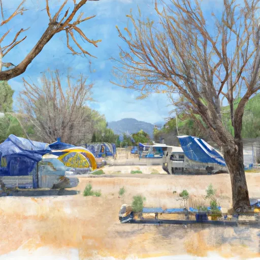
Southwest Walk-In Campground
Surrounding Views:
The campground is nestled among towering rock formations and has views of the park’s famous High Peaks. Visitors can also enjoy views of wildlife such as California condors and bats that can be spotted flying overhead at dusk.
Nearby Points of Interest:
The campground is located near several hiking trails, including the Bear Gulch Trail and the Balconies Trail. The park’s Visitor Center is only a short drive away and offers educational exhibits on the park’s history and wildlife.
Campground Amenities:
The Southwest Walk-In Campground offers basic amenities such as restrooms, potable water, picnic tables, and fire pits. There are no RV hookups or showers available.
Interesting Facts:
Pinnacles National Park is home to a unique type of volcanic rock formation known as talus caves. Visitors can explore these caves on guided tours led by park rangers.
Best Time of Year to Visit:
The best time of year to visit the Southwest Walk-In Campground is from September to November and from March to May. During these months, the weather is mild with average temperatures ranging from the 50s to the 70s. Summer months can be very hot with temperatures reaching over 100 degrees Fahrenheit. Winter months can be rainy and cold, with average temperatures in the 40s.
Sources:
- National Park Service. “Southwest Walk-In Campground.” Pinnacles National Park, U.S. Department of the Interior, 2021, www.nps.gov/pinn/planyourvisit/camping.htm.
- “Pinnacles National Park.” National Park Foundation, 2021, www.nationalparks.org/explore-parks/pinnacles-national-park.
What's on-site at Southwest Walk-In Campground
Key facilities Snoflo tracks for this campground. Confirm with the operator before booking -- amenities can change seasonally.
Plan your trip down to the hour
Same weather feed Snoflo's iOS app uses -- updated continuously from NOAA / yr.no.
Next 5 days, hour by hour
Temperature line with weather symbols on top, snow + rain accumulation as columns, humidity as a dotted line.
5-day forecast table
Every 3 hours, broken out across temperature, snow, rain, humidity, and wind. Each cell is colour-coded relative to the column min/max so trends jump out at a glance.
| Time | Condition | Temp (°F) | Snow (in) | Rain (in) | Humidity (%) | Wind (mps) | Wind dir |
|---|---|---|---|---|---|---|---|
| Loading detailed forecast… | |||||||
15-day temperature & precipitation
Daily temperatures, snow, and rain projected over the next two weeks. Hover any point for the full breakdown.
Other campgrounds in the area
Snoflo-tracked campsites within driving distance of Southwest Walk-In Campground, with reservations status.
| Campground | Reservations | Toilets | View |
|---|---|---|---|
| Southwest Campground | ✗ | ✗ | → |
| Southwest - Lassen Volcanic National Park | ✗ | ✗ | → |
| Manzanita Lake Campground | ✗ | ✗ | → |
| Manzanita Lake - Lassen Volcanic National Park | ✓ | ✓ | → |
| Summit Lake South Campground | ✗ | ✗ | → |
Nearby streamflow
USGS streamgauges within reach of Southwest Walk-In Campground -- pulled live from the National Water Information System.
| Streamgauge | Discharge | View |
|---|---|---|
| Hat C Nr Hat Creek Ca | 123 cfs | → |
| Battle C Bl Coleman Fish Hatchery Nr Cottonwood Ca | 245 cfs | → |
| Sacramento R Ab Bend Bridge Nr Red Bluff Ca | 13,300 cfs | → |
| Deer C Nr Vina Ca | 99 cfs | → |
| Mill C Nr Los Molinos Ca | 136 cfs | → |
| Cow C Nr Millville Ca | 34 cfs | → |
Nearby snow depths
NRCS SNOTEL stations within reach of Southwest Walk-In Campground -- relevant when planning a shoulder-season or alpine trip.
| SNOTEL station | Snowpack | 24h Snowfall | View |
|---|---|---|---|
| Nohrsc Harkness Flat Near Chester 8nnw | 212.0 in | 0.0 in | → |
| Blacks Mountain #1 | 0.0 in | 0.0 in | → |
| Mission Ridge Snow Pillow | 0.0 in | 0.0 in | → |
| Susanville 3.2 Ssw | 0.0 in | 0.0 in | → |
Plan a longer trip
The closest parks, lakes, boat launches, and paddle runs so a camping night can grow into a full weekend.
Parks
- Lassen Volcanic National Park
- Wilderness Lassen Volcanic
- Wilderness Caribou
- Chester Park
- Wilderness Thousand Lakes
- Cedar Drive
Boat launches
- Mccumber Reservoir
- Butte Lake Campground
- Northshore Campground
- North Of Plattville
- Knotty Pine Resort & Marina
- Big Cove Resort
Fishing spots
Points of interest
- Kohm Yah-Mah-Nee Visitor Center
- Windy Point
- Diamond Point
- Sulphur Works
- Little Hot Springs Overlook
- Bumpass Hell Trail Viewpoint
Paddle runs
- Lassen Np Boundary To Just Below Highway 36 Crossing
- Just Below Highway 36 Crossing To One-Half Mile Downstream From Hole-In-The-Ground
- South Fork Battle Creek
- One-Half Mile Downstream From Hole-In-The-Ground To Sec Line Between 29/20 T28n, R3e, Below Big Bend
- Elam Creek Campground To Deer Creek-Highway 32 Junction
- Deer Creek-Highway 32 Junction To Sec 26, T27n, R3e, West Of Deer Creek Crossing
Camping essentials & Leave No Trace
- Pack it in, pack it out
- Take all trash, food scraps, and gear back with you to keep campsites clean and protect wildlife.
- Respect wildlife
- Observe animals from a distance, store food securely, and never feed wildlife to maintain natural behavior and safety.
- Know before you go
- Check weather, fire restrictions, trail conditions, and permit requirements to ensure a safe and well-planned trip.
- Minimize campfire impact
- Use established fire rings, keep fires small, fully extinguish them, or opt for a camp stove when fires are restricted.
- Leave what you find
- Preserve natural and cultural features by avoiding removal of plants, rocks, artifacts, or other elements of the environment.
Set push alerts in the Snoflo app
Save Southwest Walk-In Campground as a favorite, set a custom threshold (precipitation, snowpack, freezing temperatures), and the iOS app will push the moment conditions cross.
About Southwest Walk-In Campground
Can I make reservations at Southwest Walk-In Campground?
This campground does not appear to accept reservations -- it's typically first-come, first-served. Arrive early on summer weekends.
How fresh is the weather data on this page?
The hourly forecast updates throughout the day from the NOAA / yr.no public feeds. Streamflow data is pulled live from USGS streamgauges and snowpack from the NRCS SNOTEL network.
What's the best time of year to visit?
Use the 15-day temperature & precipitation outlook on this page to plan -- pick a window with comfortable temperatures and low precipitation. For longer trips, the 5-day hourly meteogram shows snow + rain accumulation hour-by-hour.
How do I get to Southwest Walk-In Campground?
Tap Directions in the hero above to open driving directions in Google Maps, or Open in map to center the Snoflo interactive map on the campground.
Can I get alerts when conditions change?
Yes -- alerts are managed through the Snoflo iOS app. Favorite this campground, set a threshold (temperature, snowpack, precipitation), and you'll get a push the moment it crosses.
Other campgrounds near here
Snoflo-tracked campgrounds within driving distance of Southwest Walk-In Campground.