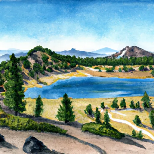
Summit Lake (North And South) - Lassen Volcanic National Park Campground
Community Reviews
Been here? Share the conditions.
Reviews, ratings & photos are added in the free Snoflo iOS app — rate a spot, tag the conditions, and your visit is verified by location. Add or manage your reviews from the app.
Summit Lake (North And South) - Lassen Volcanic National Park
The campground provides various amenities to ensure a comfortable stay. Campers can avail themselves of picnic tables, fire rings, and restrooms with flush toilets. However, it is important to note that there are no hookups for RVs and no showers available.
Reservations are accepted at Summit Lake campground, which can be made through the National Recreation Reservation Service website or by calling their toll-free number. Due to its popularity, it is recommended to make reservations well in advance, especially during peak seasons.
The best time to visit Summit Lake is during the summer months, from June to September, when the weather is mild and the area is easily accessible. However, it is essential to check the current conditions and weather forecasts before planning a trip, as the campground's availability may be affected by snowfall in early summer or late fall.
While camping at Summit Lake, visitors can explore the nearby trails, including the popular Cinder Cone hike, which provides panoramic views of the surrounding volcanic landscape. Additionally, caution should be exercised while camping near the lake, as the water can be cold, and swimming may not be suitable for everyone due to the lake's depth and potential underwater hazards. Overall, Summit Lake offers a unique and memorable camping experience in the heart of Lassen Volcanic National Park.
What's on-site at Summit Lake (North And South) - Lassen Volcanic National Park
Key facilities Snoflo tracks for this campground. Confirm with the operator before booking -- amenities can change seasonally.
Plan your trip down to the hour
Same weather feed Snoflo's iOS app uses -- updated continuously from NOAA / yr.no.
Next 5 days, hour by hour
Temperature line with weather symbols on top, snow + rain accumulation as columns, humidity as a dotted line.
5-day forecast table
Every 3 hours, broken out across temperature, snow, rain, humidity, and wind. Each cell is colour-coded relative to the column min/max so trends jump out at a glance.
| Time | Condition | Temp (°F) | Snow (in) | Rain (in) | Humidity (%) | Wind (mps) | Wind dir |
|---|---|---|---|---|---|---|---|
| Loading detailed forecast… | |||||||
15-day temperature & precipitation
Daily temperatures, snow, and rain projected over the next two weeks. Hover any point for the full breakdown.
Other campgrounds in the area
Snoflo-tracked campsites within driving distance of Summit Lake (North And South) - Lassen Volcanic National Park, with reservations status.
| Campground | Reservations | Toilets | View |
|---|---|---|---|
| Summit Lake North Campground | ✗ | ✗ | → |
| Summit Lake North | ✗ | ✗ | → |
| Summit Lake South Campground | ✗ | ✗ | → |
| Summit Lake South | ✗ | ✗ | → |
| Warner Valley Campground | ✗ | ✗ | → |
Nearby streamflow
USGS streamgauges within reach of Summit Lake (North And South) - Lassen Volcanic National Park -- pulled live from the National Water Information System.
| Streamgauge | Discharge | View |
|---|---|---|
| Hat C Nr Hat Creek Ca | 123 cfs | → |
| Pit R Bl Pit No 1 Ph Nr Fall River Mills Ca | 1,200 cfs | → |
| Burney C A Burney Falls Nr Burney Ca | 168 cfs | → |
| Battle C Bl Coleman Fish Hatchery Nr Cottonwood Ca | 245 cfs | → |
| Spanish C Ab Blackhawk C At Keddie Ca | 28 cfs | → |
| Cow C Nr Millville Ca | 34 cfs | → |
Nearby snow depths
NRCS SNOTEL stations within reach of Summit Lake (North And South) - Lassen Volcanic National Park -- relevant when planning a shoulder-season or alpine trip.
| SNOTEL station | Snowpack | 24h Snowfall | View |
|---|---|---|---|
| Nohrsc Harkness Flat Near Chester 8nnw | 212.0 in | 0.0 in | → |
| Blacks Mountain #1 | 0.0 in | 0.0 in | → |
| Susanville 3.2 Ssw | 0.0 in | 0.0 in | → |
| Mission Ridge Snow Pillow | 0.0 in | 0.0 in | → |
Plan a longer trip
The closest parks, lakes, boat launches, and paddle runs so a camping night can grow into a full weekend.
Parks
- Lassen Volcanic National Park
- Wilderness Lassen Volcanic
- Wilderness Caribou
- Wilderness Thousand Lakes
- Chester Park
- Cedar Drive
Boat launches
- Butte Lake Campground
- Mccumber Reservoir
- Northshore Campground
- Knotty Pine Resort & Marina
- Crate Lake
- Almanor Lakeside Resort
Fishing spots
Points of interest
- Devastated Area
- Devil's Kitchen
- Almanor Overlook
- Grand View
- Road Summit 8,511 Ft
- Boiling Springs Lake
Paddle runs
- Lassen Np Boundary To Just Below Highway 36 Crossing
- Just Below Highway 36 Crossing To One-Half Mile Downstream From Hole-In-The-Ground
- One-Half Mile Downstream From Hole-In-The-Ground To Sec Line Between 29/20 T28n, R3e, Below Big Bend
- South Fork Battle Creek
- Elam Creek Campground To Deer Creek-Highway 32 Junction
- Deer Creek-Highway 32 Junction To Sec 26, T27n, R3e, West Of Deer Creek Crossing
Camping essentials & Leave No Trace
- Pack it in, pack it out
- Take all trash, food scraps, and gear back with you to keep campsites clean and protect wildlife.
- Respect wildlife
- Observe animals from a distance, store food securely, and never feed wildlife to maintain natural behavior and safety.
- Know before you go
- Check weather, fire restrictions, trail conditions, and permit requirements to ensure a safe and well-planned trip.
- Minimize campfire impact
- Use established fire rings, keep fires small, fully extinguish them, or opt for a camp stove when fires are restricted.
- Leave what you find
- Preserve natural and cultural features by avoiding removal of plants, rocks, artifacts, or other elements of the environment.
Set push alerts in the Snoflo app
Save Summit Lake (North And South) - Lassen Volcanic National Park as a favorite, set a custom threshold (precipitation, snowpack, freezing temperatures), and the iOS app will push the moment conditions cross.
About Summit Lake (North And South) - Lassen Volcanic National Park
Can I make reservations at Summit Lake (North And South) - Lassen Volcanic National Park?
Yes -- this campground accepts reservations. Snoflo recommends booking early for peak season; check the operator (Recreation.gov / state park system / private operator) for the booking window and cancellation policy.
How fresh is the weather data on this page?
The hourly forecast updates throughout the day from the NOAA / yr.no public feeds. Streamflow data is pulled live from USGS streamgauges and snowpack from the NRCS SNOTEL network.
What's the best time of year to visit?
Use the 15-day temperature & precipitation outlook on this page to plan -- pick a window with comfortable temperatures and low precipitation. For longer trips, the 5-day hourly meteogram shows snow + rain accumulation hour-by-hour.
How do I get to Summit Lake (North And South) - Lassen Volcanic National Park?
Tap Directions in the hero above to open driving directions in Google Maps, or Open in map to center the Snoflo interactive map on the campground.
Can I get alerts when conditions change?
Yes -- alerts are managed through the Snoflo iOS app. Favorite this campground, set a threshold (temperature, snowpack, precipitation), and you'll get a push the moment it crosses.
Other campgrounds near here
Snoflo-tracked campgrounds within driving distance of Summit Lake (North And South) - Lassen Volcanic National Park.