Teepee Point Campground
Community Reviews
Been here? Share the conditions.
Reviews, ratings & photos are added in the free Snoflo iOS app — rate a spot, tag the conditions, and your visit is verified by location. Add or manage your reviews from the app.
Teepee Point
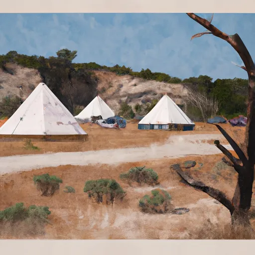
The campground has 11 campsites, each of which can accommodate up to eight people. Amenities at Teepee Point Camping Area include picnic tables, fire rings, and vault toilets. There is no potable water available at the campground, so visitors must bring their own.
Campsites are available on a first-come, first-served basis, making it ideal for those who prefer to be spontaneous. A quirky fact about the area is that Lake Almanor was created in 1914 when a dam was built across the North Fork of the Feather River.
The best time to visit Teepee Point Camping Area is during the summer months, from June to September, when the average temperature is around 80 degrees Fahrenheit during the day and drops to around 50 degrees Fahrenheit at night. However, visitors should note that the campground may be closed during the offseason. Overall, Teepee Point Camping Area is a great spot for those seeking a peaceful and scenic camping experience in northern California.
What's on-site at Teepee Point
Key facilities Snoflo tracks for this campground. Confirm with the operator before booking -- amenities can change seasonally.
Plan your trip down to the hour
Same weather feed Snoflo's iOS app uses -- updated continuously from NOAA / yr.no.
Next 5 days, hour by hour
Temperature line with weather symbols on top, snow + rain accumulation as columns, humidity as a dotted line.
5-day forecast table
Every 3 hours, broken out across temperature, snow, rain, humidity, and wind. Each cell is colour-coded relative to the column min/max so trends jump out at a glance.
| Time | Condition | Temp (°F) | Snow (in) | Rain (in) | Humidity (%) | Wind (mps) | Wind dir |
|---|---|---|---|---|---|---|---|
| Loading detailed forecast… | |||||||
15-day temperature & precipitation
Daily temperatures, snow, and rain projected over the next two weeks. Hover any point for the full breakdown.
Other campgrounds in the area
Snoflo-tracked campsites within driving distance of Teepee Point, with reservations status.
| Campground | Reservations | Toilets | View |
|---|---|---|---|
| Wilderness Outpost Camp | ✗ | ✗ | → |
| Frontier Adventure | ✗ | ✗ | → |
| Cowboy Camp | ✗ | ✗ | → |
| Pipi Campground | ✓ | ✗ | → |
| Pipi | ✓ | ✓ | → |
Nearby streamflow
USGS streamgauges within reach of Teepee Point -- pulled live from the National Water Information System.
| Streamgauge | Discharge | View |
|---|---|---|
| Pilot C Ab Stumpy Meadows Res Ca | 3 cfs | → |
| Pilot C Bl Mutton Canyon Nr Georgetown Ca | 2 cfs | → |
| Deer C Nr Cameron Park Ca | 8 cfs | → |
| Cosumnes R A Michigan Bar Ca | 50 cfs | → |
| Upper Truckee R At S Upper Truckee Rd Nr Meyers Ca | 4 cfs | → |
| Upper Truckee R At Hwy 50 Above Meyers Ca | 11 cfs | → |
Nearby snow depths
NRCS SNOTEL stations within reach of Teepee Point -- relevant when planning a shoulder-season or alpine trip.
| SNOTEL station | Snowpack | 24h Snowfall | View |
|---|---|---|---|
| Alpha | 0.0 in | 0.0 in | → |
| Nohrsc Forni Ridge | 1.2 in | 0.0 in | → |
| Nohrsc Silver Lake (Goes) | 33.4 in | 0.0 in | → |
| Black Springs | 0.0 in | 0.0 in | → |
| Bloods Creek | 0.2 in | 0.0 in | → |
| Nohrsc Echo Peak | 0.0 in | 0.0 in | → |
Plan a longer trip
The closest parks, lakes, boat launches, and paddle runs so a camping night can grow into a full weekend.
Parks
- Eldorado National Forest
- Indian Grinding Rocks State Park
- Lumsden Park
- Gold Bug Park
- Mount Zion State Forest
- Bradford Park
Boat launches
- Sly Park Road, Pollock Pines
- Jenkinson Lake - Stonebreaker Camp
- Forebay Road El Dorado County
- Poho Ridge El Dorado County
- Bear River Lake Resort
- Junction Boat Ramp Road El Dorado County
Fishing spots
- Lower Bear River Reservoir
- Bear River Reservoir
- Ice House Reservoir
- Union Valley Reservoir
- Lake Tabeaud
- Salt Springs Reservoir
Points of interest
- Leoni House
- Nature Center And Observatory
- Twin Bridges Swimming Hole
- Sobon Estate Museum
- Shenandoah Valley Museum
- Chew Kee Store
Paddle runs
- Confluence With Dogtown Creek To West Nf Boundary
- Cosumnes Mine Road To Confluence With Steely Fork Cosumnes River
- Two Miles West Of Pipi Campground To Confluence With Dogtown Creek
- Confluence With Van Horn Creek To Cosumnes Mine Road
- One Mile East Of Pipi Campground To Two Miles West Of Pipi Campground
- Confluence With Cat Creek To One Mile East Of Pipi Campground
Camping essentials & Leave No Trace
- Pack it in, pack it out
- Take all trash, food scraps, and gear back with you to keep campsites clean and protect wildlife.
- Respect wildlife
- Observe animals from a distance, store food securely, and never feed wildlife to maintain natural behavior and safety.
- Know before you go
- Check weather, fire restrictions, trail conditions, and permit requirements to ensure a safe and well-planned trip.
- Minimize campfire impact
- Use established fire rings, keep fires small, fully extinguish them, or opt for a camp stove when fires are restricted.
- Leave what you find
- Preserve natural and cultural features by avoiding removal of plants, rocks, artifacts, or other elements of the environment.
Set push alerts in the Snoflo app
Save Teepee Point as a favorite, set a custom threshold (precipitation, snowpack, freezing temperatures), and the iOS app will push the moment conditions cross.
About Teepee Point
Can I make reservations at Teepee Point?
This campground does not appear to accept reservations -- it's typically first-come, first-served. Arrive early on summer weekends.
How fresh is the weather data on this page?
The hourly forecast updates throughout the day from the NOAA / yr.no public feeds. Streamflow data is pulled live from USGS streamgauges and snowpack from the NRCS SNOTEL network.
What's the best time of year to visit?
Use the 15-day temperature & precipitation outlook on this page to plan -- pick a window with comfortable temperatures and low precipitation. For longer trips, the 5-day hourly meteogram shows snow + rain accumulation hour-by-hour.
How do I get to Teepee Point?
Tap Directions in the hero above to open driving directions in Google Maps, or Open in map to center the Snoflo interactive map on the campground.
Can I get alerts when conditions change?
Yes -- alerts are managed through the Snoflo iOS app. Favorite this campground, set a threshold (temperature, snowpack, precipitation), and you'll get a push the moment it crosses.
Other campgrounds near here
Snoflo-tracked campgrounds within driving distance of Teepee Point.