Tehachapi Mountain Park Campground
Community Reviews
Been here? Share the conditions.
Reviews, ratings & photos are added in the free Snoflo iOS app — rate a spot, tag the conditions, and your visit is verified by location. Add or manage your reviews from the app.
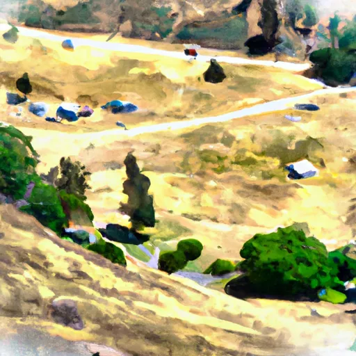
Tehachapi Mountain Park
The camping area has several amenities, including picnic tables, fire rings, and RV hookups. There are also showers and restrooms available for campers. Reservations are recommended as the campground can fill up quickly, particularly during peak season. There are 25 campsites available for tents and RVs, and the campground can accommodate up to 50 people.
An interesting fact about the area is that the Tehachapi Pass is a major wind resource area, and it is home to hundreds of wind turbines. These turbines generate enough electricity to power over two million homes.
The best time of year to visit Tehachapi Mountain Park Camping Area is in the spring or fall when temperatures are mild, ranging from the mid-60s to mid-70s. In the summer, temperatures can reach into the high 90s, and in the winter, temperatures can drop below freezing. Visitors should be prepared for sudden weather changes and should bring appropriate gear for the season. Overall, Tehachapi Mountain Park is a beautiful camping destination with stunning views and plenty of nearby activities for visitors to enjoy.
What's on-site at Tehachapi Mountain Park
Key facilities Snoflo tracks for this campground. Confirm with the operator before booking -- amenities can change seasonally.
Plan your trip down to the hour
Same weather feed Snoflo's iOS app uses -- updated continuously from NOAA / yr.no.
Next 5 days, hour by hour
Temperature line with weather symbols on top, snow + rain accumulation as columns, humidity as a dotted line.
5-day forecast table
Every 3 hours, broken out across temperature, snow, rain, humidity, and wind. Each cell is colour-coded relative to the column min/max so trends jump out at a glance.
| Time | Condition | Temp (°F) | Snow (in) | Rain (in) | Humidity (%) | Wind (mps) | Wind dir |
|---|---|---|---|---|---|---|---|
| Loading detailed forecast… | |||||||
15-day temperature & precipitation
Daily temperatures, snow, and rain projected over the next two weeks. Hover any point for the full breakdown.
Other campgrounds in the area
Snoflo-tracked campsites within driving distance of Tehachapi Mountain Park, with reservations status.
| Campground | Reservations | Toilets | View |
|---|---|---|---|
| Brite Lake | ✗ | ✓ | → |
| Cs0571b | ✗ | ✗ | → |
| Cs0593 | ✗ | ✗ | → |
| Rawhyde 2nd Location | ✗ | ✗ | → |
| Cs 0508, Horse Camping | ✗ | ✗ | → |
Nearby streamflow
USGS streamgauges within reach of Tehachapi Mountain Park -- pulled live from the National Water Information System.
| Streamgauge | Discharge | View |
|---|---|---|
| Piru C Ab Frenchmans Flat Ca | 16 cfs | → |
| Piru Creek Above Lake Piru Ca | 18 cfs | → |
| Piru Creek Below Santa Felicia Dam Ca | 21 cfs | → |
| Santa Clara R Nr Piru Ca | 32 cfs | → |
| Sf Kern R Nr Onyx Ca | 21 cfs | → |
| Sespe C Nr Fillmore | 11 cfs | → |
Nearby snow depths
NRCS SNOTEL stations within reach of Tehachapi Mountain Park -- relevant when planning a shoulder-season or alpine trip.
| SNOTEL station | Snowpack | 24h Snowfall | View |
|---|---|---|---|
| Inyokern 9.4 Wsw | 0.0 in | 0.0 in | → |
Plan a longer trip
The closest parks, lakes, boat launches, and paddle runs so a camping night can grow into a full weekend.
Parks
- Tehachapi Mountain Park
- Benz Youth Sports And Cultural Park
- Mojave West Park
- Mojave East Park
- Di Giorgio Park
- Smothermon Park
Fishing spots
Points of interest
Paddle runs
- 20.2 Miles Downstream Of Isabella Dam To Western Nf Boundary
- Green Valley At The Nf Boundary To Site Of St Francis Dam Disaster
- 7 Miles From Isabella Dam To 20.2 Miles From Isabella Dam
- Castaic To Pyramid Reservoir
- Confluence With Gold Hill Creek To Castaic
- Sandy Flat Camp To Democrat Picnic Area
Camping essentials & Leave No Trace
- Pack it in, pack it out
- Take all trash, food scraps, and gear back with you to keep campsites clean and protect wildlife.
- Respect wildlife
- Observe animals from a distance, store food securely, and never feed wildlife to maintain natural behavior and safety.
- Know before you go
- Check weather, fire restrictions, trail conditions, and permit requirements to ensure a safe and well-planned trip.
- Minimize campfire impact
- Use established fire rings, keep fires small, fully extinguish them, or opt for a camp stove when fires are restricted.
- Leave what you find
- Preserve natural and cultural features by avoiding removal of plants, rocks, artifacts, or other elements of the environment.
Set push alerts in the Snoflo app
Save Tehachapi Mountain Park as a favorite, set a custom threshold (precipitation, snowpack, freezing temperatures), and the iOS app will push the moment conditions cross.
About Tehachapi Mountain Park
Can I make reservations at Tehachapi Mountain Park?
This campground does not appear to accept reservations -- it's typically first-come, first-served. Arrive early on summer weekends.
How fresh is the weather data on this page?
The hourly forecast updates throughout the day from the NOAA / yr.no public feeds. Streamflow data is pulled live from USGS streamgauges and snowpack from the NRCS SNOTEL network.
What's the best time of year to visit?
Use the 15-day temperature & precipitation outlook on this page to plan -- pick a window with comfortable temperatures and low precipitation. For longer trips, the 5-day hourly meteogram shows snow + rain accumulation hour-by-hour.
How do I get to Tehachapi Mountain Park?
Tap Directions in the hero above to open driving directions in Google Maps, or Open in map to center the Snoflo interactive map on the campground.
Can I get alerts when conditions change?
Yes -- alerts are managed through the Snoflo iOS app. Favorite this campground, set a threshold (temperature, snowpack, precipitation), and you'll get a push the moment it crosses.
Other campgrounds near here
Snoflo-tracked campgrounds within driving distance of Tehachapi Mountain Park.