Upper Midway Camp Campground
Community Reviews
Been here? Share the conditions.
Reviews, ratings & photos are added in the free Snoflo iOS app — rate a spot, tag the conditions, and your visit is verified by location. Add or manage your reviews from the app.
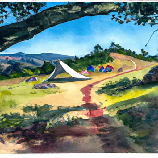
Upper Midway Camp
There are several nearby points of interest that visitors can explore. The nearby Lost Valley Reservoir is a popular spot for boating and fishing, while the nearby town of Kirkwood offers a variety of shops and restaurants for visitors to enjoy. Hiking trails in the area offer stunning vistas of the surrounding landscape, making it a great destination for outdoor enthusiasts.
The campground itself offers a range of amenities for visitors to enjoy, including tent and RV camping sites, picnic tables, fire rings, and access to clean drinking water and restrooms. There are also several hiking trails that start from the campground, making it easy for visitors to explore the surrounding area.
The best time of year to visit the Upper Midway Camp Campground is during the summer months when temperatures are mild and the weather is generally sunny. Average temperatures during this time of year range from the mid-60s to low 80s, making it ideal for outdoor activities.
Overall, the Upper Midway Camp Campground is a great place to experience nature and explore the beauty of the Lost watershed. With its stunning views, nearby points of interest, and range of amenities, it is a must-visit destination for anyone looking to escape the hustle and bustle of city life and enjoy the great outdoors.
What's on-site at Upper Midway Camp
Key facilities Snoflo tracks for this campground. Confirm with the operator before booking -- amenities can change seasonally.
Plan your trip down to the hour
Same weather feed Snoflo's iOS app uses -- updated continuously from NOAA / yr.no.
Next 5 days, hour by hour
Temperature line with weather symbols on top, snow + rain accumulation as columns, humidity as a dotted line.
5-day forecast table
Every 3 hours, broken out across temperature, snow, rain, humidity, and wind. Each cell is colour-coded relative to the column min/max so trends jump out at a glance.
| Time | Condition | Temp (°F) | Snow (in) | Rain (in) | Humidity (%) | Wind (mps) | Wind dir |
|---|---|---|---|---|---|---|---|
| Loading detailed forecast… | |||||||
15-day temperature & precipitation
Daily temperatures, snow, and rain projected over the next two weeks. Hover any point for the full breakdown.
Other campgrounds in the area
Snoflo-tracked campsites within driving distance of Upper Midway Camp, with reservations status.
| Campground | Reservations | Toilets | View |
|---|---|---|---|
| Basin Camp | ✗ | ✗ | → |
| Wildhorse Camp | ✗ | ✗ | → |
| Rock Creek Camp | ✗ | ✗ | → |
| Gerber Reservoir | ✗ | ✗ | → |
| Gerber North Campground | ✗ | ✗ | → |
Nearby streamflow
USGS streamgauges within reach of Upper Midway Camp -- pulled live from the National Water Information System.
| Streamgauge | Discharge | View |
|---|---|---|
| Link River At Klamath Falls | 1,330 cfs | → |
| North Canal At Highway 97 | 118 cfs | → |
| Ady Canal At Highway 97 | 50 cfs | → |
| Klamath Straits Drain Near Worden | 1 cfs | → |
| Klamath River At Keno | 689 cfs | → |
| Pit R Nr Canby Ca | 3 cfs | → |
Nearby snow depths
NRCS SNOTEL stations within reach of Upper Midway Camp -- relevant when planning a shoulder-season or alpine trip.
| SNOTEL station | Snowpack | 24h Snowfall | View |
|---|---|---|---|
| Gerber Reservoir | 0.0 in | 0.0 in | → |
| Nohrsc Strawberry | 0.0 in | 0.0 in | → |
| Strawberry | 0.0 in | 0.0 in | → |
| Quartz Mountain | 0.0 in | 0.0 in | → |
| Quartz Mountain | 0.0 in | 0.0 in | → |
| State Line | 0.0 in | -1.0 in | → |
Plan a longer trip
The closest parks, lakes, boat launches, and paddle runs so a camping night can grow into a full weekend.
Parks
- Fremont National Forest
- Clear Lake National Wildlife Refuge
- Booth State Scenic Corridor
- Klamath Falls Lakeview Forest State Park
- Wilderness Gearhart Mountain
- Tule Lake National Wildlife Refuge
Boat launches
- Barnes Valley
- South Gerber Campground
- Willow Valley
- Willow Valley Reservoir Boat Ramp
- Heart Lake Landing
Points of interest
Camping essentials & Leave No Trace
- Pack it in, pack it out
- Take all trash, food scraps, and gear back with you to keep campsites clean and protect wildlife.
- Respect wildlife
- Observe animals from a distance, store food securely, and never feed wildlife to maintain natural behavior and safety.
- Know before you go
- Check weather, fire restrictions, trail conditions, and permit requirements to ensure a safe and well-planned trip.
- Minimize campfire impact
- Use established fire rings, keep fires small, fully extinguish them, or opt for a camp stove when fires are restricted.
- Leave what you find
- Preserve natural and cultural features by avoiding removal of plants, rocks, artifacts, or other elements of the environment.
Set push alerts in the Snoflo app
Save Upper Midway Camp as a favorite, set a custom threshold (precipitation, snowpack, freezing temperatures), and the iOS app will push the moment conditions cross.
About Upper Midway Camp
Can I make reservations at Upper Midway Camp?
This campground does not appear to accept reservations -- it's typically first-come, first-served. Arrive early on summer weekends.
How fresh is the weather data on this page?
The hourly forecast updates throughout the day from the NOAA / yr.no public feeds. Streamflow data is pulled live from USGS streamgauges and snowpack from the NRCS SNOTEL network.
What's the best time of year to visit?
Use the 15-day temperature & precipitation outlook on this page to plan -- pick a window with comfortable temperatures and low precipitation. For longer trips, the 5-day hourly meteogram shows snow + rain accumulation hour-by-hour.
How do I get to Upper Midway Camp?
Tap Directions in the hero above to open driving directions in Google Maps, or Open in map to center the Snoflo interactive map on the campground.
Can I get alerts when conditions change?
Yes -- alerts are managed through the Snoflo iOS app. Favorite this campground, set a threshold (temperature, snowpack, precipitation), and you'll get a push the moment it crosses.
Other campgrounds near here
Snoflo-tracked campgrounds within driving distance of Upper Midway Camp.