Westside Regional Park Campground Campground
Community Reviews
Been here? Share the conditions.
Reviews, ratings & photos are added in the free Snoflo iOS app — rate a spot, tag the conditions, and your visit is verified by location. Add or manage your reviews from the app.
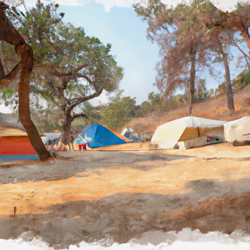
Westside Regional Park Campground
Reservations are accepted at Westside Regional Park Campground, allowing campers to secure their preferred campsites in advance. This is especially beneficial during peak seasons when the campground tends to be busy. It is highly recommended to make reservations to guarantee availability, especially for larger groups or those planning to stay for an extended period.
The best time to visit Westside Regional Park Campground is during the late spring to early fall. The weather is generally pleasant during this time and allows for various outdoor activities such as hiking, fishing, and wildlife watching. However, it is important to note that the campground is located near the coast, so fog and cool temperatures may be experienced, particularly in the mornings and evenings.
Campers should be cautious of poison oak, which can be found in the camping area. It is wise to familiarize oneself with its appearance to avoid any contact. Additionally, ticks are prevalent in the region, so taking necessary precautions such as wearing long sleeves and using insect repellent is advisable. Overall, Westside Regional Park Campground offers a beautiful setting with ample amenities, making it an ideal destination for camping enthusiasts in California.
What's on-site at Westside Regional Park Campground
Key facilities Snoflo tracks for this campground. Confirm with the operator before booking -- amenities can change seasonally.
Plan your trip down to the hour
Same weather feed Snoflo's iOS app uses -- updated continuously from NOAA / yr.no.
Next 5 days, hour by hour
Temperature line with weather symbols on top, snow + rain accumulation as columns, humidity as a dotted line.
5-day forecast table
Every 3 hours, broken out across temperature, snow, rain, humidity, and wind. Each cell is colour-coded relative to the column min/max so trends jump out at a glance.
| Time | Condition | Temp (°F) | Snow (in) | Rain (in) | Humidity (%) | Wind (mps) | Wind dir |
|---|---|---|---|---|---|---|---|
| Loading detailed forecast… | |||||||
15-day temperature & precipitation
Daily temperatures, snow, and rain projected over the next two weeks. Hover any point for the full breakdown.
Other campgrounds in the area
Snoflo-tracked campsites within driving distance of Westside Regional Park Campground, with reservations status.
| Campground | Reservations | Toilets | View |
|---|---|---|---|
| Bodega Dunes Campground | ✗ | ✗ | → |
| Wright's Beach Campground | ✗ | ✗ | → |
| Lawsons Landing | ✗ | ✗ | → |
| Campsite #5 | ✗ | ✗ | → |
| Campsite #6 | ✗ | ✗ | → |
Nearby streamflow
USGS streamgauges within reach of Westside Regional Park Campground -- pulled live from the National Water Information System.
| Streamgauge | Discharge | View |
|---|---|---|
| Austin C Nr Cazadero Ca | 4 cfs | → |
| Laguna De Santa Rosa C Nr Sebastopol Ca | 0 cfs | → |
| Russian R Nr Guerneville Ca | 108 cfs | → |
| Santa Rosa C A Willowside Rd Nr Santa Rosa Ca | 2 cfs | → |
| Colgan C Nr Sebastopol Ca | · | → |
| Mark West C Nr Mirabel Heights Ca | 3 cfs | → |
Plan a longer trip
The closest parks, lakes, boat launches, and paddle runs so a camping night can grow into a full weekend.
Parks
- Westside Park
- Doran City Park
- Sonoma Coast State Beach
- Jenner Russian Gulch Park
- Miller Boat Launch
- Ragle Ranch Regional Park
Boat launches
- Westside Regional Park
- Doran Beach Road 355, Bodega Bay
- Porto Bodega Marina
- Sonoma Coast State Park
- Monte Rio
- Miller Park
Fishing spots
Points of interest
- Meredith Pier Public Art Project
- Tides Restaurant Original Facade
- Whale Jaw Bone
- Bodega Bay Heritage Gallery
- Church Of Saintteresa Ofavila
- Duncans Mills Depot Museum
Paddle runs
- Olema Ranch Campground To Caltrans Corporation Yard At Point Reyes Station
- Headwaters To Ends One Quarter Mile South Of Bear Valley Road Bridge Segment 1: Ends 1/4 Mile South Of Bear Valley Road Bridge Segment 2: Caltrans Corporation Yard At Point Reyes Staton.
- Headwaters To Mouth
Camping essentials & Leave No Trace
- Pack it in, pack it out
- Take all trash, food scraps, and gear back with you to keep campsites clean and protect wildlife.
- Respect wildlife
- Observe animals from a distance, store food securely, and never feed wildlife to maintain natural behavior and safety.
- Know before you go
- Check weather, fire restrictions, trail conditions, and permit requirements to ensure a safe and well-planned trip.
- Minimize campfire impact
- Use established fire rings, keep fires small, fully extinguish them, or opt for a camp stove when fires are restricted.
- Leave what you find
- Preserve natural and cultural features by avoiding removal of plants, rocks, artifacts, or other elements of the environment.
Set push alerts in the Snoflo app
Save Westside Regional Park Campground as a favorite, set a custom threshold (precipitation, snowpack, freezing temperatures), and the iOS app will push the moment conditions cross.
About Westside Regional Park Campground
Can I make reservations at Westside Regional Park Campground?
This campground does not appear to accept reservations -- it's typically first-come, first-served. Arrive early on summer weekends.
How fresh is the weather data on this page?
The hourly forecast updates throughout the day from the NOAA / yr.no public feeds. Streamflow data is pulled live from USGS streamgauges and snowpack from the NRCS SNOTEL network.
What's the best time of year to visit?
Use the 15-day temperature & precipitation outlook on this page to plan -- pick a window with comfortable temperatures and low precipitation. For longer trips, the 5-day hourly meteogram shows snow + rain accumulation hour-by-hour.
How do I get to Westside Regional Park Campground?
Tap Directions in the hero above to open driving directions in Google Maps, or Open in map to center the Snoflo interactive map on the campground.
Can I get alerts when conditions change?
Yes -- alerts are managed through the Snoflo iOS app. Favorite this campground, set a threshold (temperature, snowpack, precipitation), and you'll get a push the moment it crosses.
Other campgrounds near here
Snoflo-tracked campgrounds within driving distance of Westside Regional Park Campground.