Yosemite Np Free Campsite Campground
Community Reviews
Been here? Share the conditions.
Reviews, ratings & photos are added in the free Snoflo iOS app — rate a spot, tag the conditions, and your visit is verified by location. Add or manage your reviews from the app.
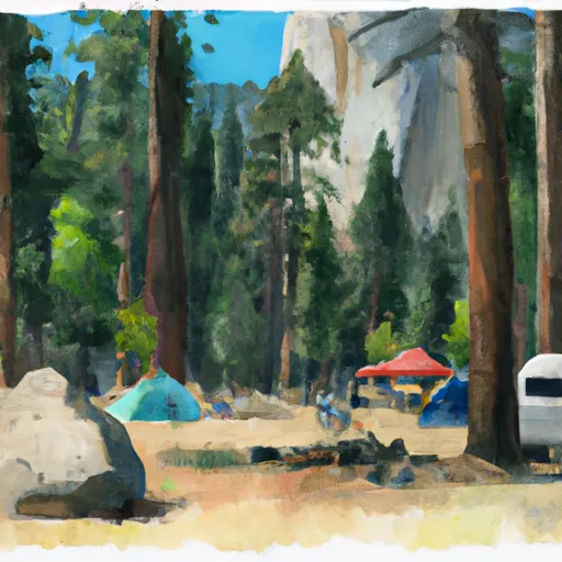
Yosemite Np Free Campsite
An interesting fact about the area is that Yosemite National Park covers an area of 747,956 acres and is home to over 400 species of vertebrates, including black bears, mountain lions, and bald eagles. The best time of year to visit the Yosemite NP free campsite camping area is during the summer months, from June to August, with average temperatures of 70-80°F during the day and 40-50°F at night. Visitors should be aware that the area is prone to thunderstorms during the summer months, and it is recommended to bring warm clothing and rain gear. Overall, the Yosemite NP free campsite camping area is a great place to experience the natural beauty of the Sierra Nevada Mountains while camping in a serene environment.
What's on-site at Yosemite Np Free Campsite
Key facilities Snoflo tracks for this campground. Confirm with the operator before booking -- amenities can change seasonally.
Plan your trip down to the hour
Same weather feed Snoflo's iOS app uses -- updated continuously from NOAA / yr.no.
Next 5 days, hour by hour
Temperature line with weather symbols on top, snow + rain accumulation as columns, humidity as a dotted line.
5-day forecast table
Every 3 hours, broken out across temperature, snow, rain, humidity, and wind. Each cell is colour-coded relative to the column min/max so trends jump out at a glance.
| Time | Condition | Temp (°F) | Snow (in) | Rain (in) | Humidity (%) | Wind (mps) | Wind dir |
|---|---|---|---|---|---|---|---|
| Loading detailed forecast… | |||||||
15-day temperature & precipitation
Daily temperatures, snow, and rain projected over the next two weeks. Hover any point for the full breakdown.
Other campgrounds in the area
Snoflo-tracked campsites within driving distance of Yosemite Np Free Campsite, with reservations status.
| Campground | Reservations | Toilets | View |
|---|---|---|---|
| Summerdale Campground | ✗ | ✗ | → |
| Summerdale | ✓ | ✓ | → |
| Big Sandy Campground | ✗ | ✗ | → |
| Little Sandy Campground | ✗ | ✗ | → |
| Summit Camp | ✗ | ✓ | → |
Nearby streamflow
USGS streamgauges within reach of Yosemite Np Free Campsite -- pulled live from the National Water Information System.
| Streamgauge | Discharge | View |
|---|---|---|
| Big C Div Nr Fish Camp Ca | 0 cfs | → |
| Nf Willow C Nr Sugar Pine Ca | 416 cfs | → |
| Merced R A Pohono Bridge Nr Yosemite Ca | 171 cfs | → |
| Merced R A Happy Isles Bridge Nr Yosemite Ca | 141 cfs | → |
| Tuolumne R A Grand Cyn Of Tuolumne Ab Hetch Hetchy | 190 cfs | → |
| Mf San Joaquin R Nr Mammoth Lakes Ca | 87 cfs | → |
Nearby snow depths
NRCS SNOTEL stations within reach of Yosemite Np Free Campsite -- relevant when planning a shoulder-season or alpine trip.
| SNOTEL station | Snowpack | 24h Snowfall | View |
|---|---|---|---|
| Nohrsc Poison Ridge | 0.0 in | 0.0 in | → |
| Ahwahnee 2.5 Nnw | 0.0 in | 0.0 in | → |
| Nohrsc Chilkoot Meadow | 0.2 in | 0.0 in | → |
| Nohrsc Graveyard Meadow | 0.6 in | 0.0 in | → |
| Nohrsc Green Mtn | 7.9 in | 0.0 in | → |
| Nohrsc White Wolf Raws | 1.0 in | 0.0 in | → |
Plan a longer trip
The closest parks, lakes, boat launches, and paddle runs so a camping night can grow into a full weekend.
Parks
- Yosemite National Park
- Stanislaus National Forest
- Wildlife Area Kinsman Flat
- Wilderness Kaiser
- Devils Postpile National Monument
- Big Table Mountain Ecological Reserve
Boat launches
Fishing spots
Points of interest
- Mariposa Welcome Plaza
- Grizzly Giant
- Gralie Grotto - Swimming Hole
- Wawona Visitor Center
- Chinese Laundry Building
- Grey Barn
Paddle runs
- Confluence With North Fork San Joaquin River To Hells Half Acre
- Headwaters Near The Tuolumne And Mariposa County Lines To Western Boundary Of Yosemite National Park
- Hemlock Crossing To Confluence With Cora Creek
- Cora Creek To Confluence With San Joaquin River
- Headwaters In Sec 8, T3s, R25 E To Hemlock Crossing
- Rainbow Falls To Confluence With North Fork San Joaquin River
Camping essentials & Leave No Trace
- Pack it in, pack it out
- Take all trash, food scraps, and gear back with you to keep campsites clean and protect wildlife.
- Respect wildlife
- Observe animals from a distance, store food securely, and never feed wildlife to maintain natural behavior and safety.
- Know before you go
- Check weather, fire restrictions, trail conditions, and permit requirements to ensure a safe and well-planned trip.
- Minimize campfire impact
- Use established fire rings, keep fires small, fully extinguish them, or opt for a camp stove when fires are restricted.
- Leave what you find
- Preserve natural and cultural features by avoiding removal of plants, rocks, artifacts, or other elements of the environment.
Set push alerts in the Snoflo app
Save Yosemite Np Free Campsite as a favorite, set a custom threshold (precipitation, snowpack, freezing temperatures), and the iOS app will push the moment conditions cross.
About Yosemite Np Free Campsite
Can I make reservations at Yosemite Np Free Campsite?
This campground does not appear to accept reservations -- it's typically first-come, first-served. Arrive early on summer weekends.
How fresh is the weather data on this page?
The hourly forecast updates throughout the day from the NOAA / yr.no public feeds. Streamflow data is pulled live from USGS streamgauges and snowpack from the NRCS SNOTEL network.
What's the best time of year to visit?
Use the 15-day temperature & precipitation outlook on this page to plan -- pick a window with comfortable temperatures and low precipitation. For longer trips, the 5-day hourly meteogram shows snow + rain accumulation hour-by-hour.
How do I get to Yosemite Np Free Campsite?
Tap Directions in the hero above to open driving directions in Google Maps, or Open in map to center the Snoflo interactive map on the campground.
Can I get alerts when conditions change?
Yes -- alerts are managed through the Snoflo iOS app. Favorite this campground, set a threshold (temperature, snowpack, precipitation), and you'll get a push the moment it crosses.
Other campgrounds near here
Snoflo-tracked campgrounds within driving distance of Yosemite Np Free Campsite.